|
[#1]
I know a fair amount about this. I am a RR fan of the old NG. I have hiked in there several times. Much of the ROW of the Banjum branch is a road but you may need a 4WD depending on rain and road conditions. Some sections of the RR ROW are off the raod but most of it is the Banjum Rd itself. It is a bit "hilly" for a RR grade but it was only a logging branch and was always a "temporary" track.
|
|
|
|
[#2]
Quoted:
I know a fair amount about this. I am a RR fan of the old NG. I have hiked in there several times. Much of the ROW of the Banjum branch is a road but you may need a 4WD depending on rain and road conditions. Some sections of the RR ROW are off the raod but most of it is the Banjum Rd itself. It is a bit "hilly" for a RR grade but it was only a logging branch and was always a "temporary" track. Awesome, this is why I love this forum. Did you hike in to the old Barnjum operation? If so, was there anything left? I want to hit all the 4k peaks of Maine this summer (only have Mt. Abraham done so far), so I wonder if I could incorporate some of this exploration with hiking Redington, Spaulding, and the Crockers... |
|
|
|
[#3]
I don't believe there is anything left from the operation as it ended so many years ago but I could be wrong. I hiked most of the way in but the grade gets hard to find/ follow when it gets near the bridge across Banjum Stream. I stopped there when I went but I should have crossed to the east side of the stream and kept going. The other end of the Banjum branch (West side) left the RR main line at a place called Banjum Jct. You could hike along that heading up towards Redington. That is fun but you get to a place where it is posted. Some of that can be disregarded but as you go a bit further you will be entering US Govt land were the SEAL train. I have heard of people being confronted by armed SEALs who came out of no-where! I have gone in to where the main line crosses the outlet stream of Redington pond just east of the pond but there is no bridge there any more and a giant washout of the mill dam in the 1970's obliterated the east side stone work and grade for a few hundred feet so it's a little hard to follow. The west side stone work is still there but be advised that you will be on US Govt property at this point - even before you come to the washout. There are many other parts of this NG that can be hiked. I have all of them marked in pencil on my Maine Gazatteere map book. See map 29 mostly at the bottom of the page. The dotted road in the middle of the bottom going north to Redington Pond Falls is the old mainline. It continued on towards Dallas, then on along but not directly on Rt 16 towards Rangeley.
There was another branch that went off from Dallas to Langtown following Rt 16. There were multiple lumber mills in the area at Redington and Langtown. Several miles of logging branches up there too. Here is a lantern I have from the Phillips and Rangeley RR. 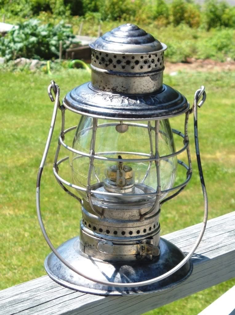
|
|
|
|
[#4]
How interesting. A hunting camp I use is in that area, in Freeman TWP. I had heard a rumor that the area over there was used for SERE training. Basically a guy gets dropped off in nowheresville and has to make it to Portland or somewhere within an alotted time limit. Don't know if it's fact or fiction.
Beautiful country but the bears outnumber the deer! |
|
|
|
[#5]
The base is a missile testing range for the USN. Technically part of Brunswick NAS in some way but not closed. The SEALS being there on occasion is probably a secondary use.
|
|
|
|
[#6]
Quoted:
I don't believe there is anything left from the operation as it ended so many years ago but I could be wrong. I hiked most of the way in but the grade gets hard to find/ follow when it gets near the bridge across Banjum Stream. I stopped there when I went but I should have crossed to the east side of the stream and kept going. The other end of the Banjum branch (West side) left the RR main line at a place called Banjum Jct. You could hike along that heading up towards Redington. That is fun but you get to a place where it is posted. Some of that can be disregarded but as you go a bit further you will be entering US Govt land were the SEAL train. I have heard of people being confronted by armed SEALs who came out of no-where! I have gone in to where the main line crosses the outlet stream of Redington pond just east of the pond but there is no bridge there any more and a giant washout of the mill dam in the 1970's obliterated the east side stone work and grade for a few hundred feet so it's a little hard to follow. The west side stone work is still there but be advised that you will be on US Govt property at this point - even before you come to the washout. There are many other parts of this NG that can be hiked. I have all of them marked in pencil on my Maine Gazatteere map book. See map 29 mostly at the bottom of the page. The dotted road in the middle of the bottom going north to Redington Pond Falls is the old mainline. It continued on towards Dallas, then on along but not directly on Rt 16 towards Rangeley. There was another branch that went off from Dallas to Langtown following Rt 16. There were multiple lumber mills in the area at Redington and Langtown. Several miles of logging branches up there too. Here is a lantern I have from the Phillips and Rangeley RR. http://i1222.photobucket.com/albums/dd484/ericdowneast/PRRRAW.jpg Thank you for your response, now I'm extra motivated to get into the woods around there. I'll get to it within the month--first peak up is Old Speck, probably this weekend. I'm starting southwest and hitting all the 4kers moving northeast. |
|
|
 Win a FREE Membership!
Sign up for the ARFCOM weekly newsletter and be entered to win a free ARFCOM membership. One new winner* is announced every week!
You will receive an email every Friday morning featuring the latest chatter from the hottest topics, breaking news surrounding legislation, as well as exclusive deals only available to ARFCOM email subscribers.

AR15.COM is the world's largest firearm community and is a gathering place for firearm enthusiasts of all types.
From hunters and military members, to competition shooters and general firearm enthusiasts, we welcome anyone who values and respects the way of the firearm.

Subscribe to our monthly Newsletter to receive firearm news, product discounts from your favorite Industry Partners, and more.
Copyright © 1996-2024 AR15.COM LLC. All Rights Reserved.
Any use of this content without express written consent is prohibited.
AR15.Com reserves the right to overwrite or replace any affiliate, commercial, or monetizable links, posted by users, with our own.