|
Posted: 10/21/2014 11:55:02 PM EDT
The Bankhead Highway was one of the first modern highways in the US, going across the southern United States from Washington, DC to San Diego. It was named after Alabama Senator John H. Bankhead, who led the congessional push for federal road appropriations leading to the Federal Aid Road Act of 1916.
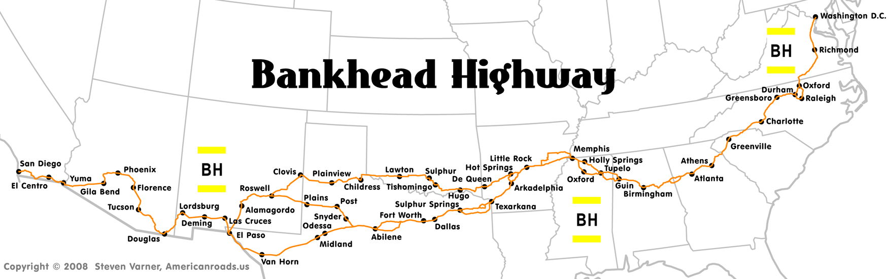
"In the early years of the twentieth century, as more and more Americans began traveling by automobile, a clamor arose for better roads than the prevailing trails and mud tracks. The Good Roads Movement came out of that clamor, and when the Federal Aid Road Act achieved passage in 1916, Rep. Bankhead was ready with his plan for a national thoroughfare that would link the older, established states of the East and South with the new ones in the West. Though slowed somewhat by World War I, construction nonetheless proceeded on the highway, soon to be known as the Bankhead Highway. By the late 1920s, the highway was completed, and just as Route 66 would do twenty years later, the "Broadway of America" brought prosperity and commerce to the towns and cities along its route." (1) Zero milestone in Washington DC: 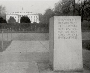
Texas has a fairly strong history program. "In Texarkana, the historic route along 7th Street is lined with 1940s, '50s, and '60s motels, restaurants, and gas stations built for those traveling by car. Similarly, in the 1920s, the Bankhead Highway traversed the Deep Ellum neighborhood in Dallas along Commerce Street. Today, the neighborhood retains many of the gas stations, garages, and dealerships dating to that era. In Abilene, South 1st Street contains on the best collections of historic motels (1930s-60s) along the entire highway's path in Texas... In smaller towns, the Bankhead often traveled Main Street business districts. Communities such as Mount Vernon in Franklin County, Ranger and Eastland in Eastland County, and Big Spring in Howard County hosted the historic highway, and they retain respectable collections of auto-related businesses dating to the mid-1900s." (2) Former gas station from 1930 in Greenville, Texas: 
Local cities generally welcomed the business of travelers. "Not surprisingly, the belief of the Garland News editor that the Bankhead Highway promised “fine opportunities” for Garland and other towns on its route proved to be accurate. The automobile had been the primary stimulus for the development of highways such as the Bankhead, but the improved highways in turn stimulated the evolution of motor transportation. The impact on auto traffic was almost immediate. For 19 hours one Sunday in June 1923 the Garland Chamber of Commerce counted autos passing through the Square on the Bankhead Highway. They counted 2,585 and estimated that 75% of them stopped for service, drinks, and food. Later that summer the paper declared: “People are moving to Garland so fast lately that what few gossips we have are being worked overtime to circulate their peculiarities and shortcomings.” In the same issue the paper noted that the iron hitching rack on the Square had been moved to a side street since there were so many autos it was dangerous to have teams on the Square." (3) Motel along old Bankhead Hwy in Abilene, Texas: 
Motel along old Bankhead Hwy in El Paso, Texas: 
Cited works: (1) http://www.everything2.com/index.pl?node_id=1729831 (2) http://www.thc.state.tx.us/preserve/projects-and-programs/historic-texas-highways/bankhead-highway/bankhead-highway-history (3) http://douglasathas.net/blogs/index.php/bankhead_flook3 Other References: Federal Aid Road Act of 1916 the Development of Highways in Texas (opens pdf document) |
|
|
|
[#1]
I forgot to mention one of the more interesting engineering challenges along the road. In the Califormia desert west of Yuma was a set of impassable sand dunes.
First, travelers had to cross the Ocean-to-Ocean bridge, which was the only crossing for 1200 miles. 
"If you wanted to drive from coast to coast in 1915, the Ocean to Ocean bridge was one of the few ways to do it. Legend has it that during the Great Depression California officials exploited this bottleneck by creating a makeshift immigration checkpoint at the northern end of the bridge. Folks trying to migrate west in search of work found the bridge guarded by California policemen who frequently turned people back. To this day a section of Yuma is called “Okie Town” for the population of Oklahomans who settled there after being turned away at the California border." http://everywhereonce.com/2013/02/01/ocean-to-ocean-bridge/ Then, they got into the dunes. At first, people came up with the idea of using wooden planks over the dunes, miles and miles of them-- one car wide. There were turnoffs every once in a while to allow opposing traffic to pass. "Amid great fanfare, the first planks were laid on February 14, 1915. For the next two months, a combination of volunteers and paid workers hauled lumber and laid down two parallel plank tracks, each 25" wide, spiked to wooden cross pieces underneath. The wheel path floated across 6 1/2 miles of shifting sand east of Gray's Well. Work ended on April 4, 1915. A week later, the 'glad Hand Excursion," consisting of 25 cars loaded with over 100 riders, gaily traveled the Plank Road and declared it a success." 
"With more funds, manpower, and equipment than the pioneer road builders, the Highway Commission built a new Plank Road in 1916. Engineers abandoned the double-track plan and designed a roadway of wooden cross ties laid to a width of 8 feet with double-width turnouts every-1,000 feet. Sections 12 feet long were preassembled at a fabricating plant set up at the railroad town of Ogilby, California. Completed units, which weighed 1,500 pounds each, were transferred onto wagons by means of a derrick specially designed for the task. Out in the dunes, workers prepared the roadbed by leveling the sand with scrapers. Sections of the Plank Road were then lowered into place using a crane. Plank Road upkeep proved difficult, and a permanent maintenance force was stationed near Gray's Well. From 1916 to 1926, crews of workmen struggled incessantly against nature to keep the road passable. Hard winds blew drifting sand across the road an average of two or three days a week, rendering the road nearly impassable about one-third of the time. The crew routinely worked the road with Fresno scrapers hitched to a team of draft animals, and travelers huddled in their vehicles while the sand swirled around them." http://www.desertusa.com/sandhills/plankrd.html Plank road example in the dunes: 
|
|
|
 Win a FREE Membership!
Sign up for the ARFCOM weekly newsletter and be entered to win a free ARFCOM membership. One new winner* is announced every week!
You will receive an email every Friday morning featuring the latest chatter from the hottest topics, breaking news surrounding legislation, as well as exclusive deals only available to ARFCOM email subscribers.

AR15.COM is the world's largest firearm community and is a gathering place for firearm enthusiasts of all types.
From hunters and military members, to competition shooters and general firearm enthusiasts, we welcome anyone who values and respects the way of the firearm.

Subscribe to our monthly Newsletter to receive firearm news, product discounts from your favorite Industry Partners, and more.
Copyright © 1996-2024 AR15.COM LLC. All Rights Reserved.
Any use of this content without express written consent is prohibited.
AR15.Com reserves the right to overwrite or replace any affiliate, commercial, or monetizable links, posted by users, with our own.