|
[#1]
Spent today on a snorkeling charter near St. John. Captain said his boss had charters booked through Wednesday. Lmfao, that'll be interesting. Everyone here on island is really on edge and low key freaking out right now.
|
|
|
|
[#2]

|
|
|
|
[#3]

|
|
|
|
[#4]
This is not the forecast I wanted to see. Where's the damn hook to the north?
|
|
|
|
[#5]
The example below features, in gray, the ensemble forecast tracks from the European Centre for Medium-Range Weather Forecasts, conducted Sept. 2 at 8 p.m. EDT. You can hardly see the U.S. map below the mess of possible tracks, extending from south of Newfoundland to the Gulf of Mexico.
The second part of the animation shows another set of ensemble forecast tracks – this time in blue – from NOAA. 
|
|
|
|
[#6]
looks like Florida is smack dab in the middle of the cone to me?
in M 4s chart above you cant even see Florida time to get busy |
|
|
|
[#7]
Quoted:
Preps completed back in the summer. My homes are prepared. Prayers have been said. Now the wait |
|
|
|
[#8]
Man if anything even close to these came true half the state would be gone.
|
|
|
|
[#9]
|
|
|
|
[#10]
That looks like a hot mess express..
|
|
|
|
[#11]
Oops, should not have looked at 2 am update.
Maybe it will get in the mountains of Cuba first. |
|
|
|
[#12]
Does this mean we get to see Trump?
|
|
|
|
[#13]
I'm in. Miami checking in for this.
|
|
|
|
[#14]

|
|
|
|
[#15]
Hurricane Irma Discussion Number 20NWS National Hurricane Center Miami FL AL112017
500 AM AST Mon Sep 04 2017 Irma's signature in infrared satellite images has been improving over the past few hours. An eye has appeared and is warming, and the central dense overcast has become more symmetric. Although the satellite presentation is better than when a NOAA plane investigated Irma last evening, the initial intensity will be held at 100 kt for now. Another NOAA P3 aircraft is just now beginning to sample the hurricane and should provide an updated intensity estimate during the next few hours. A strong, stationary mid-tropospheric high centered over the central Atlantic is forcing Irma on a west-southwestward course, and the initial motion estimate remains 255/12 kt. Irma will begin rounding the southwestern edge of the high soon, which will allow the hurricane to turn westward later today and then west- northwestward in 36-48 hours. Down the road, a large mid-latitude trough is expected to dig southward over the eastern United States during the next 72 hours, but the global models have been trending toward quickly lifting the trough out over New England and eastern Canada on days 4 and 5, with the subtropical ridge building westward toward Florida. As a result, it's becoming increasingly likely that Irma would maintain a west-northwestward heading on days 3 through 5, and the track guidance shifted significantly westward on this cycle during that period. Remarkably, the track models are very tightly clustered through day 5, which increases the confidence in the westward shift of the latest NHC forecast. All environmental factors suggest that Irma will at least maintain its intensity for the entire 5-day forecast period, if not strengthen gradually. Oceanic heat content values increase along Irma's forecast path, mid-level moisture will be more abundant, and vertical shear appears to be generally low. As a result, the NHC intensity forecast continues to call for gradual intensification through at least 72 hours, with a possibility for some slight weakening by days 4 and 5 (but still as a major hurricane). As with any major hurricane, Irma's intensity may fluctuate around these forecast intensities, but the overall trend is for a gradual increase of the maximum winds, assuming Irma's core does not move over any of the islands in the Greater Antilles. |
|
|
|
[#16]
|
|
|
|
[#17]

|
|
|
|
[#18]
Damn.
Where in the hell is this bitch headed ? |
|
|
|
[#19]
Mara Lago
|
|
|
|
[#20]
I just read the text on the bottom of that last graphic.
"If anything on this graphic causes confusion, ignore the entire product." 
|
|
|
|
[#21]
Quoted:
What are the landscape blocks for? Tarp weights? Neighbor is getting hurricane windows installed tomorrow. He has a big solar system but no battery storage. |
|
|
|
[#22]
Quoted:
Protus- guess we'll camp.. yup..hang the hammocks up in the trees. Wife- build our tree house Protus - fuck yeah,,,Swiss family Robinson did it with a boat...we can do it...hell yeah. Wife- there ya go....awesome.. Protus- but we don't have an elephant...... Wife - stay positive babe ...... Needless to say...as ready as we can be... |
|
|
|
[#23]
Looks like this thing shifted further south ...
|
|
|
|
[#24]
Quoted:
Looks like this thing shifted further south ... Big change in the models since yesterday 11PM. Looks like the chances of a loop out into the Atlantic without making a US landfall are decreasing as time goes on. |
|
|
|
[#25]

***FLORIDA MAN GOVERNMENT ALERT*** Florida Man has issued an official Hurricane Irma Authorization for Pre Hurricane Panic Sex. All Floridians are to commence in Pre Hurricane Panic Sex. As such, all Floridians are to open their official state issued Pre Hurricane Panic Sex Kit. Bacardi 151, Coke, Lime, and Prophylactics. Since this is in response to Hurricane above Cat 2, Prophylactics are to be discarded and instead Floridians should proceed to find the sexist gal you can within 12 hours. Wrapping before tapping is ill advised. Florida needs a new generation of Floridians to keep the State population viable after the Death and Doom that comes with the Hurricane. ***FLORIDA MAN GOVERNMENT ALERT*** 
|
|
|
|
[#26]
Quoted:
Which I believe looks worse for the US Mainland since it will turn to the north at some point. Big change in the models since yesterday 11PM. Looks like the chances of a loop out into the Atlantic without making a US landfall are decreasing as time goes on. Quoted:
Quoted:
Looks like this thing shifted further south ... Big change in the models since yesterday 11PM. Looks like the chances of a loop out into the Atlantic without making a US landfall are decreasing as time goes on. It would have to make one hell of a turn north for it to skip past Florida. I fuckin hate these things. |
|
|
|
[#27]
Quoted:
Which I believe looks worse for the US Mainland since it will turn to the north at some point. Big change in the models since yesterday 11PM. Looks like the chances of a loop out into the Atlantic without making a US landfall are decreasing as time goes on. At least I'll have a front row seat as the hurricane approaches here in the Virgin Islands. We are leaving before it makes landfall though, thank god |
|
|
|
[#28]
Sure hope the guy I gave my tent to on this site when I moved out of Coral Springs to Putnam county will let me borrow it if I need it.
|
|
|
|
[#29]
the 11 just came out
not looking to good????? |
|
|
|
[#30]
Shows it going right into Havanna, If so I am sure the Keys are f**ked too. As much as I would like to ask a thousand questions on how the rest of the state would be affected I realize it won't make a bit of difference until we know for sure just where it ends up.
However if this does occur what are the chances of it spinning up and hitting again from the gulf side? |
|
|
|
[#31]
At this juncture it's anybody's guess - anyone who says different is (IMHO) a fool.
|
|
|
|
[#32]
I agree. The initial models had it pulling north along the east coast.
Thats going to need to be an incredibly sharp turn at this point. 


|
|
|
|
[#33]
Just did a Home Depot run south Florida east
HEADS UP its crazy in there seriously |
|
|
|
[#34]
Looks like it'll go into the gulf but this thing hasn't hit any land yet has it?
Mathew wobbled northeast once it hit the Caribbean and I think that's a distinct possibility for this one as well. |
|
|
|
[#35]
Quoted:
Damn. Where in the hell is this bitch headed ? |
|
|
|
[#36]
Just went to the garage and counted plywoods. There are 8 for two houses.
Thinkin' if I cut them in half there will be sixteen. That should do it. |
|
|
|
[#37]
|
|
|
|
[#38]

Gennie is running fine and made sure the starter fluid and screw driver stay with it this time.
|
|
|
|
[#39]
That wobble saved our asses in Palm Beach County.
|
|
|
|
[#40]
Mrs. Miami_JBT in enroute to PR right now to get Abuela and bring her Stateside. She's 88 year olds and is one feisty woman but she can't take care of herself during a Hurricane like that anymore. Yeah, I know bringing her Stateside has risks. But if PR doesn't get it bad and Tallahassee does. The Wife and Abuela can scoot outta here long before impact with the pups and supplies to a safe zone.
We can't risk having the Abuela by herself in PR at the moment. She has nowhere to go, no car (she walks to the corner bodega or takes the bus), and no one in her AO that could assist. Plus the medical issues.... pacemaker, arrhythmia, blood pressure medication, asthma, and all the other old people related shit. Oh, flights from Tallahassee ain't fucking cheap either. |
|
|
|
[#41]
Scott has declared a state of emergency for all 67 Florida counties.
yeah, yeah... I know. |
|
|
|
[#42]
Quoted:
Scott has declared a state of emergency for all 67 Florida counties. yeah, yeah... I know. |
|
|
|
[#43]
Depending on the model, this bitch can be anywhere and everywhere; it's all over the place.
|
|
|
|
[#44]
I was working in the Miami to key largo area the day after "Andrew hit" I spent two years living in the key largo area and working between Miami and Homestead... Andrew was no joke, Irma looks to be just as pissed. I was hoping also for a north east turn out to sea because I'm in SC.. but I have alot of friends in south and gulf coast Florida. lets hope it rides a bit more into Cuba and loses a bit... a cat 4 or 5 would suck for even the well prepared.. good luck guys! thoughts are with ya .
|
|
|
|
[#45]
8pm update

|
|
|
|
[#46]
will see if this will hold true
please please don't come up the East Coast |
|
|
|
[#47]
Hard to imagine the Keys, at very least, not taking a huge beating at this point.
|
|
|
|
[#48]
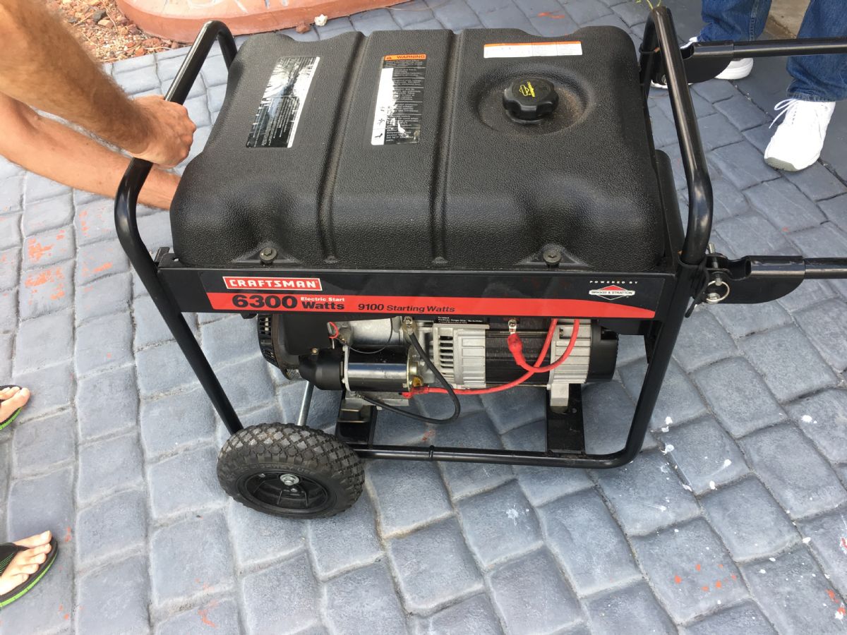
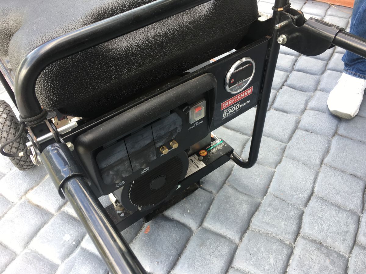
Found this today for $400. Never been used. Score.
|
|
|
|
[#49]
Hi to you all! Good luck and i hope it doest hit you! My wife and I (sorry no pics, search my name if you must to see) are supposedly flying to the Dominican on Wednesday for a week. Does anyone know the legality of carrying a decent knife there check on? I know its ridiculous to think, but i would rather be prepared than not. I have packed a water purifier and first aid kit, but i am not used to being somewhere without a weapon. If we were to request a change on our trip it would be a $1k cost to change if they do not "recognize" the threat. Thanks in advance..... for those of you saying i should not go, I agree.....
|
|
|
|
[#50]
Quoted:
Hi to you all! Good luck and i hope it doest hit you! My wife and I (sorry no pics, search my name if you must to see) are supposedly flying to the Dominican on Wednesday for a week. Does anyone know the legality of carrying a decent knife there check on? I know its ridiculous to think, but i would rather be prepared than not. I have packed a water purifier and first aid kit, but i am not used to being somewhere without a weapon. If we were to request a change on our trip it would be a $1k cost to change if they do not "recognize" the threat. Thanks in advance..... for those of you saying i should not go, I agree..... |
|
|
 Win a FREE Membership!
Sign up for the ARFCOM weekly newsletter and be entered to win a free ARFCOM membership. One new winner* is announced every week!
You will receive an email every Friday morning featuring the latest chatter from the hottest topics, breaking news surrounding legislation, as well as exclusive deals only available to ARFCOM email subscribers.

AR15.COM is the world's largest firearm community and is a gathering place for firearm enthusiasts of all types.
From hunters and military members, to competition shooters and general firearm enthusiasts, we welcome anyone who values and respects the way of the firearm.

Subscribe to our monthly Newsletter to receive firearm news, product discounts from your favorite Industry Partners, and more.
Copyright © 1996-2024 AR15.COM LLC. All Rights Reserved.
Any use of this content without express written consent is prohibited.
AR15.Com reserves the right to overwrite or replace any affiliate, commercial, or monetizable links, posted by users, with our own.