|
Posted: 5/13/2023 6:11:21 PM EDT
Starting to build endurance for a philmont trip next year with the 13 year old.
Been doing shorter hikes every weekend we can get out This morning we went out to coopers furnace in GA. Cool spot that was destroyed by Sherman. There’s a shitload of Sherman’s legacy and destruction in the area. We have already done kennesaw mountain a few times. Pine log mountain and some others. Next weekend is a 10 mile stretch of the AT in Nc with his scout group. Who got outside today? What did ya do |
|
|
|
|
[#1]
Savage gulf a few weeks ago in TN
Stone door Random waterfall |
|
|
|
|
[Last Edit: the_narrator]
[#2]
hiked the burro loop in golden gate canyon park. elevation started around 7800’ and peaked at about 8700’. roundabouts 6 miles, took about 2.5 hours. didn’t take any pictures but it was amazing views.
eta. stole a couple pics off of alltrails |
|
|
|
ME, USA
|
[Last Edit: ME2112]
[#3]
Today I took a short hike out to a local mountain called Slidedown, right on the Canadian border. There’s an old skidder trail that goes up toward the summit, I’m going to follow that and bushwhack the rest of the way to the summit one weekend.
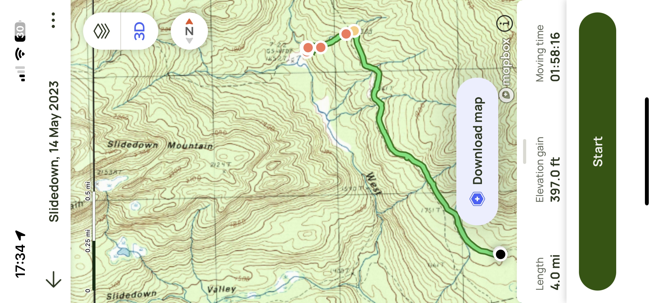 The highest point on the mountain is right on the border, a little over 2900’. So I should have maybe a mile to go from where the path ends, assuming the map is accurate. Yeah, right! But the undergrowth shouldn’t be too bad to bust through. Hopefully there’s a decent spot for my tent. 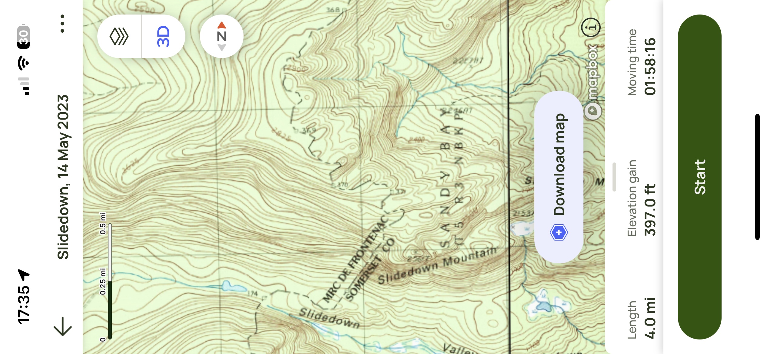 The reason it’s called Slidedown, seen from several miles away to the south. 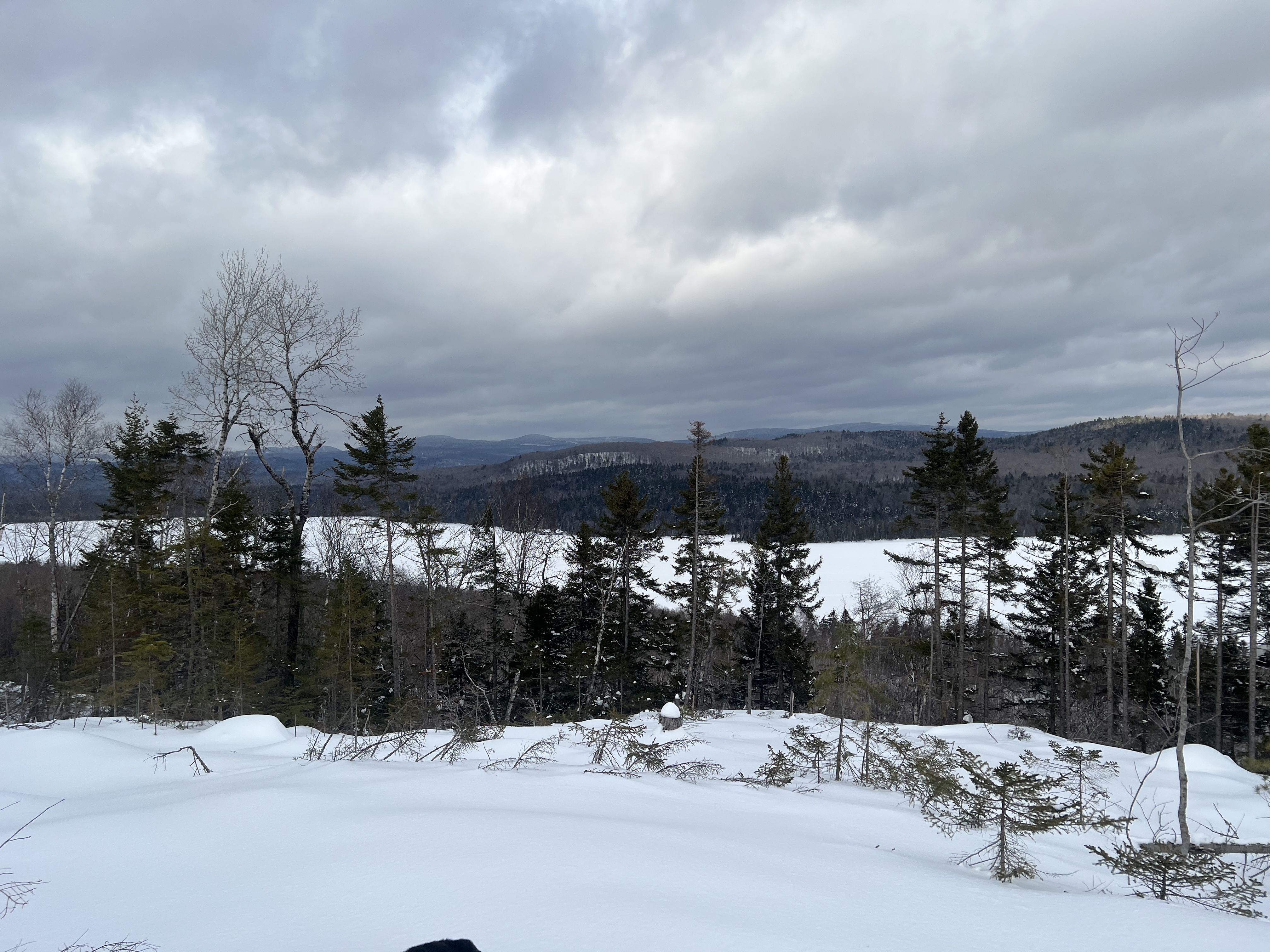 I followed a logging road for 1.5 miles, then took a left onto the skidder path. This was sketchy as hell at first, with all the limbs and brush from the delimbing operation just laid down on the trail and partially overgrown by grass. There were a couple other spots like that, but it was mostly solid ground. A little muddy in places from recent runoff, with lots of moose tracks and droppings. 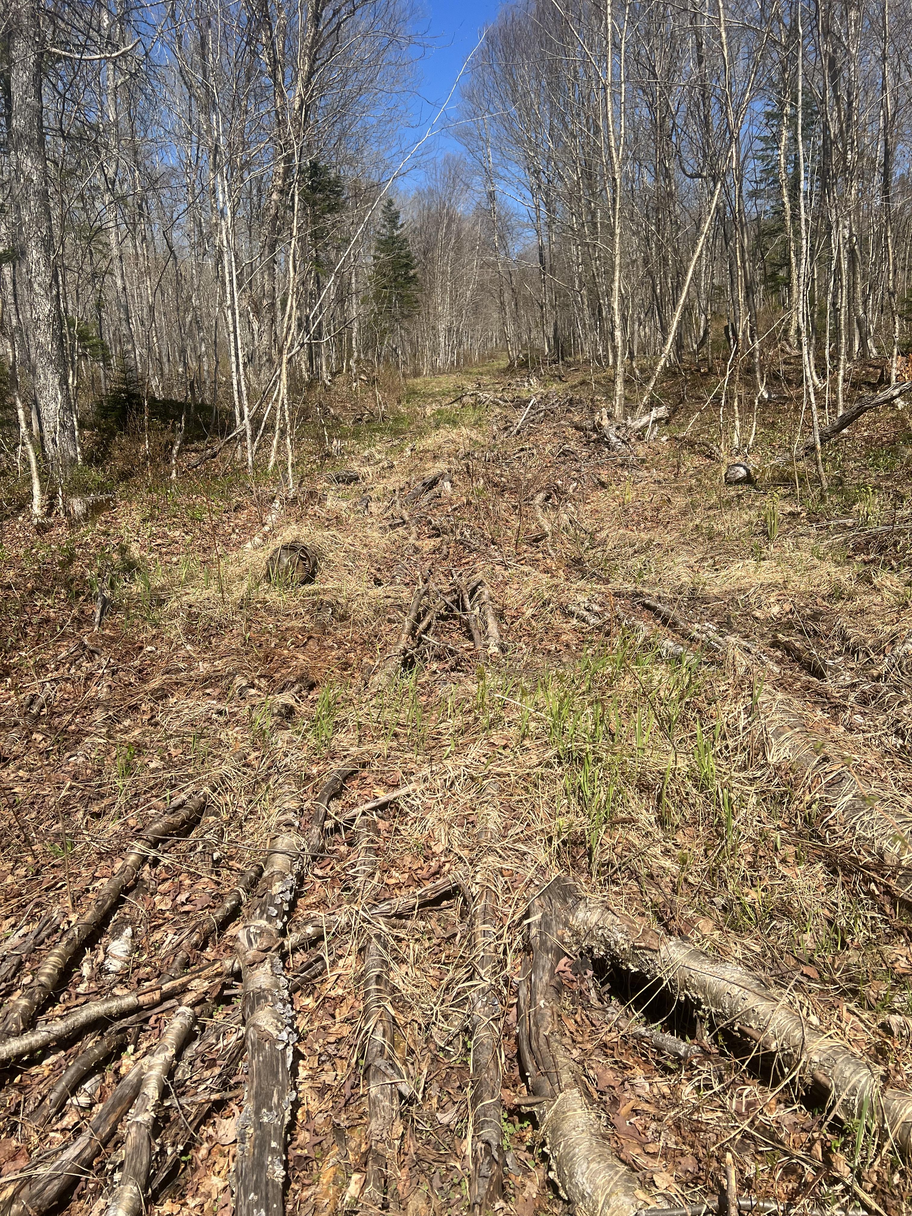 I knew there was a stream at the bottom from the map, but had never been down to it so this was a bit of a surprise. 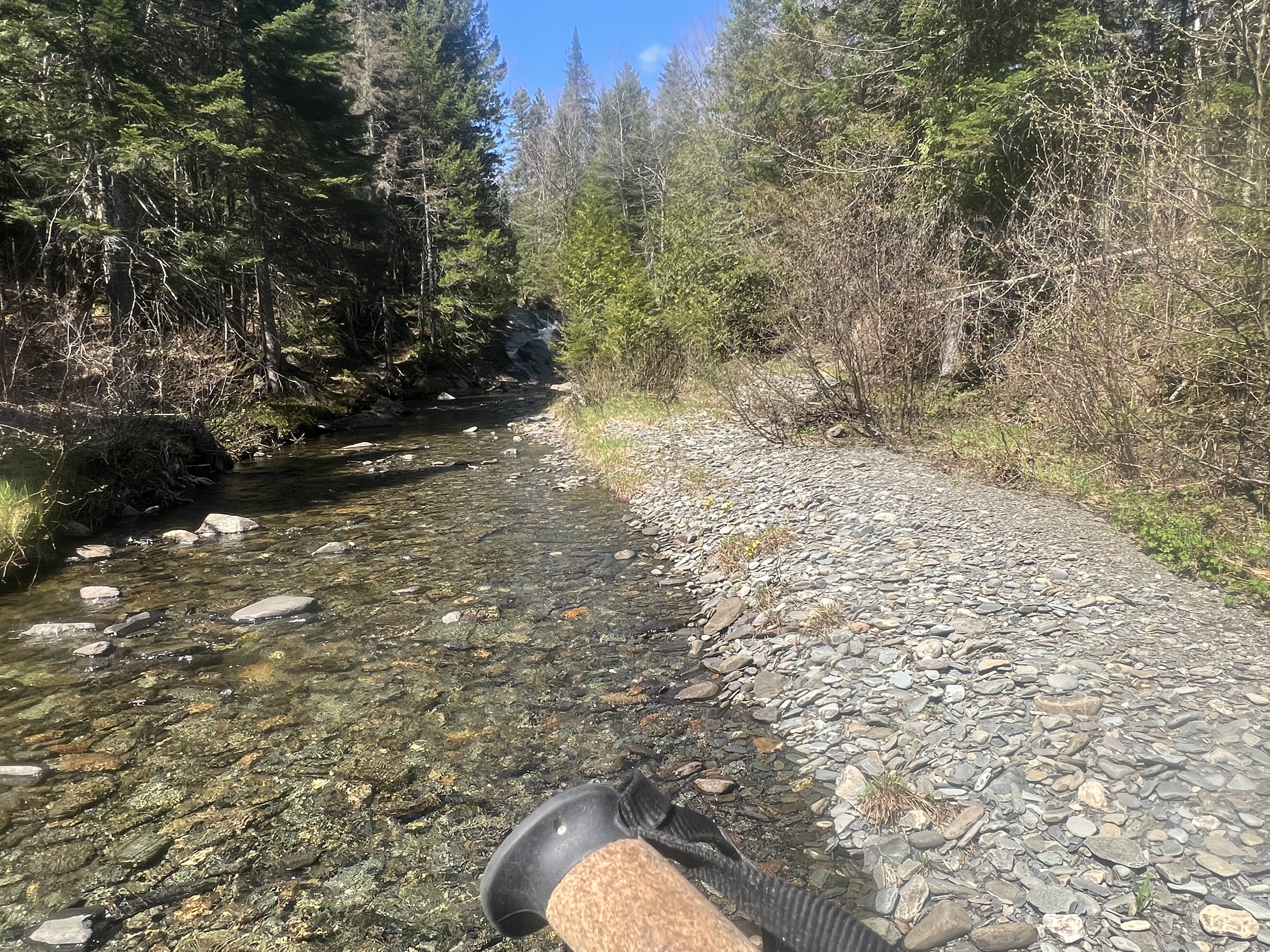 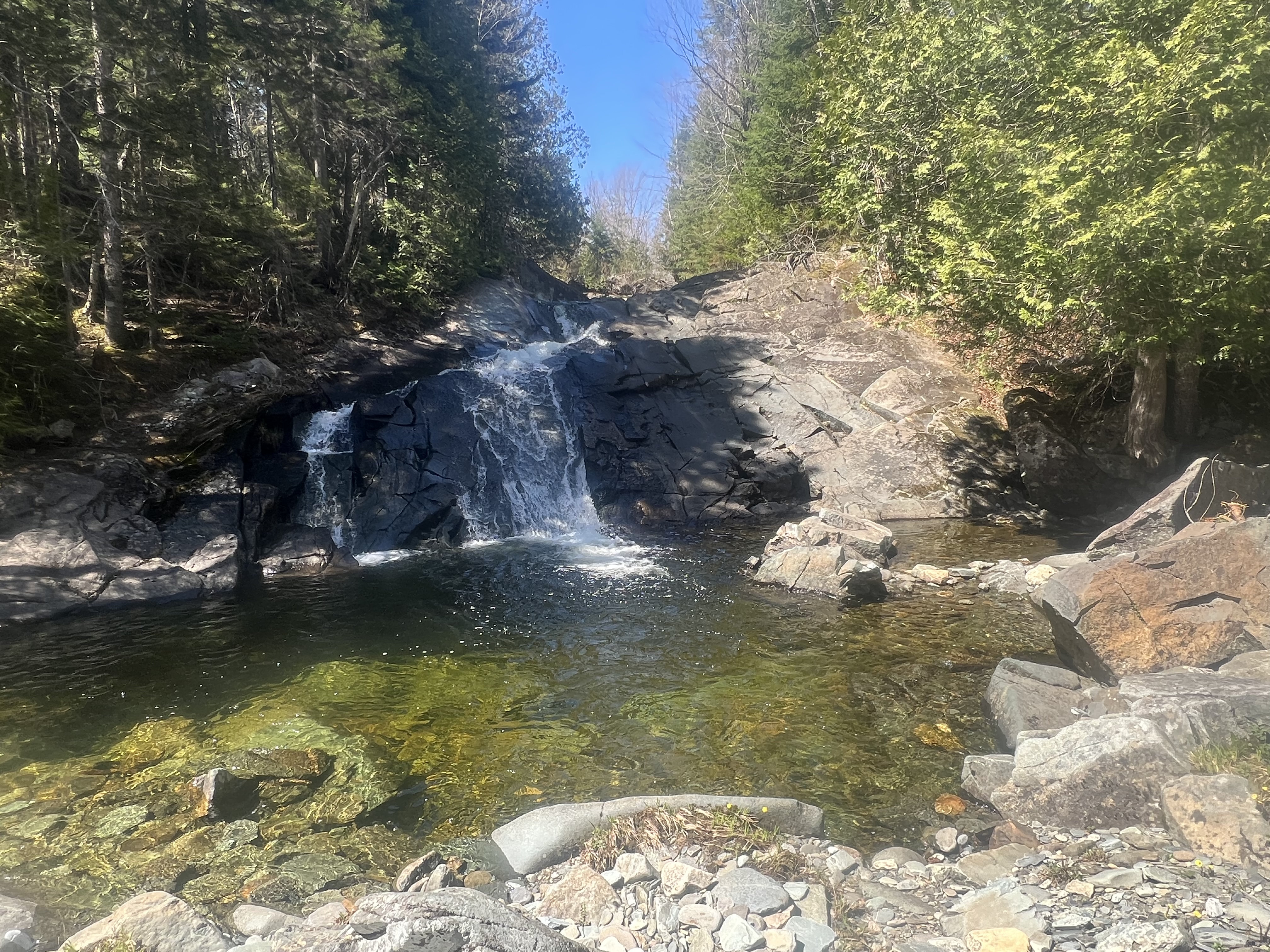  Cascades on Sandy Stream #1  Cascades on Sandy Stream #2 I was starting to get hungry and didn’t feel like boiling water and reconstituting one of the freeze-dried meals in my pack, so I headed back to the Jeep and back to town. If it’s not raining this coming weekend, and if I’m not too lazy to get all my yard work done during the evening this week, I’m heading up and hopefully making it to the summit. I should have done it this winter, when the snow was covering all the undergrowth. |
|
|
|
[Last Edit: tveddy]
[#4]
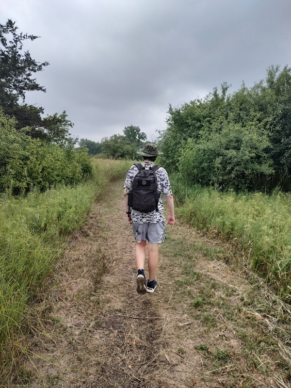
I did a 700 ft elevation 3 mile loop with a 40 lb 3yo in the pack
Eta just subscribed this. Need a hiking thread this summer for motivatuon |
|
|
|
|
[#5]
Originally Posted By tveddy: I did a 700 ft elevation 3 mile loop with a 40 lb 3yo in the pack https://www.ar15.com/media/mediaFiles/272736/20230513_104916_jpg-2817314.JPG Eta just subscribed this. Need a hiking thread this summer for motivatuon Hoping to get a bunch of pics from around the country and motivation as well. Nice having the Appalachian trailhead about 30 miles from the house |
|
|
|
|
[#6]
When training for a big hike I always do the Coosa Backcountry Trail at Vogel State Park.
That is a man breaker trail. If you can do that trail in 95 degree heat, you can hike anything in the US. |
|
|
|
|
[#7]
Originally Posted By gmill: When training for a big hike I always do the Coosa Backcountry Trail at Vogel State Park. That is a man breaker trail. If you can do that trail in 95 degree heat, you can hike anything in the US. Holy hell that one looks like a bear for a single day. |
|
|
|
|
[#8]
Up to Nc this weekend with the scout crew. 6.55 in, shitload of elevation climb. Back out in the morning
|
|
|
|
ME, USA
|
[Last Edit: ME2112]
[#9]
Went out exploring more in the Slidedown Mountain area, it ended up being a little disappointing because while slogging along an old skidder path all of a sudden I came to this.
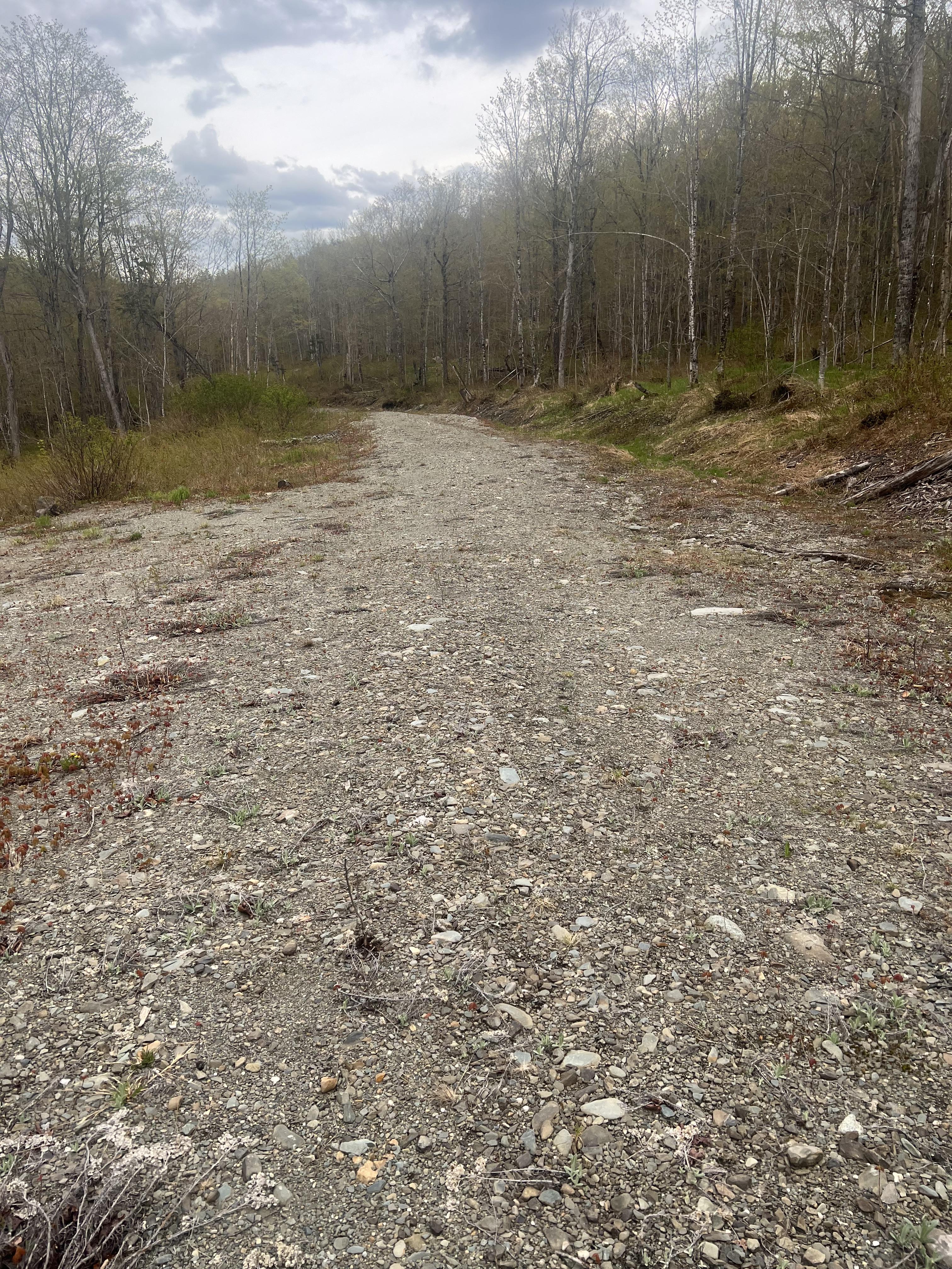 Nobody has been cutting up here for a long time, not with washouts like this from runoff. 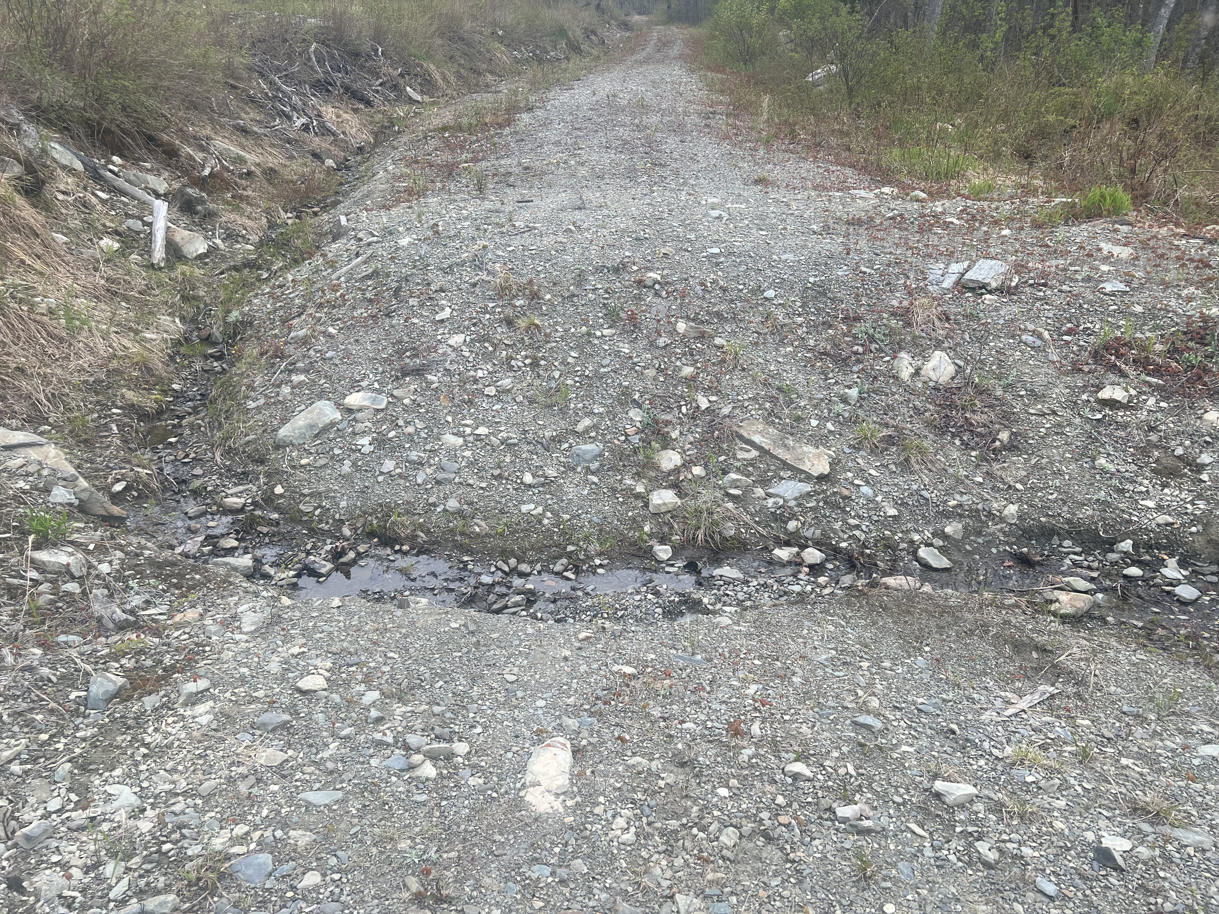 I was packed to spend the night and had planned on it (I wanted to see if my seam sealing job on my tent was any good LOL), but this was part of the reason I headed home instead. 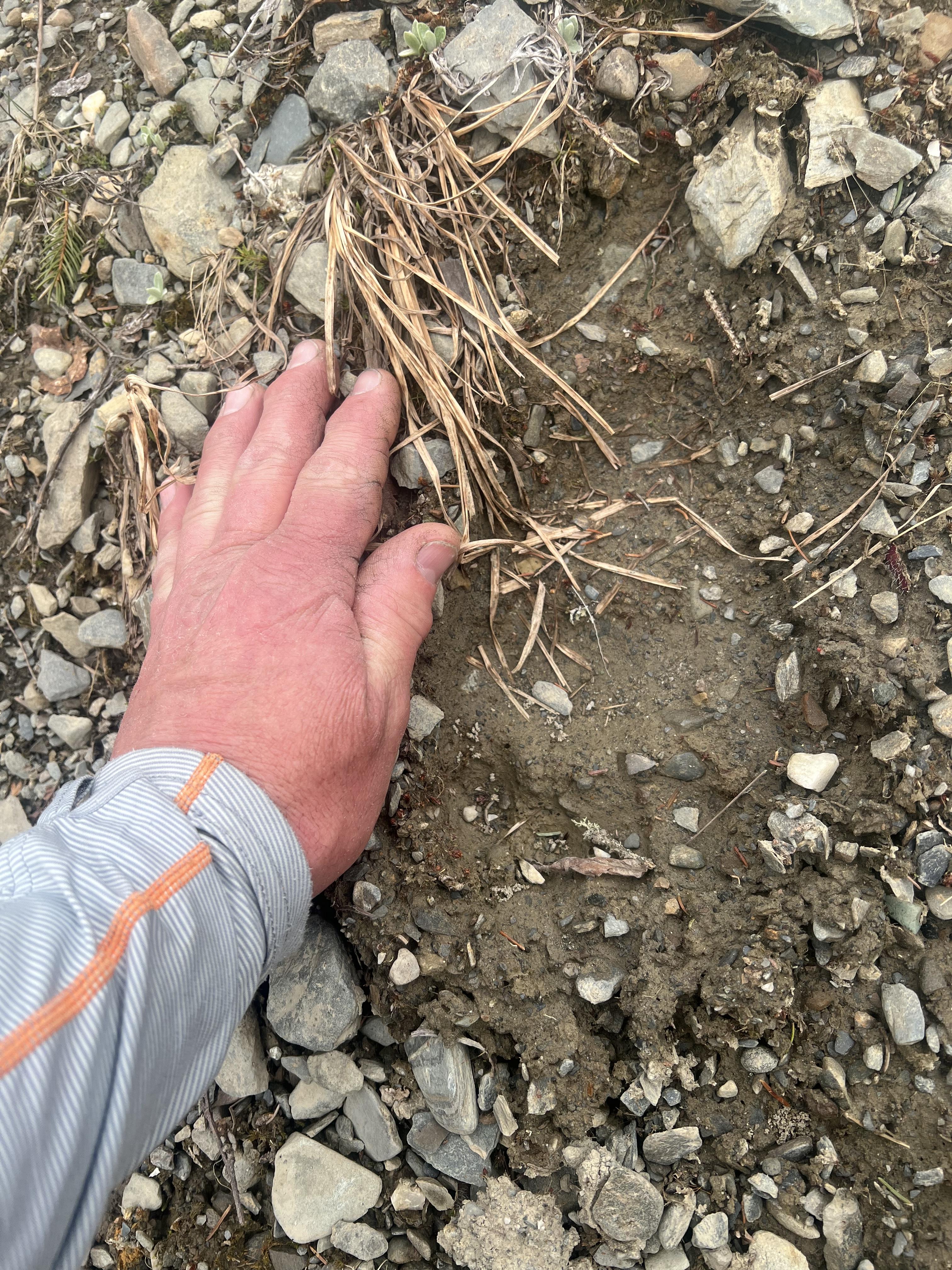 It wasn’t a fresh track, but knowing it was in the area within the past couple days and with a nice, pungent curry for my dinner I decided not to tempt fate. My total track today. 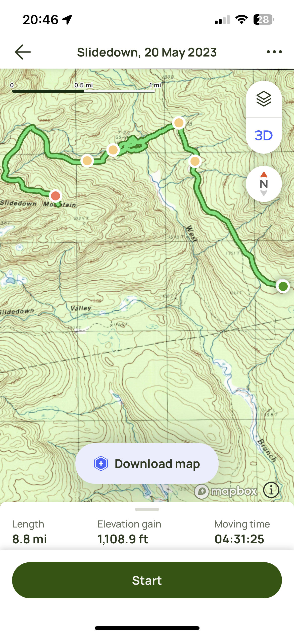
|
|
|
|
[#10]
Took my group out for a morning loop hike consisting of a few miles on our local long distance trail, the Finger Lakes Trail, combined with a seasonal road and a stretch of public road. Could have used more seasonal roads or FLT miles but we were on a time limit
I spent most of last week sick in bed so hikes on Friday and Saturday along with today's hike were still wiping me out fairly quickly |
|
|
|
|
[#11]
Originally Posted By tc556guy: Took my group out for a morning loop hike consisting of a few miles on our local long distance trail, the Finger Lakes Trail, combined with a seasonal road and a stretch of public road. Could have used more seasonal roads or FLT miles but we were on a time limit I spent most of last week sick in bed so hikes on Friday and Saturday along with today's hike were still wiping me out fairly quickly It’s quite the muscle group workout when hiking/backpacking. Calves going up then Hammies going down. I’m recovering better from this one than our savage gulf run last month |
|
|
|
|
[Last Edit: spmx7777]
[#12]
Me and Mrs spmx7777 hiked a few short trails at Joshua Tree NP.
A view from the trail, we didn’t walk up those rocks. San Andreas fault is the ridge in the middle of this valley. Yes, that’s a rattle snake. |
|
|
|
|
[Last Edit: TREETOP]
[#13]
My lower back and my knees are pretty jacked up lately so I haven’t been doing anything extreme, but there’s a 90 acre nature preserve a mile from home and I get out there and walk the trails a couple times a week.
This is my favorite time of year there. In the winter the trees are like tree skeletons without their leaves, so springtime is such a welcome season. 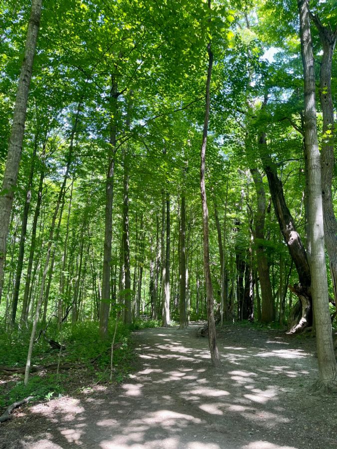 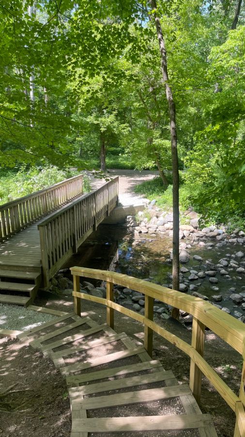 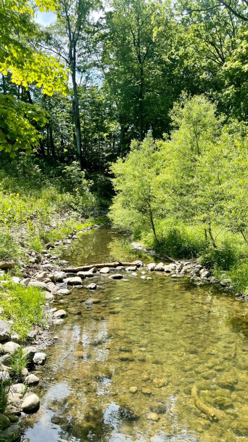
|
|
|
|
|
[#14]
Nice. Keep ‘em coming.
10.2miles today with the kid. No real views and a lot of horse shit. Probably because we were on a horse trail but I digress He stopped for water on a horseshoe and didn’t even notice. |
|
|
|
ME, USA
|
[#15]
Today I went to another local mountain, 3639’ Boundary Bald, with a plan to spend 1 night and possibly 2 on it. The goal tonight was to follow an old ATV/Jeep track (actually probably a VERY old logging track) to where it ended to the SE of the 3454’ easternmost summit on the ridge, bushwhack up, and camp at a cleared spot on the summit.
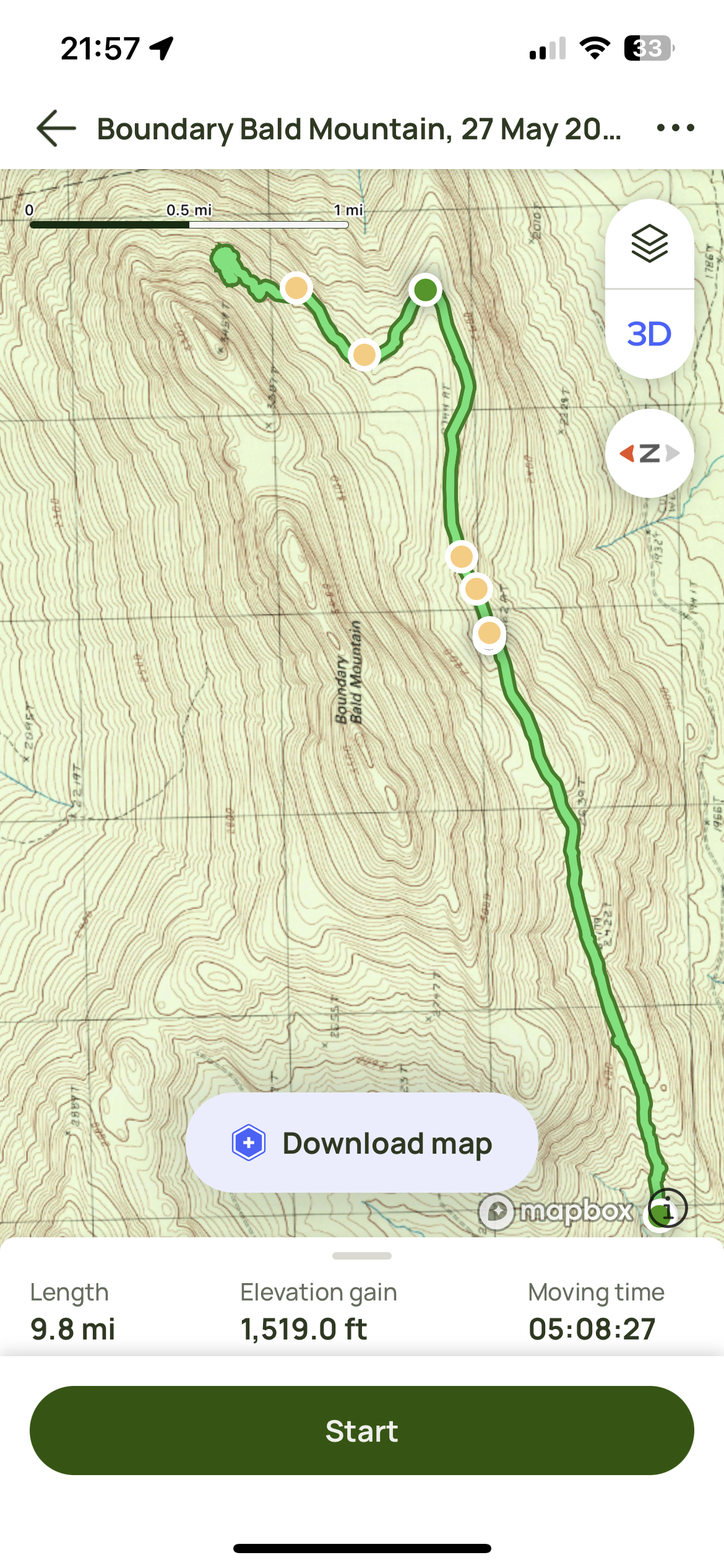 The problem was that I got a late start and was pretty much out of daylight by 1730 since I was going up the eastern slope. It was NASTY! Not something I wanted to do by headlamp. But I followed moose trails to get to this point, at least they’re easy to follow due to the ubiquitous piles of huge Cocoa Puffs. I had to go slowly and keep checking all around because they started dropping calves in the last 2 weeks and stumbling into a cow and calf is #1 on my list of shit not to do. 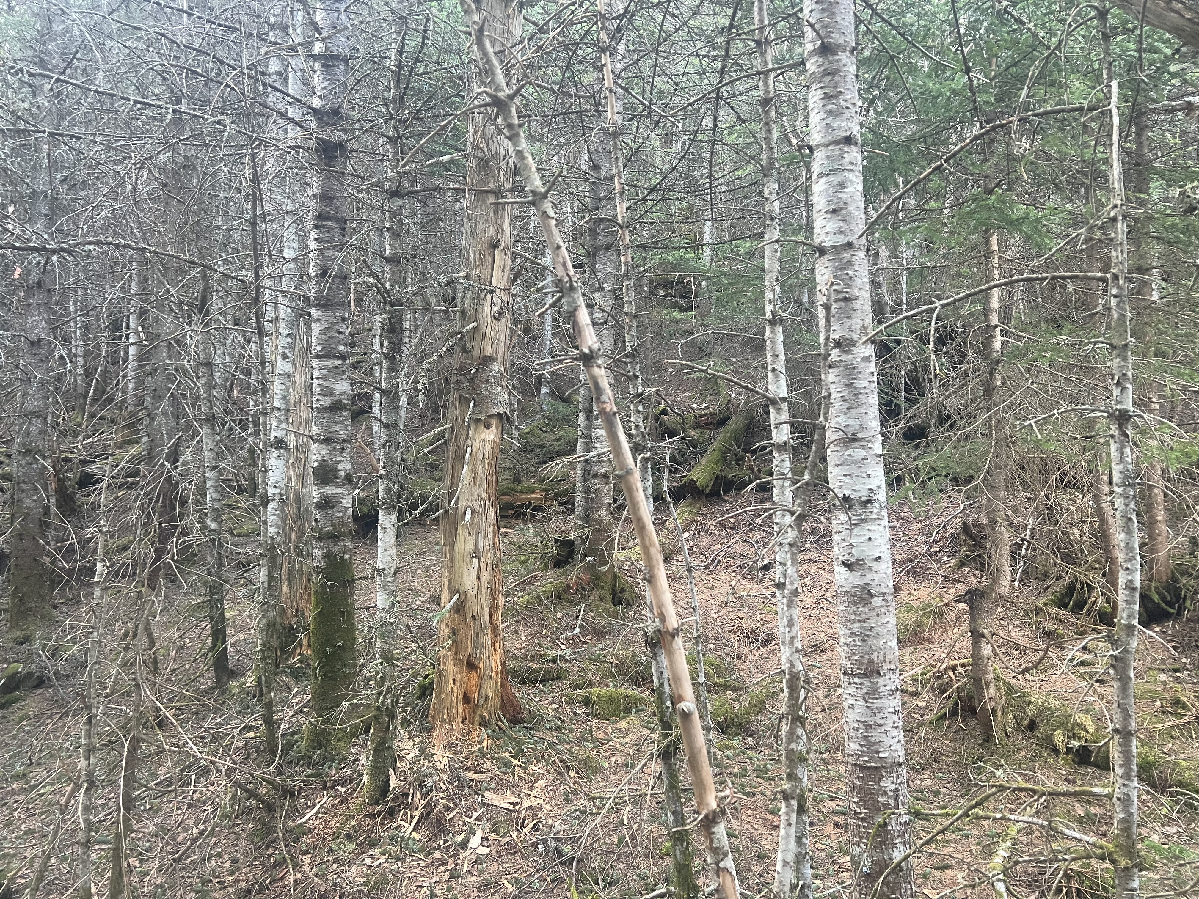 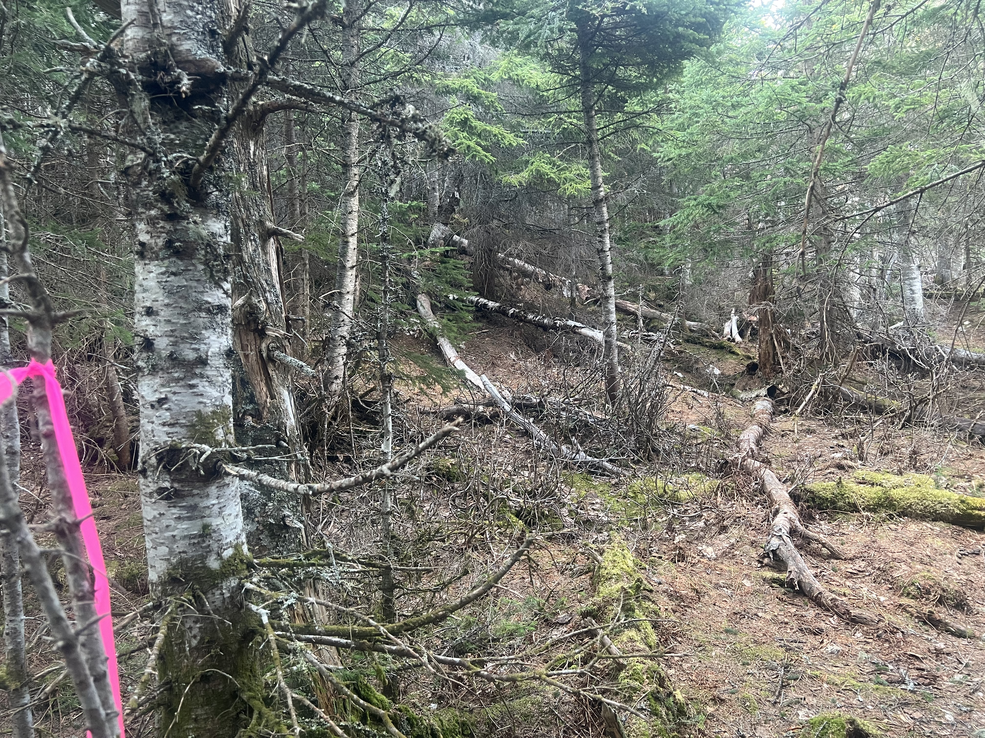 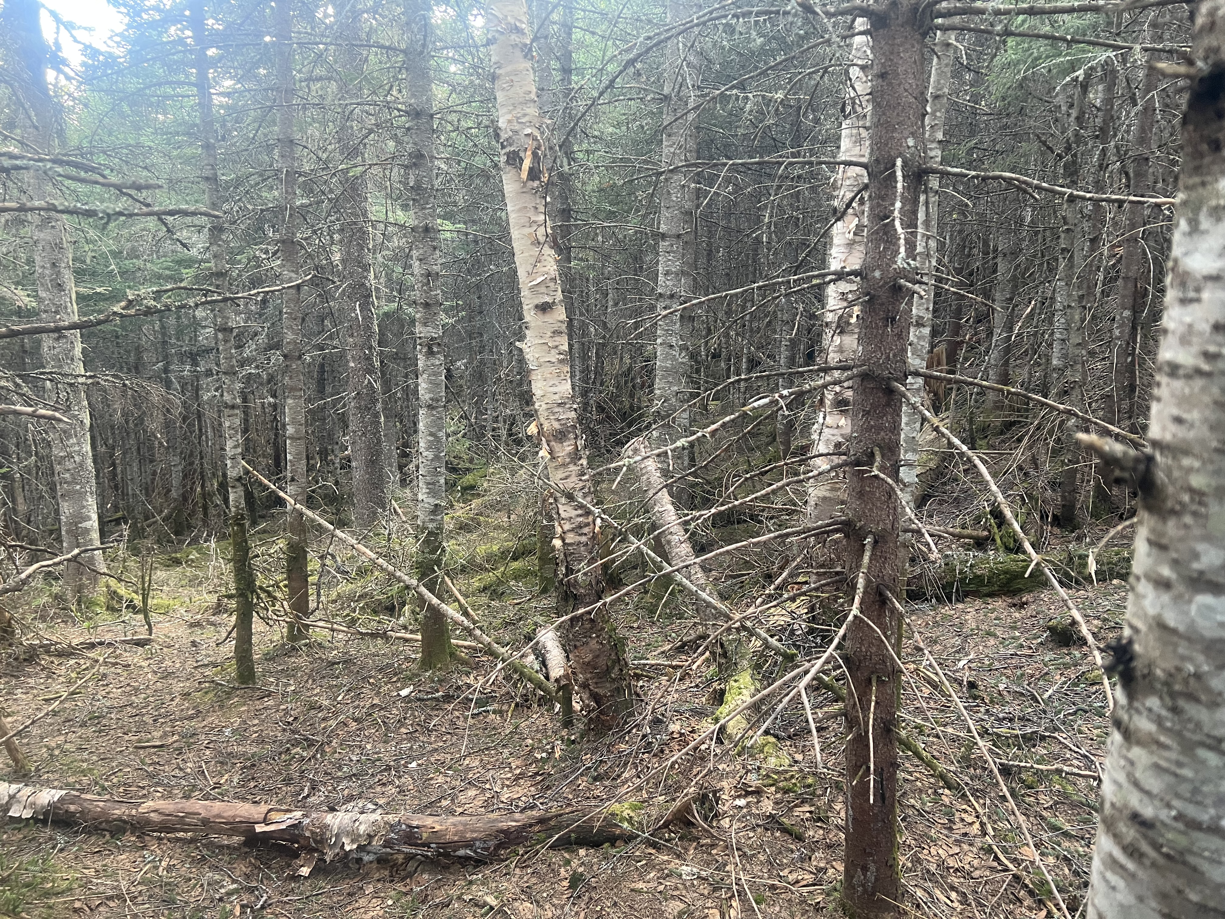 So maybe next weekend I’ll get an early start and find a path up there that’s not too hazardous. From there I want to follow the ridgeline, down the cols and over the summits, until I get to the main summit. From there I want to either follow an old defunct trail down or mark out my own. There’s a trail that goes up but I’ve done that at least 1/2 dozen times and it’s boring now. Next time I do it will be in winter, the summit is above the treeline so I can try out a sleeping bag, pad, and a couple mountaineering tents I haven’t used yet. 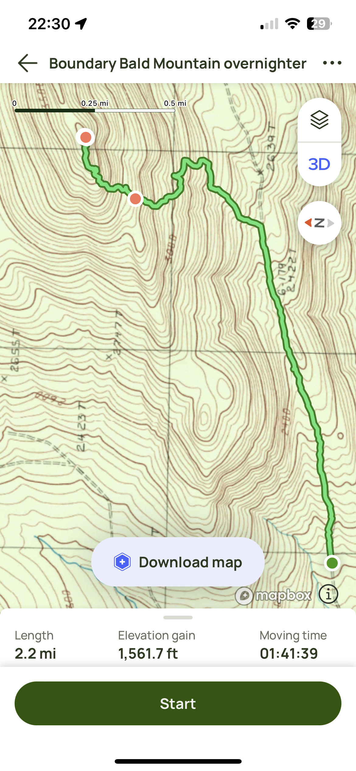 |
|
|
|
[#16]
That topo map looks a little steep
|
|
|
|
|
[#17]
A couple days ago we did the 49 Palms Oasis Trail at Joshua Tree NP. Easy trail to follow, no shade on the trail except at the end, go very early to avoid the heat, take plenty of water, hiking poles are helpful, lots of steps carved into the hillsides.
|
|
|
|
MO, USA
|
[#18]
Took grandson for walk behind the house half mile maybe in woods. Hes 3 and kept stopping to grab rocks to throw in creek when we got to it. There was no water in creek......he was bummed.
|
|
|
|
[Last Edit: L_JE]
[#19]
No idea how many miles this is. Not many. But, that last mile or two, I'm particularly proud of those. Blazing hot sun, and a firm 3:30pm deadline to catch the last cabin heading back to France.
"We don't have time for this.". "We don't have time for that.". "We don't have time for that, either." ... I know I sounded like bitchy broken record, but I got us into the station with 11 minutes to spare, this over the course of a 10 hour day. If we were 12 minutes slower, that would have set us back a full day, given the transport schedules.  There's an errant point in there, and I'm guessing that point pings around 9:30am, when I was heading up a somewhat tight slot. At least the point throws out far enough that it is too far to be a fall or avalanche. Fortunately, nobody watches this real-time, so worrisome stuff like that isn't so worrisome. ETA:  |
|
|
|
|
[#20]
Did this 3 weeks ago.
Pikes Peak 2 weeks ago via Devils Playground This one will be done in the coming weeks |
|
|
|
|
[#21]
Horrible air quality due to the Canadian forest fires. Most of my hikers stayed indoors and complied with air quality hazard warnings the local health department was putting out
Five of us decided to defy the warnings and hit a local loop trail for a couple of hours. The orange sun, the twilight levels of illumination, the massive wall of grey haze that shut down any long views, the omnipresent campfire smell, it all contributed to a very eerie feeling. We're supposed to get some precipitation the next three days so hopefully that will flush some of the crud out of the air. |
|
|
|
|
[#22]
Hiked 6 miles. Gained 1000 ft of elevation topping out at 10919ft carrying my 45lb 3 yo in the pack. This was a tough one |
|
|
|
|
[#23]
Hiked Owl’s Head Mountain, in the Pemigewasset Wilderness (NH) yesterday. 20 miles, 3k elevation gain. Pretty long approach (nice woods walk with several stream crossings) and a steep climb to a wooded view less summit.
|
|
|
|
|
[#24]
Originally Posted By spuddicus: Nice. Keep ‘em coming. 10.2miles today with the kid. No real views and a lot of horse shit. Probably because we were on a horse trail but I digress https://www.ar15.com/media/mediaFiles/150826/IMG_4698_png-2830929.JPG He stopped for water on a horseshoe and didn’t even notice. https://www.ar15.com/media/mediaFiles/150826/IMG_4697_jpeg-2830930.JPG Interesting. I didn't know Garland Mtn. had trails. |
|
|
|
|
[#25]
Hiked Peaked Mountain today, eastern central Adirondacks. Less than 10 miles, 1400 feet of ele. gain.
Nice brook, pond and beaver activity to see before it gets steep to the summit. Pretty views into the Siamese Ponds Wilderness Area. |
|
|
|
|
[Last Edit: tc556guy]
[#26]
Sixteen hikers and one dog on a loop route through Shindagin Hollow State Forest using various bike and snowmobile trails and the Finger Lakes Trail
https://www.dec.ny.gov/docs/regions_pdf/shdhll.pdf |
|
|
|
|
[Last Edit: sandboxmedic]
[#27]
Another seven miles, nothing hard but it was 95F and typical SC humidity. I knocked out my 100oz Camelbak and had iced water waiting on me in the truck. I've hiked out west, in Mexico and Central America, the Middle East and around Asia during the summer too, just gotta know what you're doing and know yourself.
I've been increasing my trail running, trying to get back into it and I'm running the last mile to mile and a half which I'm kind of proud of given I'm kinda busted up at this point in my life. Dropping a motorcycle on your knee will do that.  I carry a daypack with basically the same stuff I've always carried, which is enough to stay out overnight in an emergency and the other doodads my young cousins think are excessive. It's rare to see others carrying much more than a bottle of water in their hand. I've thought about getting one of the weighted exercise bars just to carry since I obviously can't carry a rifle (ex. https://www.amazon.com/dp/B00XH756YS?tag=arfcom00-20). I figure it'd be better than nothing although I usually like to use one or two trekking poles. I've got a ten pound Indian mace but I really don't want to carry that thing. I carry a daypack with basically the same stuff I've always carried, which is enough to stay out overnight in an emergency and the other doodads my young cousins think are excessive. It's rare to see others carrying much more than a bottle of water in their hand. I've thought about getting one of the weighted exercise bars just to carry since I obviously can't carry a rifle (ex. https://www.amazon.com/dp/B00XH756YS?tag=arfcom00-20). I figure it'd be better than nothing although I usually like to use one or two trekking poles. I've got a ten pound Indian mace but I really don't want to carry that thing. While I prefer having the trails mostly to myself, I find it sad how few people you see on the trails these days, especially younger people. My cousin's kids are usually with us and they're easily the youngest outside of the playground part of the state parks. It's really odd to me too that most of the people I see on mountain bikes are in their mid forties or older. I honestly think the youngest I've seen on mountain bikes were probably in their thirties, only a couple of them and of those some had electric assist of some sort. I didn't seen the Scout camping area used but once this summer and that group was sitting around apparently for some sort of summer camp; I haven't seen anyone camping in the Scout area and not that many campers in the campground either (and all of those were RVs or tow behinds, not actual camping, i.e. tents). Same with the other parks I've been to. On the down side, the blueberry bushes are all about finished for the season and I only found a couple of blackberry bushes this year but the persimmons have fruit on them. I've done some other foraging, but we all know how dangerous that is. |
|
|
|
|
[#28]
Got out in the drizzling rain to finish off a few cooking merit badge requirements.
|
|
|
|
|
[#29]
|
|
|
|
|
[#30]
94F, another six miles, running the last mile and a half then came home and edged, weed eated, mowed and blew off the front and back yards. Time to shower, slap on a Tigaer Balm patch and go eat some grilled chicken breast and kimchi.
Granted they moved in early this year, but I've never, ever seen my neighbor's 16yo boy do a lick of yard work; my neighbor says he likes to do it himself but I've never seen the kid even pick up a pine cone. He pulled up while I was mowing and quickly went inside. I grew up thinking that one of the reasons my parent's had kids was so that they didn't have to do yard work anymore. I was a yard mowing machine in the neighborhood too since it was one of the ways I made money for the weekends.
|
|
|
|
|
[#31]
Small group of eight on the local Bob Cameron Loop with a section of the Finger Lakes Trail at the end.
|
|
|
|
|
[Last Edit: kevhogAZ]
[#32]
Wife and I decided to try hiking. Bought some packs and all kinds of other cool stuff we thought we'd need, and set out for some eastern AZ adventures!! We've hiked before, but nothing over 3 miles, and nothing hard at all. Just the tourist stuff that everybody does.
Day 1. We hiked an easier trail, ~5 miles out and back, along a small stream the whole way. It was the wife's birthday, and she insisted we hike where there was water. I think I nailed it!! Oh yeah, if you think AZ is nothing but dirt and cactus, prepare to be blown away!! Our goal was the small dam in the pics. We hiked a bit past it, but the trail turned in to nothing but rocks and boulders, so we turned around and headed back.      No idea why there's a tank trap in the middle of the stream!! Is this a future dam??  Day 2. Decided we'd try something a little harder. Mt. Baldy has an east and west trail that go to the summit. We took the east side. Our goal was to make it to the top, and check out a plane crash. We didn't get there, due to the rain storm that came in and the thought of getting struck by lightning didn't seem appealing at all!! So, we hiked up about 4.5 miles and then turned around and headed back down.       Not bad for our first foray in to the hiking world!! We're already planning on going back and making it to the plane crash next summer before the monsoons hit. |
|
|
|
|
[#33]
Saturday: 23 hikers, 1 dog. Buttermilk Falls State Park
https://parks.ny.gov/documents/parks/ButtermilkFallsTrailMap.pdf Generally a decent hike loop in the summer. They've been slow to repair trail damage this year Sunday: 17 hikers, 1 dog. Logan Hill Nature Preserve https://www.fllt.org/wp-content/uploads/2016/02/Preserve-Brochure-Logan-3.pdf We usually save this place for one summer hike every August. Nice mix of open fields, ponds, ravines, wooded trails. Not much elevation change after the initial approach trail coming out of the adjacent village. |
|
|
|
|
[#34]
Originally Posted By kevhogAZ: Wife and I decided to try hiking. Bought some packs and all kinds of other cool stuff we thought we'd need, and set out for some eastern AZ adventures!! We've hiked before, but nothing over 3 miles, and nothing hard at all. Just the tourist stuff that everybody does. Day 1. We hiked an easier trail, ~5 miles out and back, along a small stream the whole way. It was the wife's birthday, and she insisted we hike where there was water. I think I nailed it!! Oh yeah, if you think AZ is nothing but dirt and cactus, prepare to be blown away!! Our goal was the small dam in the pics. We hiked a bit past it, but the trail turned in to nothing but rocks and boulders, so we turned around and headed back. https://i.imgur.com/Gf7P43f.jpg https://i.imgur.com/8awMFPc.jpg https://i.imgur.com/jPeVX0y.jpg https://i.imgur.com/qocVCGS.jpg https://i.imgur.com/kjKallp.jpg No idea why there's a tank trap in the middle of the stream!! Is this a future dam?? https://i.imgur.com/aYhEknW.jpg Day 2. Decided we'd try something a little harder. Mt. Baldy has an east and west trail that go to the summit. We took the east side. Our goal was to make it to the top, and check out a plane crash. We didn't get there, due to the rain storm that came in and the thought of getting struck by lightning didn't seem appealing at all!! So, we hiked up about 4.5 miles and then turned around and headed back down. https://i.imgur.com/qrdTJiq.jpg https://i.imgur.com/0YeNG9G.jpg https://i.imgur.com/56ExdTN.jpg https://i.imgur.com/wLC4UpH.jpg https://i.imgur.com/6ga7fZp.jpg https://i.imgur.com/kO0Vv53.jpg Not bad for our first foray in to the hiking world!! We're already planning on going back and making it to the plane crash next summer before the monsoons hit. If you hadn't pointed out that it was Arizona I would have never guessed it. Interesting landscape. |
|
|
|
|
[#35]
Originally Posted By Loonytik: If you hadn't pointed out that it was Arizona I would have never guessed it. Interesting landscape. 21% or so of the state is covered by Ponderosa pine forests- from west of Flagstaff down east southeast through the center East of the state and into New Mexico. The higher elevations in the eastern part where kevhog hiked are by far the wettest and coolest. |
|
|
|
|
[#36]
Originally Posted By lew: 21% or so of the state is covered by Ponderosa pine forests- from west of Flagstaff down east southeast through the center East of the state and into New Mexico. The higher elevations in the eastern part where kevhog hiked are by far the wettest and coolest. All of this is true. It rains pretty much every day in the White Mountains where I was at, for most of the summer. We definitely have a few different options when it comes to forests out here. |
|
|
|
|
[#37]
Originally Posted By kevhogAZ: All of this is true. It rains pretty much every day in the White Mountains where I was at, for most of the summer. We definitely have a few different options when it comes to forests out here. I drove through Arizona once and all I saw were rocks and dirt. To be fair, I was only on the interstate but I do remember the exit signs saying "Exit 5, No Services." I assume those were for ranchers to get to the other side of their 100,000 acre ranches. |
|
|
|
|
[Last Edit: tc556guy]
[#38]
Robinson Hollow State Forest
https://www.dec.ny.gov/docs/regions_pdf/robinsonhollowsf.pdf Bit of a gloomy day under the canopy, and rain didn't help. Lots of contrasting color on the forest floor thanks to an explosion of various fungi along the trail. A good percentage of this forest gets overlooked due to it falling outside the corridor of the Finger Lakes Trail. |
|
|
|
|
[Last Edit: tc556guy]
[#39]
Loop hike, CCC Rim and Gorge Trails Robert Treman State Park
Perfect hiking weather https://parks.ny.gov/documents/parks/RobertHTremanTrailMap.pdf |
|
|
|
|
[#40]
Cayuga Trail, south side, in a loop
26 hikers, 3 dogs https://ithacatrails.org/site/Cayuga%20Trail Warm sunny weather. Nice day to be out. |
|
|
|
|
[Last Edit: ADKRebel]
[#41]
I’m visiting NH. Saturday I hiked Mt. Starr King and Waumbek. Saturday I hiked Moriah and the Carters and stayed at Carter Notch Hut. Monday I hiked the Wildcats and didn’t die descending from Wildcat D. It’s steep.
Today is gorgeous but my legs and feet need a rest. |
|
|
|
|
[#42]
Good work ADK. Looks like you're in Gods country
|
|
|
|
|
[#43]
Green and yellow blazed multi-use trails on Hammond Hill State Forest. Lots of single and group day hikers, dog walkers , equestrians and mountain bikers sharing the trail system today
https://www.dec.ny.gov/docs/regions_pdf/hammondhillsf.pdf |
|
|
|
|
[#44]
Bristlecone pine loop
3.7 miles and almost 800 ft of elevation gain. Carried 45 lb toddler in the pack |
|
|
|
|
[Last Edit: tc556guy]
[#45]
Bock Harvey Preserve and Rieman Woods Preserve in Enfield NY, along with part of the Finger Lakes Trail that passes through the area
https://www.fllt.org/preserves/bock-harvey-forest-preserve/ https://ithacatrails.org/site/Riemen%20Woods%20Nature%20Preserve |
|
|
|
|
[#46]
Sunday hike on the Finger Lakes Trail through Danby State Forest
https://www.dec.ny.gov/lands/64131.html https://www.dec.ny.gov/docs/regions_pdf/danbysf.pdf |
|
|
|
ME, USA
|
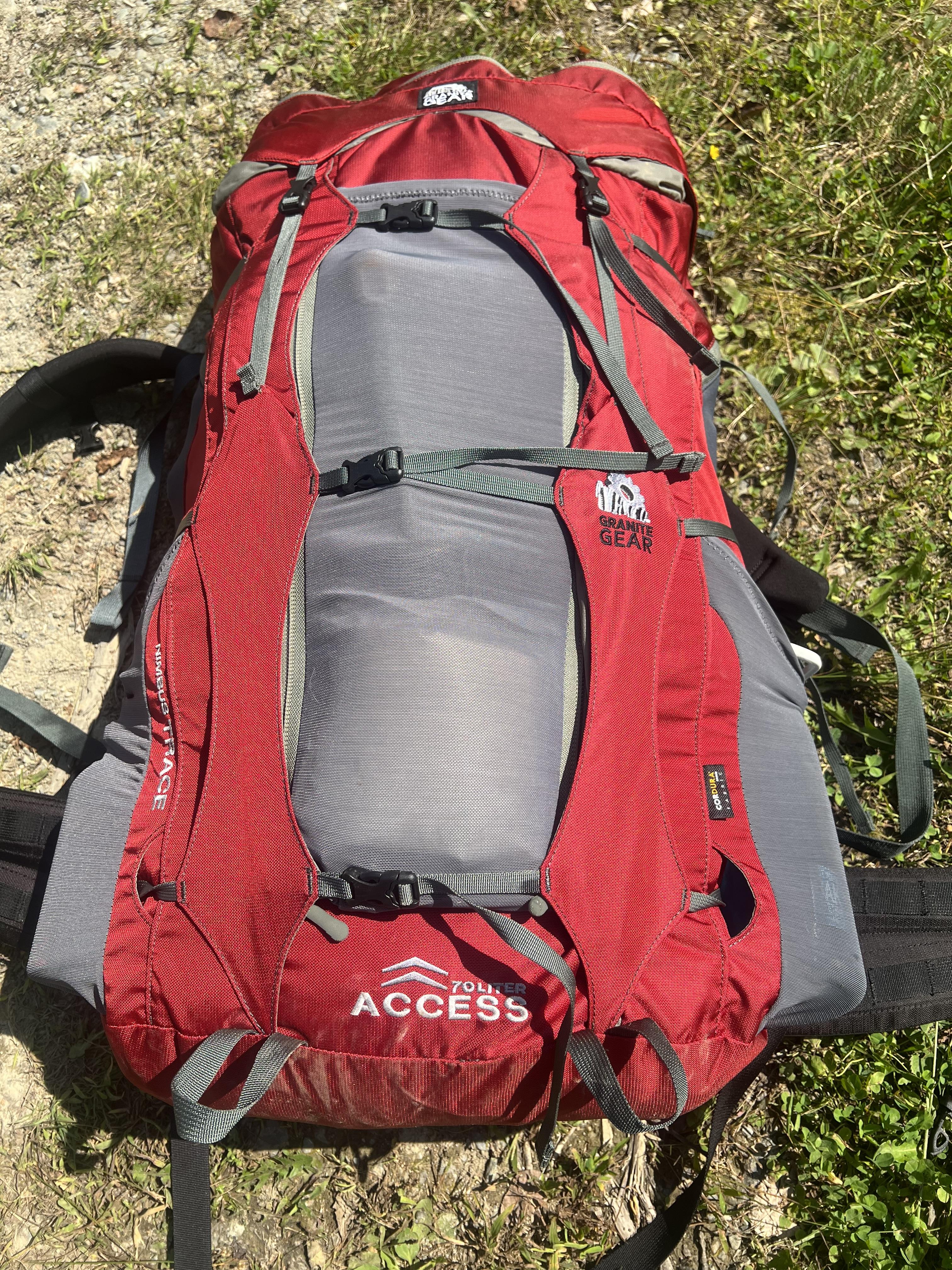
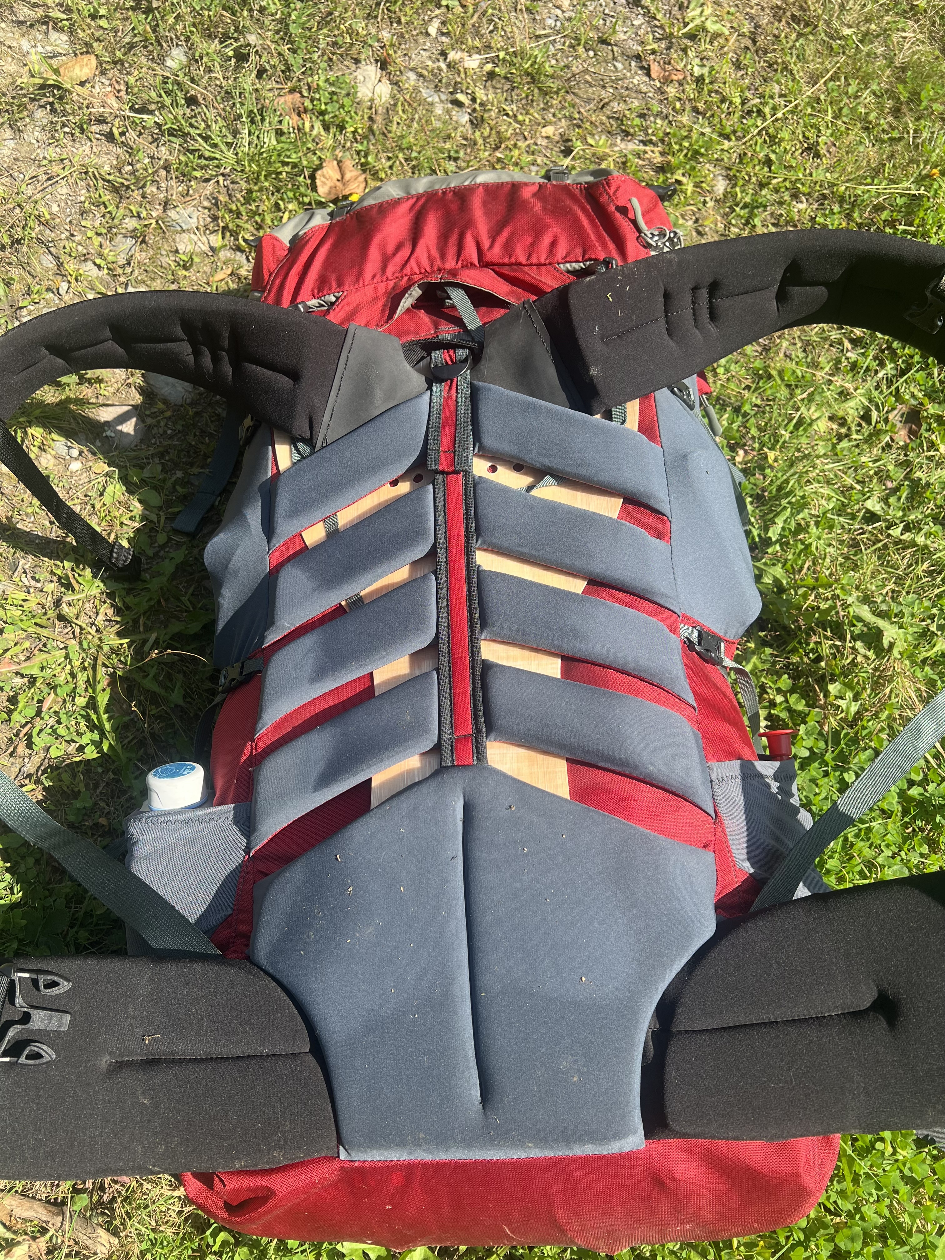
[#47]
Just did a couple miles today, testing out a new Granite Gear Nimbus Trace Access 70. It was pretty comfortable but I have to experiment with packing and also the shoulder strap adjustment.
|
|
|
|
[#48]
Black Diamond Trail, a local converted rail trail
https://parks.ny.gov/documents/parks/BlackDiamondBlackDiamondTrailMap.pdf |
|
|
|
|
[#49]
I hiked three different ADK trails today. Echo cliff near Piseco, Crane Mountain and Buck Mountain, which has a new trail cut to the firetower at the summit. Gorgeous weather!
|
|
|
|
|
[#50]
Saturday:
James Kennedy State Forest: https://www.dec.ny.gov/lands/8192.html Sunday: Bahar Preserve Carpenter Falls https://www.fllt.org/preserves/bahar-preserve-carpenters-falls/ |
|
|
|
 Win a FREE Membership!
Sign up for the ARFCOM weekly newsletter and be entered to win a free ARFCOM membership. One new winner* is announced every week!
You will receive an email every Friday morning featuring the latest chatter from the hottest topics, breaking news surrounding legislation, as well as exclusive deals only available to ARFCOM email subscribers.

AR15.COM is the world's largest firearm community and is a gathering place for firearm enthusiasts of all types.
From hunters and military members, to competition shooters and general firearm enthusiasts, we welcome anyone who values and respects the way of the firearm.

Subscribe to our monthly Newsletter to receive firearm news, product discounts from your favorite Industry Partners, and more.
Copyright © 1996-2024 AR15.COM LLC. All Rights Reserved.
Any use of this content without express written consent is prohibited.
AR15.Com reserves the right to overwrite or replace any affiliate, commercial, or monetizable links, posted by users, with our own.