|
Posted: 7/20/2008 9:02:45 PM EDT
My Dad's 60th birthday was this past weekend, so the family and I headed to Heber Springs ARk. to Greer's Ferry Lake, Ark. My Dad has a house there, so I did I little searching and found this for a bit of a hike.
http://www.ffbchamber.org/cms/?page_id=21 I was not disappointed as this was a wonderful hike. Take a look at the pics below. The only way to get here is by boat and from my dad's house to the mountain was about a 45 minute boat ride. I left out at about 6:30 and the lake looked like this 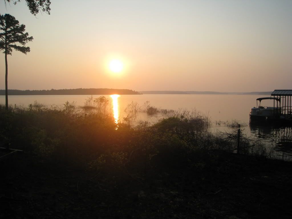 Beautiful does not even describe it. The water was super smooth and the air was cool. The mist hung in the air as I rounded the corner was was greeted with Sugar Loaf mountain. 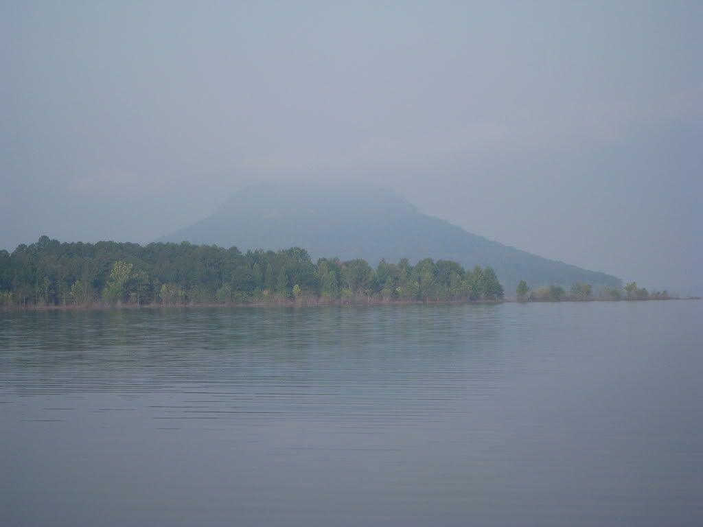 After I got the boat tied up, I found a bit of a problem, which was solved by a quick boot removal. Apparently, the tornado that went through here this May did a bit of damage to the island including the dock. 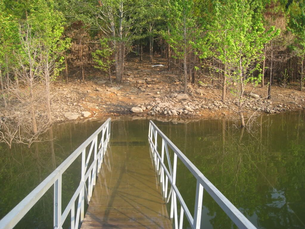 The trail begins by heading about 1/3 of the way up the mountain then around the circumference. The trail is easy to follow but is not easy as you are constantly going up and down. 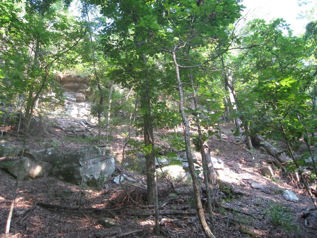 There are two ways up to the summit. The first takes you around the west side of the island and is a pretty easy walk up the steps, but the trail on the eastern side is gnarly. They were not kidding when they put up this sign. 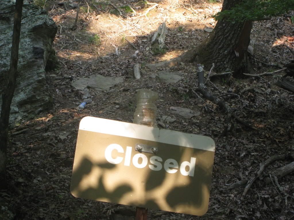 This is the view looking up. The pic is deceiving as the incline is about 60+ degrees. 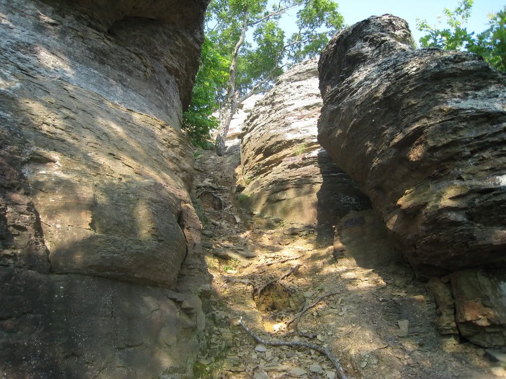 Here are a few pics of the hike on the way up.  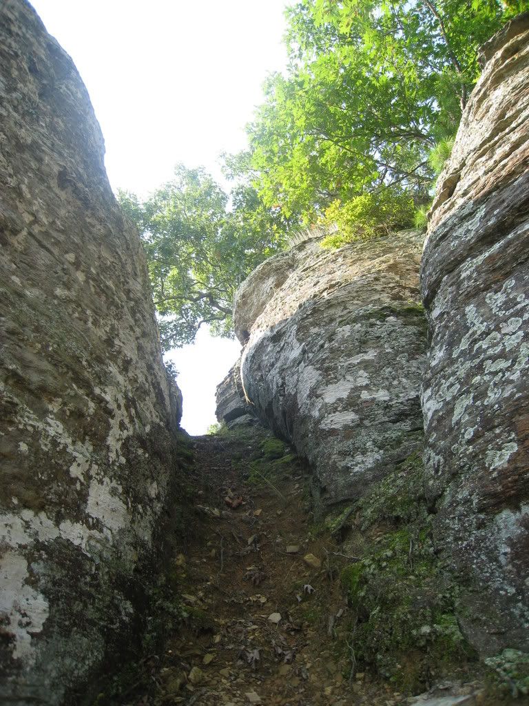  The top..... 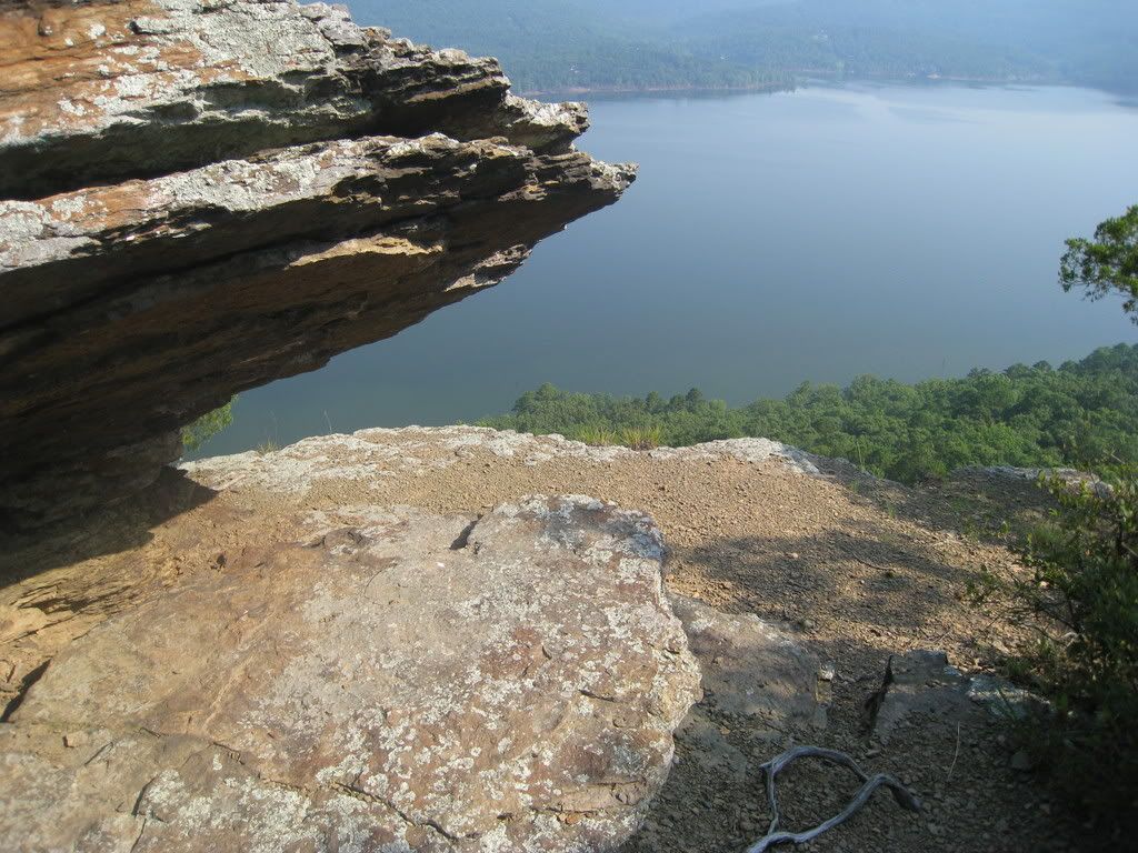 On my way down I saw a unique opptunity. I saw a pretty vertical descent that just so happened to have a tree growing out from the top. Being the prepared guy that I am, I pulled out the rope, harness, carabiner, and fig 8. Instant haggard backwoods rappel. I rappelled down to a rock below. You can see it looking down in this pic. 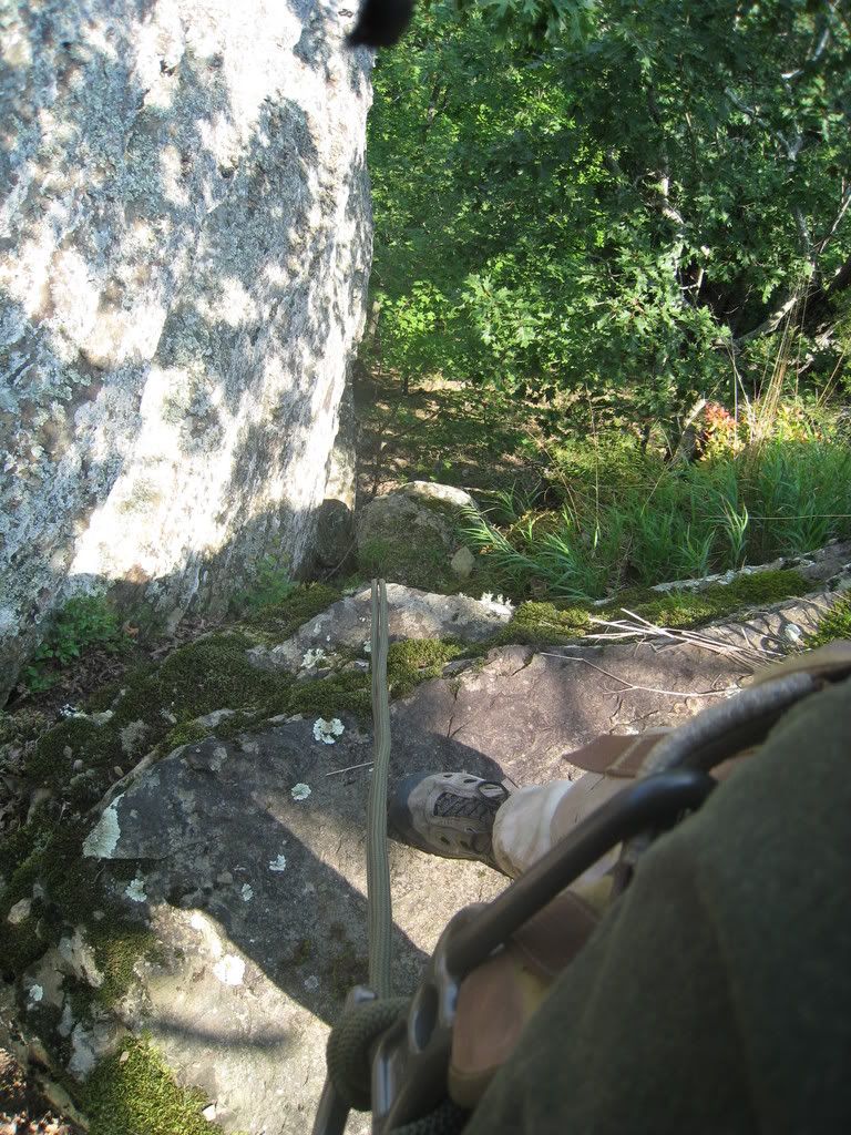 So I locked in, pushed away and headed down. Was a bit sketchy as I had to bounce off the rock on one side a couple of times. Once I got to the bottom, I hooked onto another tree and headed down to the bottom. I tied off took a pic looking up. Pretty cool. 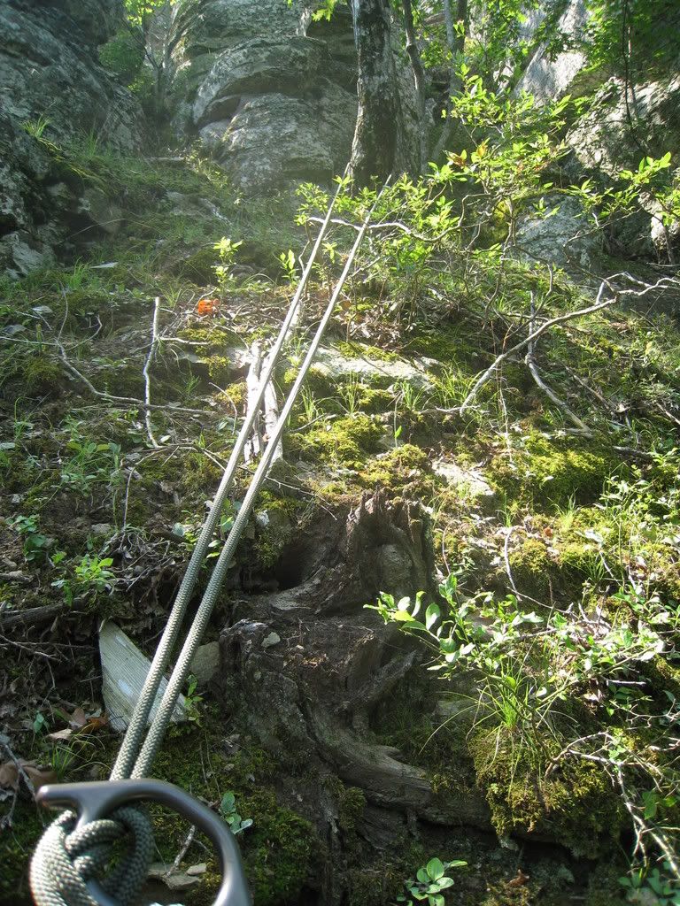 It wasn't the longest hike, but it was pretty tough. Temps were in the high 90's and the humidity was brutal with zero breeze. If you are ever in the area, I would highly recommend it. The view from the top is just amazing. It is about a 1000 foot peak. Hope you liked the pics. This would be a sweet place to do a campout. LD |
|
|
|
[#1]
Awesome pictures. Thanks for sharing!
|
|
|
|
[#2]
Great pictures...
Thx. for posting. ETA: It's a lot closer than driving to Colo. |
|
|
|
[#3]
Thanks guys. It was a cool hike. Pretty laid back. If I had a few buddies with me, there are a couple of serious rappel's and climbs that I would have worked on. I will see if I can post a few more pics.
LD |
|
|
|
[#4]
beautiful country
|
|
|
|
[#5]
Nice.......wish I had been there........
|
|
|
 Win a FREE Membership!
Sign up for the ARFCOM weekly newsletter and be entered to win a free ARFCOM membership. One new winner* is announced every week!
You will receive an email every Friday morning featuring the latest chatter from the hottest topics, breaking news surrounding legislation, as well as exclusive deals only available to ARFCOM email subscribers.

AR15.COM is the world's largest firearm community and is a gathering place for firearm enthusiasts of all types.
From hunters and military members, to competition shooters and general firearm enthusiasts, we welcome anyone who values and respects the way of the firearm.

Subscribe to our monthly Newsletter to receive firearm news, product discounts from your favorite Industry Partners, and more.
Copyright © 1996-2024 AR15.COM LLC. All Rights Reserved.
Any use of this content without express written consent is prohibited.
AR15.Com reserves the right to overwrite or replace any affiliate, commercial, or monetizable links, posted by users, with our own.