|
Posted: 3/2/2006 5:21:12 PM EDT
I'm changing my planned trip to Utah and going to Death Valley, Mono Lake and Yosemite mid March.
Any advice on extra things to see and do in the areas between these parks. How cold are the night temps in Yosemite? I am seeing 8 degree's at night. My wife is coming with me more than likeley so I plan on hearing some complaining on the trip.  But she can hack the long hikes and camping. I'd really like any info on the better ghost towns in the area. I plan on seeing the ghost town in NV. called Rhyolite. Thanks |
|
|
|
[#1]
www.bodie.net
bodie is the largest ghost town in america. yosemite is normally a crowded park and in the summer i would say it is a waste of time. in march there will be few people there and is about the best time to go. you might want to try kings canyon and the sierra national forest to the south of yosemite. don't forget your camera. |
|
|
|
[#2]
I was there 20 years ago, and up just drove up and plop down on an empty camping site. Now, there is a reservation system in place, I would call the park and ask them the particulars. I think the Curry Company is the contractor for handling the daily affairs inside the park such as lodging and food.
|
|
|
|
[#4]
In mid-March you will have a long trip to get into Yosemite. Tioga Road (Hwy 120), over Tioga Pass into Tuollomne Meadows and down to the Valley, will be closed due to snow at that time of year.
To get to Yosemite Valley you will have to either north or south and cross the Sierra Nevada Mountains at an open road and then head to the Valley. It will be a long drive but if that's okay, go for it. If you haven't seen the Valley, well,.. Yosemite National Park |
|
|
|
[#5]
Thanks for the info guys. Looks like I will be enjoying some beautiful country.
Any other suggestions feel free to let me know. |
|
|
|
[#6]
Yosemite is worth the visit. Visit the valley floor. Hike up to vernal falls. Have a hot drink in the Awahnee Hotel. Drive to Glacier Point (this can take a day)
For most, it is too long a drive to Bodie if Tioga pass is closed. Suggest hitting up the California Gold Country if you are near Yosemite Valley. Sutter's mill. Sonora. Columbia. www.historichwy49.com/mainmap.html |
|
|
|
[#7]
I wonder how hard its going to be to find snow chains in Dallas Texas.
I bet I will have better luck picking those up when I drive through Las Vegas. |
|
|
|
[#8]
Probably hard to find in Vegas as well.
|
|
|
|
[#9]
The wife and I just went 3 weeks ago for a long weekend. We stayed at Tenaya Lodge, a great palce. Hanging out by the fireplace in teh lobby drinking my scotch was A-ok! As for te park, check out the Awahnee hotel for sure, do teh short hike to lower yosemite falls and the one to Bridal Veil falls. We didnt make the hike to Vernal unfortunately. Next time for sure. Feb was THE time to go. Light crowds, less traffic.
|
|
|
|
[#10]
Did they have Tioga Road (Hwy 120) closed? How was the snow fall amounts? Mike_Mills said they closed it during heavy snows. Right now I plan on coming in from the south entrance. I'll be going to Mono Lake before or after Yosemite. |
|
|
|
|
[#11]
List of opening/closing dates for the last 25 years |
||
|
|
|
[#12]
If you have time when driving down to Death Valley see if you can drive along the Coast 101 highway. It is real windy, and will take you at least twice as long to get to your intended destination, but the view of the coast line is spectacular is an understatment. Oh be sure to have motion sickness meds if any one in your family is sensitive to it. You will pass by such cities as Carmel, etc.
Also stop by the Monterey Bay Aquarium. This is probably at least a whole day outing. ETA: check out the web cam, it has some pretty intereting pics of aquarium and the surrounding area. Monterey Bay Aquarium Photos & Info
|
|
|
|
|
[#13]
As stated above, Hwy 120 (Tioga Raod) is not closed during heavy snow, it is closed - period! They make no attempt to plow it or otherwise keep it open. This road will NOT be open to you at the time of your trip. Only a very few roads which pass through the Sierra Nevada (such as I-80) are kept open during winter. From Death Valley, you take Hwy 395 south to Mojave. Then turn towards Tehachapi/Bakersfield. Take Hwy 99N to get to Fresno, then Hwy 41 to Yosemite. The "southern" entrance to Yosemite is via Hwy 41. You usually pick up Hwy 41 in Fresno and go north east. Hwy 41 is plowed all winter long. Even in major snow storms, they keep Hwy 41 open, or get it reopened, quickly. You enter the Park (and pay your fee) then wind your way up to Yosemite Valley. You will drive past the Wawona Hotel. An historic place to stay. It's a nice drive but inside the Park is the best. Along Hwy 41 you will pass the Tenaya Lodge near the southern entrance to the Park but I believe it is outside the Park boundary. It's a nice place. The Ahwanee is actually in Yosemite Valley. Both these two hotels are top notch. There are no better accommodations. |
||
|
|
|
[#14]
Thanks Mike, I want to go to Mono Lake as well, how is the route if I take Hwy 395 to Mono Lake, then take Hwy 108 to Hwy 49, take that to Hwy 140 and come in from the west entrance? Could leave this way as well. I will be sleeping in a tent the entire trip. In Utah I have just needed to find a place to shower. Some RV parks have a place you can pay to do this. I've always been solo on the other trips. My wife is going this time and will want to stay in a hotel there I am sure, but I've prepared her for how cold it will be. And that I wake up before the sun comes up to start taking photos.  |
|||
|
|
|
[#15]
There was little to no snow. Warm temps in the daytime too.
Tenaya Lodge is outside the park. I think its 2 miles to the gate. A very nice place to stay. We're going back one of these days and I personally would have no problem sleeping there again. Very courteous and a nice setup. The lobby is COOL. Come up with somewhere to host and I'll show you soem photos.... |
|
|
|
[#16]
There are places you could camp all along your route, some even have showers. Yosemite Valley has camping, including some canvas tent cabins. There are public showers available to clean up. There are accommodations in all price ranges available. I mention this because Tenaya, Wawona and Ahwanee are pretty steep.
No matter where you stay, eat a lunch at the Ahwanee. You'll enjoy it. Dinner at the Ahwanee includes a dress code (such as, jacket and tie for the men,...). Lunch has no dress code. They have ice skating in the valley and downhill skiing at Badger Pass. We do both. |
|
|
|
[#17]
Hwy 108 is closed for the winter. You can check CA hwy info here: www.dot.ca.gov/hq/roadinfo/ Good site. They up date it almost hourly. |
|
|
|
|
[#18]
Some web cams to check out.
www.yosemite.org/vryos/index.htm Was up there in the summer at Crane Flats and took a drive down to the village. Probably not possible, but the hike and climb on top of half dome is worth looking into. |
|
|
|
[#19]
Get yourself a copy of California Camping by Tom Stienstra.
It is by FAR the BEST campground book out there. My copy is 20 years old and well worn (as you can see). It stays in my Jeep at all times because you never know where you'll be when it's time to tuen in for the night. Gives directions, phone numbers, facilities, # and type of campsites, etc. 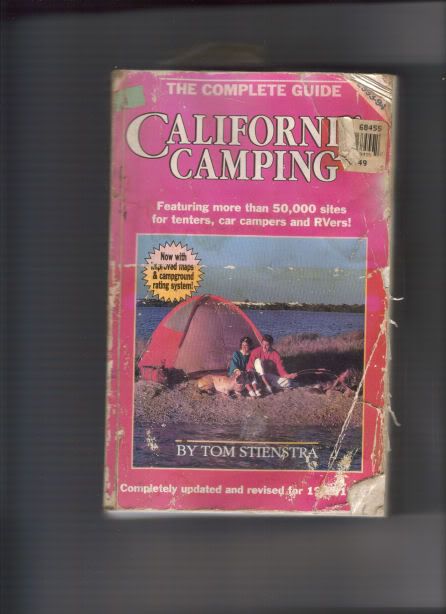 You could come up from Vegas, go through Death Valley, come out on 395. Go up 395 to Mammoth and Mono Lake. Continue up 395 (120 through Tioga Pass WILL be closed) towards Carson City (Hwy 108 and Hwy 4 are closed for the winter). Be sure to check road conditions for 395, some parts of it go up quite high in elevation and it will get shut down occasionally till they clear it. You'll want to make sure you go up 395 during daylight hours. It runs along the eastern side of the Sierra Nevada mountains and when you get onto 395 you'll pass Mt. Whitney. The scenery along 395 is simply outstanding. As you get close to Carson City Hwy 88 may, or may not, be open depending on snow. If it's open you can take 88 over the Sierra to 49. If it's closed you'll need to go up to Carson City and take Hwy 50. I'd recommend Hwy 50 anyway because it will take you past Lake Tahoe. Argueably the most beautiful lake in north America. (you could also stop for the night there and stay at a nice hotel and go gambling in one of the casinos). Continueing west on Hwy 50 will take you down to Placerville (where gold was first discovered in CA) and you can catch 49 there. Then 49 south through the gold country. If 120 is open on the western side of the Sierra you can get into Yosemite that way. If it is, GO! The drive into Yosemite on 120 offers THE MOST breath taking view of the valley as you wind your way down to the valley floor. It's one of the views you see in pictures alot. If 120 into the park is closed, continue south on 49 till you get to 140. That runs from the central Ca valley up into Yosemite. If you can go in on 120, then you can leave on 140 or 41. When 140 gets to 49, head south again until you get to 41. If you take 41 it will take you to Fresno and 180. Take 180 up into Sequoia National Park / Kings Canyon. You can camp out at the north side of the park if 180 through the park is closed due to snow. If it's open, 180 will take you along a rigde line that runs through the park to the south end, then goes down and out to Visalia. When it hits 99 you go south and head home. And if you come down Hwy 50 let me know. I'll buy you lunch or dinner. You'd drive right past my place before you get to Placerville. |
|
|
|
[#20]
ROFL! I went to the web cam page but all the images were black. I couldn't figure it out. Then I remembered, it's night time, it's dark outside. See how smart I am. LOL! |
|
|
|
|
[#21]
I love Yosemite. Be sure to hike from the valley floor to the top of Half Dome.
|
|
|
|
[#22]
In March? I don't think so. They take the cables down for the winter. Not to mention there's probably about 2-5 feet of snow on most of the dome this time of year. But I have to agree that when it's open, the hike is worth every sore muscle for the view from the top. |
|
|
|
|
[#23]
Yosemite valley is lower altitude so im thinking that is about all your gonna be able to do. the sierras get snow, and tons of it.
if i heard right.. yosemite from 5000ft up is supposed to get 4ft of snow today thru tuesday. the best time to visit the sierras is mid summer imho I have had good luck with july. Even then there are still frozen lakes over 10k. |
|
|
|
[#24]
The floor of Yosemite Valley is at about 3000 feet above sea level. It does get snow but less frequently than the surrounding, higher elevations. It often rains in the Valley when it is snowing at those higher elevations.
|
|
|
|
[#25]
my last trip thru yosemite lasted about 20 seconds..

|
|
|
|
[#26]
After the last snow, last week you can be sure that ALL the passes over the Sierras between 58 (Mojave to Bakersfeld) will be closed. Tioga Pass 120 (Mono Lake to Yosemite is the first reasonable pass north of 58. As noted check the CALTRANS mountain road closures, usually all the passes between 58 and 50 close. You might be able to get over via Marklleville, but don't bet on it. And although it appears that the road runs from Kings Canyon National Park over to Big Pine, it doesn't. That "road" is a spectacular trail accesible by 2 or 4 feet only.
Bodie is worth the side trip, if the roads are open. The short easy route up from the north side of Mono Lake is unpaved the whole way, the state highway in off 395 is paved about 2/3rds of the way.. Both are very likely closed by snow. 395 is kept open. Bodie and the passes on 395 in that area are over 8000 feet in altitude. If you have never been in high mountains the 395 route north out of Lone Pine (west entrance of Death Valley) is one of the best and prettiest roads in the country as far as scenery and ability to see the old west. Take the side trip up to Convict Lake and or to Mammoth Hot Springs in the Mammoth area. Convict has to be one of the prettiest sites you can see and the Hot Springs are pretty much always open. Rumor has it that snow bunnies and others go topless in the Springs. If you ever watch the movie "North to Alaska" with John Wayne, you'll recognized the Hot Springs. If you get north into Nevada, Virginia City and the RR Museum and State Museum in Carson City are worth visiting. Try dinner at the Overland in Minden, basque served family style in the original stagecoach era dining room. I've been snowed on at Rock Creek Lake and Bodie in August. I've also been miserably hot in Bodie in August, too. |
|
|
|
[#27]
Try this link to check for open roads
www.dot.ca.gov/cgi-bin/roads.cgi |
|
|
|
[#28]
Current forecast is for some SERIOUS snow above 5000 for the next couple of days, then the snow level is dropping to 1000-1500 over the weekend. There's probably feet of snow in YV after the last storm, and the next storm is going to add to it.
Pick up your chains in Fresno if you come through that way, and pick up the cable-type chains, as they are easier to don, doff, and store. I have a toolbox on the pickup, and 4WD, so 2 sets of actual chains are in the truck at all times. If you're a skiier, or you want to be, visit Badger Pass Ski Area while you're in the park. The Ski School there has been around over 60 years and is very well known. I learned to ski there back in the day... They have plenty of rentals if you don't have your own equipment, and if you don't have chains, you probably don't have skis either If you're into off-road driving, there's a couple of books that highlight the back- and 4WD-roads of the Sierras. One covers the Western side, accessed from the San Joaquin Valley, and the other covers the Eastern side, accessed from US 395. Most of those roads won't be accessable during the winter, but it gives you an idea of what's out there. |
|
|
|
[#29]
Thanks guys.
I've been watching the whether and the forecasts. Looks like I am going to shoot to come in between storms. I'll look for some chains somewhere in Fresno. I was going to take the northern route in but I will take that when I leave instead and go to Mono Lake after YNP. |
|
|
|
[#30]
I think there is a disconnect here.
Coming out of Death Valley to the west brings you into Lone Pine or Olancha, depending on which way you go around Owens Lake, or 168 through Westgard Pass to Big Pine, if it isn't closed by snow also. To get from there to Yosemite you will need to go south and take 58 into the Central Valley and then north on 99 to Fresno and then into YNP. Or you can go north on 395 to 50 in Carson City and west over the Sierras at Lake Tahoa nd then south on 99 to 120 and east into YNP. There are no roads available over the Sierras between 58 over Tehachapi Pass and I-50 via Lake Tahoe. Mono Lake is at the intersection of 395 and 120. The gate closing 120 west of 395 is probably abut a quater-mile off 395, allowing entry and exit from the gas station/general store complex. The gate closing 120 East of 395 when used is right at 395. If you are going north on 395 you may need chains as soon as a few miles out of Bishop. You likely can buy chains in Bishop, but no guarantees to availability or reasonableness of price. Study both the CalTrans and CHP pages regarding Winter Closures and chains. If you go the south route over 58 you might not need chains to get to Yosemite Valley. Todays SR 120 [CENTRAL CALIFORNIA & SIERRA NEVADA] IS CLOSED FROM CRANE FLAT TO 5 MI WEST OF THE JCT OF US 395 /TIOGA PASS/ (TUOLUMNE, MONO CO's) - WINTER CLOSURE - MOTORISTS ARE ADVISED TO USE AN ALTERNATE ROUTE CHAINS OR SNOW TIRES ARE REQUIRED FROM 8.5 MI WEST TO 15 MI EAST OF GROVELAND (TUOLUMNE CO) CHAINS ARE REQUIRED ON ALL VEHICLES EXCEPT 4-WHEEL-DRIVE VEHICLES WITH SNOW TIRES ON ALL 4 WHEELS FROM 3 MI WEST OF THE YOSEMITE NATL PARK BNDRY TO THE YOSEMITE NATL PARK BNDRY (TUOLUMNE CO) [EASTERN SIERRA NEVADA] IS CLOSED FROM CRANE FLAT TO 5 MI WEST OF THE JCT OF US 395 /TIOGA PASS/ (TUOLUMNE, MONO CO's) - WINTER CLOSURE - MOTORISTS ARE ADVISED TO USE AN ALTERNATE ROUTE IS CLOSED FROM THE SOUTH JCT OF US 395 TO THE JCT OF US 6 (MONO CO) - WINTER CLOSURE - MOTORISTS ARE ADVISED TO USE AN ALTERNATE ROUTE SR 4 [CENTRAL CALIFORNIA & SIERRA NEVADA] IS CLOSED FROM 0.5 MI EAST OF THE JCT OF SR 207 /MT REBA TURNOFF/ TO THE JCT OF SR 89 /EBBETTS PASS/ (ALPINE CO) - WINTER CLOSURE - MOTORISTS ARE ADVISED TO USE AN ALTERNATE ROUTE CHAINS ARE REQUIRED ON ALL VEHICLES EXCEPT 4-WHEEL-DRIVE VEHICLES WITH SNOW TIRES ON ALL 4 WHEELS FROM MURPHYS TO 3.5 MI EAST OF COTTAGE SPRINGS (CALAVERAS CO) CHAINS OR SNOW TIRES ARE REQUIRED FROM 3.5 MI EAST OF COTTAGE SPRINGS (CALAVERAS CO) TO THE MT REBA TURNOFF (ALPINE CO) SR 89 [EASTERN SIERRA NEVADA] IS CLOSED FROM THE JCT OF US 395 (MONO CO) TO THE JCT OF SR 4 /MONITOR PASS/ (ALPINE CO) - WINTER CLOSURE - MOTORISTS ARE ADVISED TO USE AN ALTERNATE ROUTE [CENTRAL CALIFORNIA & SIERRA NEVADA] CHAINS ARE REQUIRED ON ALL VEHICLES EXCEPT 4-WHEEL-DRIVE VEHICLES WITH SNOW TIRES ON ALL 4 WHEELS FROM PICKETT'S JCT (ALPINE CO) TO 2.7 MI SOUTH OF THE JCT OF US 50 (EL DORADO CO) /LUTHER PASS/ [NORTH CENTRAL CALIFORNIA & THE LAKE TAHOE BASIN] IS CLOSED FROM 5 MI NORTH OF THE JCT OF US 50 TO BLISS STATE PARK /EMERALD BAY/ (EL DORADO CO) - DUE TO SNOW - MOTORISTS ARE ADVISED TO USE AN ALTERNATE ROUTE CHAINS OR SNOW TIRES ARE REQUIRED FROM BLISS STATE PARK TO 2 MI NORTH OF BLISSS STATE PARK (EL DORADO CO) SR 108 [CENTRAL CALIFORNIA & SIERRA NEVADA] IS CLOSED FROM 7.2 MI EAST OF STRAWBERRY TO 5.3 MI WEST OF THE JCT OF US 395 /SONORA PASS/ (TUOLUMNE,MONO CO's) - WINTER CLOSURE - MOTORISTS ARE ADVISED TO USE AN ALTERNATE ROUTE CHAINS ARE REQUIRED ON ALL VEHICLES EXCEPT 4-WHEEL-DRIVE VEHICLES WITH SNOW TIRES ON ALL 4 WHEELS FROM EAST TWAIN HARTE TO 7.2 MI EAST OF STRAWBERRY (TUOLUMNE CO) [EASTERN SIERRA NEVADA] IS CLOSED FROM 7.2 MI EAST OF STRAWBERRY TO 5.3 MI WEST OF THE JCT OF US 395 /SONORA PASS/ (TUOLUMNE,MONO CO's) - WINTER CLOSURE - MOTORISTS ARE ADVISED TO USE AN ALTERNATE ROUTE SR 270 [EASTERN SIERRA NEVADA] IS CLOSED FROM THE JCT OF US 395 TO BODIE (MONO CO) - WINTER CLOSURE - MOTORISTS ARE ADVISED TO USE AN ALTERNATE ROUTE You are heading into some very beautiful high country. At some pretty high altitudes. Like going out into the desert in summer, you need to be prepared for a killer environment. The High Sierras in winter can be be deadly if you aren't prepared. Anedotally the distance between the Tioga Pass Road and the road over Kennedy Meadows to the south is upoosed to be the longest distance anyplace in the continental US without a passable road. It definitely is when the snow closures to the north and sout arae added in. |
|
|
|
[#31]
A lot of good info, and I can't really ad much to it other than give you some idea of the conditions you can expect to encounter on the east side. I lived on Hwy. 120 just outside of the east entrance of Yosemite for about 7 years, living and working at Tioga Pass Resort. Last winter, the road was closed for about 8 months, and the only way in or out for me was either snowmobile, skis, or snowshoes. The road is closed for about 45 miles from just west of 395 to the Crane Flat junction, and like others have said, its NOT going to open. Highway 120 is also closed from Benton to 395 if you had any thoughts of coming up from Vegas that way.
If you come up 395 from Death Valley, you are going to gain alot of elevation just north of Bishop, going from Bishops elevation of about 4,000 feet to about 7,000 feet in about 10 miles, and you will gradually gain elevation to about 8,000 feet on Deadman summit just north of the turn off for Mammoth. You should take the elevation into consideration along with the weather if you want to drive on the east side. Bodie is well worth seeing, but its also above 8,000 feet. I love the east side, its beauty is beyond my ability to describe it, and if you can make the trip over, it is definately worth it! Have a safe trip! Dave |
|
|
|
[#32]
Just got back late last night. I drove through major storms all the way from Bishop. Also from New Mexico to Kingman AZ. Took me 16 hours to get from Death Valley to the west side entrance of Yosemite. Mono Lake was covered by a blizzard when I went through the area. Bodie was closed as well. They closed hwy 88 so I had to go up to Lake Tahoe and picked up hwy 50. Had to drive 35 mph most of the time. Camped in the snow for 3 nights while I was there. Only one good day of marginal sunshine. Planning the next trip for August this summer.
Thanks again for all the advice. California is a beautiful state!      Here is a link to some more pics. xzodus.com/yosemite/index.htm xzodus.com/deathvalley/index.htm |
|
|
|
[#33]
Yes, indeed, it is a beautiful place. And we are gonna get it back someday, too. And soon.
|
|
|
|
[#34]
watch out for BEARs!!!!
|
|
|
|
[#35]
What camera did you use for the photos and do you have some high-res images? |
|
|
|
|
[#36]
I used the new Canon 5D. All images are high res @ 12.8 mega pixel. Shot both RAW and High res Jpeg. 40 meg files! |
||
|
|
 Win a FREE Membership!
Sign up for the ARFCOM weekly newsletter and be entered to win a free ARFCOM membership. One new winner* is announced every week!
You will receive an email every Friday morning featuring the latest chatter from the hottest topics, breaking news surrounding legislation, as well as exclusive deals only available to ARFCOM email subscribers.

AR15.COM is the world's largest firearm community and is a gathering place for firearm enthusiasts of all types.
From hunters and military members, to competition shooters and general firearm enthusiasts, we welcome anyone who values and respects the way of the firearm.

Subscribe to our monthly Newsletter to receive firearm news, product discounts from your favorite Industry Partners, and more.
Copyright © 1996-2024 AR15.COM LLC. All Rights Reserved.
Any use of this content without express written consent is prohibited.
AR15.Com reserves the right to overwrite or replace any affiliate, commercial, or monetizable links, posted by users, with our own.