|
[#1]
What ever the "special" military guys are using right now.
I've been very happy with the Garmin 60CSx. It does everything I need a GPS to do. -Mark. |
|
|
|
[#2]
+1 Garmin 60Csx
|
|
|
|
[#3]
the 60CSx seems to be the one most people i know use. i have an older garmin but i also have 2 cell phones that have built in GPS chips that does not need cell coverage to work. plus with them if i have internet access i have sat views of the area im in. i can even DL maps to use on it.
|
|
|
|
[#4]
The 60CSx looks like a nice unit and very reasonably priced-
I was thinking of something with 3D imaging for topo maps or perhaps a satellite view (like google map) for use finding landmarks - anyone have any experience or thoughts with those? 
|
|
|
|
[#5]
Quoted:
+1 Garmin 60Csx +1 |
|
|
|
[#6]
Quoted:
The 60CSx looks like a nice unit and very reasonably priced- I was thinking of something with 3D imaging for topo maps or perhaps a satellite view (like google map) for use finding landmarks - anyone have any experience or thoughts with those? http://dvice.com/assets_c/2009/05/oregon-550t-camera-thumb-300x498-17716.jpg For on demand satellite imaging you need either WiFi or cellphone reception. The 3D thing is more of a gimmick...fun to play with but not very useful. There are several programs, even several that are free, that will merge topo maps with satellite images that you can load onto your gps. Again, I have found them of little use and more of a gimmic. I would definitely go and play with some gps units in person. Personally I don't like the touch screen models since they tend to be difficult to use with gloves on. BTW you can get the GPSMAP 60CSx for $320 1 day overnight at Walmart.com BTW remember that you will have to buy/obtain the TOPO maps and/or other Navigation maps. They tend to be around $100 each. I downloaded 2010 U.S. TOPO and 2010 City Navigation U.S. for free through Torrents and upgraded the microSD card to 4gb. |
|
|
|
[#7]
Quoted:
The 60CSx looks like a nice unit and very reasonably priced- I was thinking of something with 3D imaging for topo maps or perhaps a satellite view (like google map) for use finding landmarks - anyone have any experience or thoughts with those? http://dvice.com/assets_c/2009/05/oregon-550t-camera-thumb-300x498-17716.jpg i have google maps on my cell with GPS. its nice to have the sat view but it does require either cell coverage or WiFi to work. |
|
|
|
[#8]
When you say high-end you leave it open for a lot of different types of features. I have been using the Garmin GPSMAP 378 in my truck for the past while. It originally was a $1000 unit, now I think you can get them for $500-600.
It is an old-style mounted/portable unit that has the full N. America detailed street maps plus can be hooked up for XM weather and radio. I use the XM weather feature extensively to help plan my trips - I routinely drive 1000+ miles per day when I am traveling for work and knowing what the weather is ahead can really save me a lot of time or keep me out of a bad spot such as snow and ice conditions. On a few occasions when I have rented cars without built-in XM radio I have turned on the XM feature so that I can still have my Fox news and talk radio shows that I normally am addicted to while I travel. If using it for navigation then it gives voice-guided turn by turn instructions. This unit is still current but as mentioned is "old-style" meaning it uses Garmin's proprietary memory cards which are horribly expensive. I only use it for road navigation so I have never purchased memory cards to load extra maps to it. It definitely does not have the new bells and whistles like touch screen, etc. It can be used hand-held if needed but the battery life is not that good and the battery is proprietary as well. It is also designed to work as a fish-sonar with a separate sonar unit, and already has all the major inland lake hydrographic charts built in for finding underwater structure etc when fishing. My off-road GPS is a Garmin 76CSx which is the functional twin to the 60CSx. |
|
|
|
[#9]
Quoted:
Quoted:
+1 Garmin 60Csx +1 +1 GPSmap 60csx. i would worry about battery life with the new model with images. mp3 players, photo storage, etc. the NA base map is good, load tons of waypoints, you can add topo, marine, whatever else you want, and has expandable memory. personally, i dont need to see a crystal clear image of the valley i am already looking at. |
|
|
|
[#10]
Quoted:
Quoted:
Quoted:
+1 Garmin 60Csx +1 +1 GPSmap 60csx. i would worry about battery life with the new model with images. mp3 players, photo storage, etc. the NA base map is good, load tons of waypoints, you can add topo, marine, whatever else you want, and has expandable memory. personally, i dont need to see a crystal clear image of the valley i am already looking at. Those who I've talked with about the newer Colorado series Garmins did remark that the battery life is a lot shorter than the 60 CSX. I was on the fence, but I picked up a 60 CSX last year and couldn't be happier. I use it for off road and dual sport motorcycling as well as hiking and hunting. I also purchased a RAM handlebar mount and a 12v hardwire kit for my WR250R. I bought the City Navigator and US Topo maps and loaded them onto a microSD card. These two programs allow me to switch back and forth between turn-by-turn car style navigation and detailed off road topo maps. I still need to pick up a RAM windshield mount for my truck, but overall I can't imagine a more versatile handheld GPS. |
|
|
|
[#11]
Quoted: *snip*
personally, i dont need to see a crystal clear image of the valley i am already looking at. Not many people would... Kind of short sighted to think that is the only use of this feature. I think it would be nice to see what is on the other side of the hill/mountain, down the road, along the river though. You never know when you might like to scroll up and down the river or road you are in front of to see where the closest house/building/permanent shelter may be. |
|
|
|
[#12]
Garmin GPSMap 60 CSx
It's not particularly spendy, but it's best of breed. |
|
|
|
[#13]
Quoted:
Quoted:
Quoted:
Quoted:
+1 Garmin 60Csx +1 +1 GPSmap 60csx. i would worry about battery life with the new model with images. mp3 players, photo storage, etc. the NA base map is good, load tons of waypoints, you can add topo, marine, whatever else you want, and has expandable memory. personally, i dont need to see a crystal clear image of the valley i am already looking at. Those who I've talked with about the newer Colorado series Garmins did remark that the battery life is a lot shorter than the 60 CSX. I was on the fence, but I picked up a 60 CSX last year and couldn't be happier. I use it for off road and dual sport motorcycling as well as hiking and hunting. I also purchased a RAM handlebar mount and a 12v hardwire kit for my WR250R. I bought the City Navigator and US Topo maps and loaded them onto a microSD card. These two programs allow me to switch back and forth between turn-by-turn car style navigation and detailed off road topo maps. I still need to pick up a RAM windshield mount for my truck, but overall I can't imagine a more versatile handheld GPS. Fantastic unit. Add road and or topo maps and you are stylin'!! |
|
|
|
[#14]
Also a 60CSx user (bought mine on Amazon for $250... DAM fine unit. But I also have a Etrex Vist HCx.... which is also great and can be had for under 190. As for maps.... Im cheap... GPSfiledepot.... its been good enough for anything I needed.
|
|
|
|
[#15]
+1 to Garmin 60Csx.
I use it as well. |
|
|
|
[#16]
I thought I replied to this... geez.
For field use, I'd have a Trimble handheld computer/GPS. For auto/aero use I'd look at Garmin's avionics lines. There are also some "big screen" kick-ass GPs/displays intended for airplane instrument panels. There has to be someone making a HUD type GPS for vehicles... |
|
|
|
[#17]
i would get the latest rhino. i have a few friends with them.
|
|
|
|
[#18]
Quoted:
I thought I replied to this... geez. For field use, I'd have a Trimble handheld computer/GPS. For auto/aero use I'd look at Garmin's avionics lines. There are also some "big screen" kick-ass GPs/displays intended for airplane instrument panels. There has to be someone making a HUD type GPS for vehicles... So, went to the trimble site, no indication of prices, and the website sucks. How much do they run? |
|
|
|
[#19]
Quoted:
Quoted:
I thought I replied to this... geez. For field use, I'd have a Trimble handheld computer/GPS. For auto/aero use I'd look at Garmin's avionics lines. There are also some "big screen" kick-ass GPs/displays intended for airplane instrument panels. There has to be someone making a HUD type GPS for vehicles... So, went to the trimble site, no indication of prices, and the website sucks. How much do they run? If you have to ask you can't afford it. 
|
|
|
|
[#20]
we have some trimble gps at the company i work for....
they are not cheap. and by not cheap i mean i could buy a car instead. |
|
|
|
[#21]
Quoted:
So, went to the trimble site, no indication of prices, and the website sucks. How much do they run? It depends on the model and features. New, $1500 and up. Refurbs as low as $800. |
|
|
|
[#22]
Quoted:
i would get the latest rhino. i have a few friends with them. Im still rocking the original. |
|
|
|
[#23]
Quoted:
The 60CSx looks like a nice unit and very reasonably priced- I was thinking of something with 3D imaging for topo maps or perhaps a satellite view (like google map) for use finding landmarks - anyone have any experience or thoughts with those? http://dvice.com/assets_c/2009/05/oregon-550t-camera-thumb-300x498-17716.jpg I think out of all the HH GPS the Oregon 550 or 550t is what you want. The 550t has topo maps where the 550 does not, plus both come with a camera. Kinda like the iPhone of the GPS world. |
|
|
|
[#24]
I too planned on getting the 60csx (after slamming my Summit in the trunk lid and breakng it), but ended up with a Vista Hcx because it was mint and a steal. Put a big enough memory card in there I could fit the entire western US maps in there. I've been happy with it. Would still like the 60 someday tnough. Seems to be the standard.
|
|
|
|
[#25]
Hand held the 60CSX , got it and its perfect for what I use it for .
Mounted Trimble , had them on my farm equipment and they rocked. |
|
|
|
[#26]
Quoted:
I too planned on getting the 60csx (after slamming my Summit in the trunk lid and breakng it), but ended up with a Vista Hcx because it was mint and a steal. Put a big enough memory card in there I could fit the entire western US maps in there. I've been happy with it. Would still like the 60 someday tnough. Seems to be the standard. I too have the Vista Hcx and have thought about the 60 series. Unless I am mistaken, they have the same receiver chipsets and the differences lie display size, controls, and chassis. The Etrex series is tougher than you would think, though. I have dropped my vista and an older non-mapping etrex many times. 
|
|
|
|
[#27]
|
|
|
|
[#28]
Quoted:
Quoted:
The 60CSx looks like a nice unit and very reasonably priced- I was thinking of something with 3D imaging for topo maps or perhaps a satellite view (like google map) for use finding landmarks - anyone have any experience or thoughts with those? http://dvice.com/assets_c/2009/05/oregon-550t-camera-thumb-300x498-17716.jpg For on demand satellite imaging you need either WiFi or cellphone reception. The 3D thing is more of a gimmick...fun to play with but not very useful. There are several programs, even several that are free, that will merge topo maps with satellite images that you can load onto your gps. Again, I have found them of little use and more of a gimmic. I would definitely go and play with some gps units in person. Personally I don't like the touch screen models since they tend to be difficult to use with gloves on. BTW you can get the GPSMAP 60CSx for $320 1 day overnight at Walmart.com BTW remember that you will have to buy/obtain the TOPO maps and/or other Navigation maps. They tend to be around $100 each. I downloaded 2010 U.S. TOPO and 2010 City Navigation U.S. for free through Torrents and upgraded the microSD card to 4gb. I have been lookinf at the 60csx for some time. my question is are yourequired to use garmin maps? they are pretty expensive, and the 24k maps are only partial. I want to have detaild wisconsn, minnesota, ill, and michigan or hunting, but if i go to colorado for a trip i neep to purchase a new $100 map set just to get colorado, and i may nt use it after that trip, not to mention if you need to upgrade the maps that costs to. So here it is: Are there other mapping soltions? And can the maps be manipulited on my PC I particularly would like to map out our property lines and ATV trails and deer paths for example. Thanks, |
|
|
|
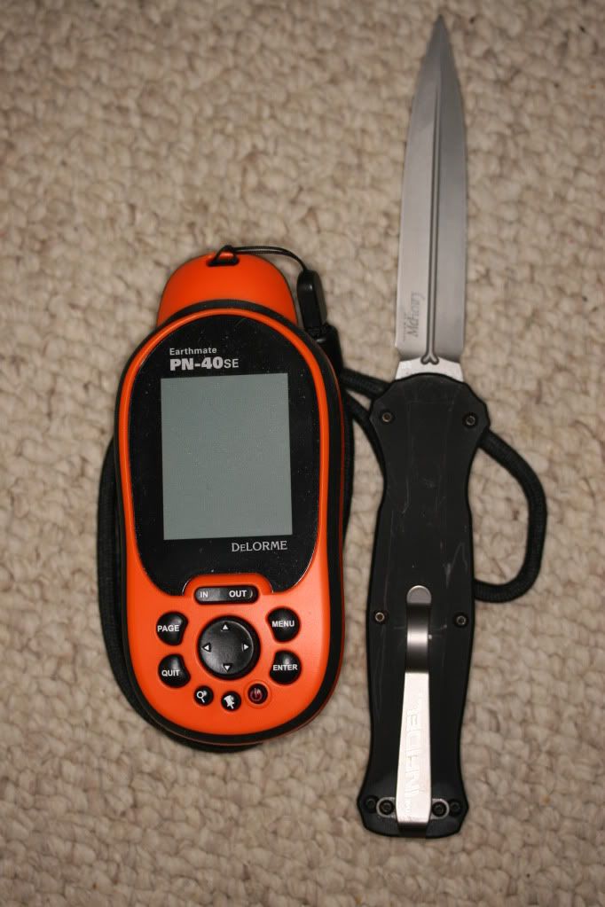
[#29]
I ended up with the above unit. Seems very nice and durable. I almost went with the 60csx but after handling them both I made my choice. Thanks everyone for your thoughts and help!! |
|
|
|
[#30]
Quoted:
I ended up with the above unit. Seems very nice and durable. I almost went with the 60csx but after handling them both I made my choice. Thanks everyone for your thoughts and help!! I've been doing the research as well and so far as I can tell u made the right choice. You can't beat the maps and aerial imaging isn't even an option with Garmin. Garmin maps will also run into the hundreds AFTER buying their unit. The learning curve is a bit steeper with the Delorme but if you aren't a total waterhead and spend a little time studying and working with it it's no problem. |
|
|
|
[#31]
Quoted:
Quoted:
Quoted:
The 60CSx looks like a nice unit and very reasonably priced- I was thinking of something with 3D imaging for topo maps or perhaps a satellite view (like google map) for use finding landmarks - anyone have any experience or thoughts with those? http://dvice.com/assets_c/2009/05/oregon-550t-camera-thumb-300x498-17716.jpg For on demand satellite imaging you need either WiFi or cellphone reception. The 3D thing is more of a gimmick...fun to play with but not very useful. There are several programs, even several that are free, that will merge topo maps with satellite images that you can load onto your gps. Again, I have found them of little use and more of a gimmic. I would definitely go and play with some gps units in person. Personally I don't like the touch screen models since they tend to be difficult to use with gloves on. BTW you can get the GPSMAP 60CSx for $320 1 day overnight at Walmart.com BTW remember that you will have to buy/obtain the TOPO maps and/or other Navigation maps. They tend to be around $100 each. I downloaded 2010 U.S. TOPO and 2010 City Navigation U.S. for free through Torrents and upgraded the microSD card to 4gb. I have been lookinf at the 60csx for some time. my question is are yourequired to use garmin maps? No they are pretty expensive, and the 24k maps are only partial. I want to have detaild wisconsn, minnesota, ill, and michigan or hunting, but if i go to colorado for a trip i neep to purchase a new $100 map set just to get colorado, and i may nt use it after that trip, not to mention if you need to upgrade the maps that costs to. Look into the GPS File Depot, they have many maps and resources for free. OR you can just download the Garmin maps from torrent files. I downloaded the Garmin City Nav and Topo from torrents and an Arizona Topo from GPS File Depot. So here it is: Are there other mapping soltions? And can the maps be manipulited on my PC Yes, there are many programs out there that will allow you to edit, manipulate and make maps. Personally I just use Mapsource from Garmin, free to download, to edit and make tracks and waypoints. I particularly would like to map out our property lines and ATV trails and deer paths for example. Thanks, |
|
|
|
[#32]
Just took my 60csx on a hunting trip over the weekend. The batteries never dipped below 50% being used from dawn until dusk. Used the track log and waypoints a LOT! Extremely impressed with the unit an battery life.
|
|
|
|
[#33]
I would get the Garmin Dakota 10 Link
I played with one at REI and really liked it. I just don't want to be the beta tester for it. I always wait for new technology to get the bugs worked out first. Currently using a Garmin 76. Works fine, just big and clunky. |
|
|
|
[#34]
Foretrex® 401 and a good collection of high quality maps
|
|
|
|
[#35]
Quoted:
Quoted:
I ended up with the above unit. Seems very nice and durable. I almost went with the 60csx but after handling them both I made my choice. Thanks everyone for your thoughts and help!! I've been doing the research as well and so far as I can tell u made the right choice. You can't beat the maps and aerial imaging isn't even an option with Garmin. Garmin maps will also run into the hundreds AFTER buying their unit. The learning curve is a bit steeper with the Delorme but if you aren't a total waterhead and spend a little time studying and working with it it's no problem. BIG +87 on the Delorme Pn-40 or new PN-30. The avalability of maps is second to none with their map library. I love this unit. |
|
|
|
[#36]
Quoted:
Quoted:
Quoted:
I ended up with the above unit. Seems very nice and durable. I almost went with the 60csx but after handling them both I made my choice. Thanks everyone for your thoughts and help!! I've been doing the research as well and so far as I can tell u made the right choice. You can't beat the maps and aerial imaging isn't even an option with Garmin. Garmin maps will also run into the hundreds AFTER buying their unit. The learning curve is a bit steeper with the Delorme but if you aren't a total waterhead and spend a little time studying and working with it it's no problem. BIG +87 on the Delorme Pn-40 or new PN-30. The avalability of maps is second to none with their map library. I love this unit. How's the battery life on the Delorme? I've heard some complaints about this, but you can find complaints about anything if you look hard enough (especially on the internet). |
|
|
 Win a FREE Membership!
Sign up for the ARFCOM weekly newsletter and be entered to win a free ARFCOM membership. One new winner* is announced every week!
You will receive an email every Friday morning featuring the latest chatter from the hottest topics, breaking news surrounding legislation, as well as exclusive deals only available to ARFCOM email subscribers.

AR15.COM is the world's largest firearm community and is a gathering place for firearm enthusiasts of all types.
From hunters and military members, to competition shooters and general firearm enthusiasts, we welcome anyone who values and respects the way of the firearm.

Subscribe to our monthly Newsletter to receive firearm news, product discounts from your favorite Industry Partners, and more.
Copyright © 1996-2024 AR15.COM LLC. All Rights Reserved.
Any use of this content without express written consent is prohibited.
AR15.Com reserves the right to overwrite or replace any affiliate, commercial, or monetizable links, posted by users, with our own.