|
Posted: 1/22/2006 2:20:10 AM EDT
Started raining about midnight and supposed to rain all the way into sunday night and there are chances for precipitation most all of next week!
Have never in my life ever seen such a dry spell as this un. Was starting to look like west tx or az around here and the winds and dust the last couple of months have been hell on folk's eyes and respitory systems. Maybe now the danger from wild fires [we have had quite a few] will slack up a bit. Anyway it is going to be a good day for the folks of north central texas today!!!  PS I wonder if Chuck Norris could have somthing to do with this living over there right out of dallas county and all??? |
|
|
|
[#1]
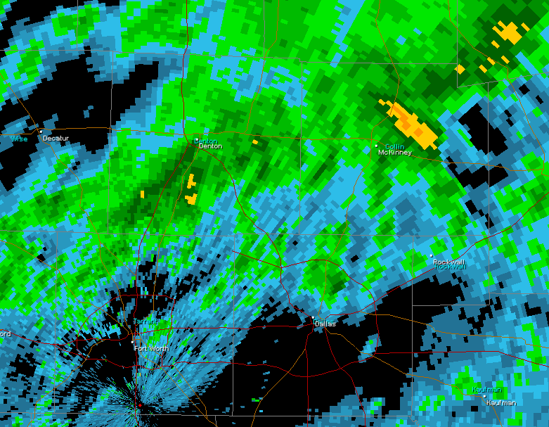
Here is a radar image I saved around 5:30 AM CST from Dallas/Ft.Worth using my Gibson Ridge GR Level 3 radar software:
 It also appears areas in Oklahoma are getting in on some action as well: 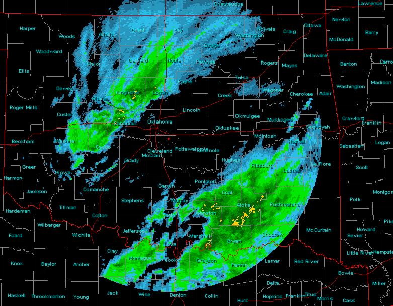 I am really happy to see you folks in the Southern Plains finally getting some rainfall. It's not much, but when you are powder dry as has been the case for so long, even .10" or .25" of rainfall is a big deal. When trying to break a drought, you have to start somewhere. This looks like a good start. If we can keep the rain falling out there for much of today and then get some decent follow-up showers over the coming week, perhaps we can start a new pattern. It takes rain to make rain in many cases (having moisture in the soil helps boost boundary layer moisture ahead of approaching storm systems and boosts precip potential). So again, a good start. Now let's keep it going! BTW, my area suffered through a pretty bad drought back in 1999 (and maybe 2000 also). Many people in my area have wells and we were getting pretty concernedc bthat they were in danger of going dry. The river level also became very low, so water concerns became a very big issue, as did agricultural related concerns. I can remember rejoicing when the sky finally started opening up. Then from 2002-2004, it seems we got TOO MUCH rain. Hehe. Ah well, from one extreme to the other. That seems to be the pattern as of late. |
|
|
|
[#2]
Thanks for the info bro.
Somone at work told me last week that there is a theory going round about the possibility that the sunnami back in dec. 04 could have shifted the earths axis ever so slightly and caused the southern jet stream to shift to the north thus dening the areas of this region with only very slight conditions for rain. This ''educated guess'' was said to have been made more probable due to the fact so many oil wells on and off shore in that devestated regon have been pumped dry for the last forty years or so then refilled with salt water thus taking the shock absorbing affect that crude petrolium has in the earth when energy is relesed when continental sub-terrainian plates shift. Anybody else heard of this or care to comment???  |
|
|
|
[#3]
Congrats, I know you needed it
|
|
|
|
[#4]
The last measurable rain was back in Dec. It wasn't much!!!!

|
|
|
|
[#5]
They must have got this from DU, as it blames the oil industry! Bahahahahahahahaha!  No. The Tsunami didn't knock the earth off it's axis. |
|
|
|
|
[#6]
As I just told a brit on another thread,''Yes,...........................quite''
 . .
|
|
|
|
[#7]
Yous guys up on the eastern seaboard have been getting plenty lately right???
|
|
|
|
|
[#8]
Actually is did sort of, it shifted the magnetic pole. I think it was about an inch. The poles are moving anyway. Weather & climatology are not an exact science, lots of unknowns as to cause & effect. Not to mention that the breathable atmosphere is barely two miles thick, think about that one next time you go for a bike ride or a walk. Glad to hear that rain is falling in TX, if you've never experienced a drought or other weather extreme, you have no idea how it wears on your nerves. Poles moving, no more aruroas for Alaska New ocean formng in Africa |
|
|
|
|
[#9]
What exactly are the magnetic poles and how do they move over such vast distances.
|
|
|
|
[#10]
We got about 1/4" this morning here in Paris (Texas of course). Need about 10" in the next month and maybe the lakes will start to fill up a bit.
Thank God for rain! |
|
|
|
[#11]
we'd already gone to bed last night when I heard this sound... this familiar-but-only-from-a-memory sound... then I realized what it was - rain!!!! I was so excited that I got up to look out the window... I felt a little silly being so excited, but it hasn't rained at my house in over a month, and the last time it did, it was only a tiny bit...
I slept so well last night. |
|
|
|
[#12]
Well good for you guys in N. Tex.
I spent 6 months in Dallas working on a project for my old company, and it surprises me that the weather people can predict when the rain faill would hit a particular area. Coming from Los Angeles, where the ocean and the mountains can greatly influence the weather, the weatherman can be wrong sometimes, but like clockwork the rain appears. |
|
|
 Win a FREE Membership!
Sign up for the ARFCOM weekly newsletter and be entered to win a free ARFCOM membership. One new winner* is announced every week!
You will receive an email every Friday morning featuring the latest chatter from the hottest topics, breaking news surrounding legislation, as well as exclusive deals only available to ARFCOM email subscribers.

AR15.COM is the world's largest firearm community and is a gathering place for firearm enthusiasts of all types.
From hunters and military members, to competition shooters and general firearm enthusiasts, we welcome anyone who values and respects the way of the firearm.

Subscribe to our monthly Newsletter to receive firearm news, product discounts from your favorite Industry Partners, and more.
Copyright © 1996-2024 AR15.COM LLC. All Rights Reserved.
Any use of this content without express written consent is prohibited.
AR15.Com reserves the right to overwrite or replace any affiliate, commercial, or monetizable links, posted by users, with our own.