|
[#1]
The Cirius can be equipped for flight into known icing conditions so that alone may not have been it. The flight was filed at an IFR altitude so the pilot may well have been rated.
I don't know that there's a smoking gun with this one. |
|
|
|
[#2]
You plaintiffs attorney?
|
|
|
|
[#3]
Quoted:
I hear this one the radio so started researching it. Article Selected parts of the article: "Jennifer Frieling, 40, of Castle Rock, at 7 p.m. Oct. 28, was sewing a daughter’s Halloween costume when she heard an airplane engine that “sounded way too close.” “I started getting up — and heard a boom,” she said. She said out there in the fog, she could only see about 5 to 10 feet ahead of her, but soon spotted, down in the ravine, broken branches and then the plane’s red tail wing. And at 7:08 p.m. she called 911, again, to report a downed plane. Morales said the pilot had planned to land at Front Range Airport in Adams County, but because of icing problems radioed Centennial Airport and was on her way to land there when she hit the major north-south power lines that are about 100 to 150 feet above the ravine." Path/flight info from FlightAware Weather info from the Front Range airport: METAR/SPECI from KFTG, Denver Nexrad (United States). SA 28/10/2013 21:50 METAR KFTG 282150Z 07005KT 1/2SM FG OVC002 00/00 A3002= What this shows is that at 350 PM local, the weather at the destination airport had 1/2 statute mile visibility, fog, overcast clouds at 200 feet and the temperature and due point were both 0 degrees C. That info should have been available prior to take-off around 543 PM. Weather info from the alternate airport at Centennial: 1) SA 28/10/2013 21:53-> METAR KAPA 282153Z 03004KT 3SM BR OVC003 01/00 A2999 RMK AO2 SLP158 T00060000= 2) SA 29/10/2013 00:53-> METAR KAPA 290053Z 11006KT 2SM BR OVC004 M01/M01 A3003 RMK AO2 SLP187 T10061006= Also not desirable from my point of view. Both airports have conditions could be conducive to fog and possibly freezing conditions. The flight altitude suggests that the pilot is instrument rated but I doubt that the plane is approved for flight in icing conditions. Sometimes it is better to avoid a flight. Get-there-itis can end up badly. We shall see what the official NTSB analysis reveals. I highly doubt a cirrus isn't going to be equiped for IFR. The pilot shouldn't have been up in that weather anyway. The vis and ceiling are just way too low. |
|
|
|
[#4]
Interesting.
I'm in Castle Rock and didn't hear a plane crash or even sirens. eta I see it's on the other side of the Interstate. In fact, I almost bought a house in that Sapphire Point subdivision. Anyway, the weather here today was weird. It was like a thick fog/haze that you might get on the east coast in the morning, but it never burned off. Here's what it looked like at 5:08 PM: 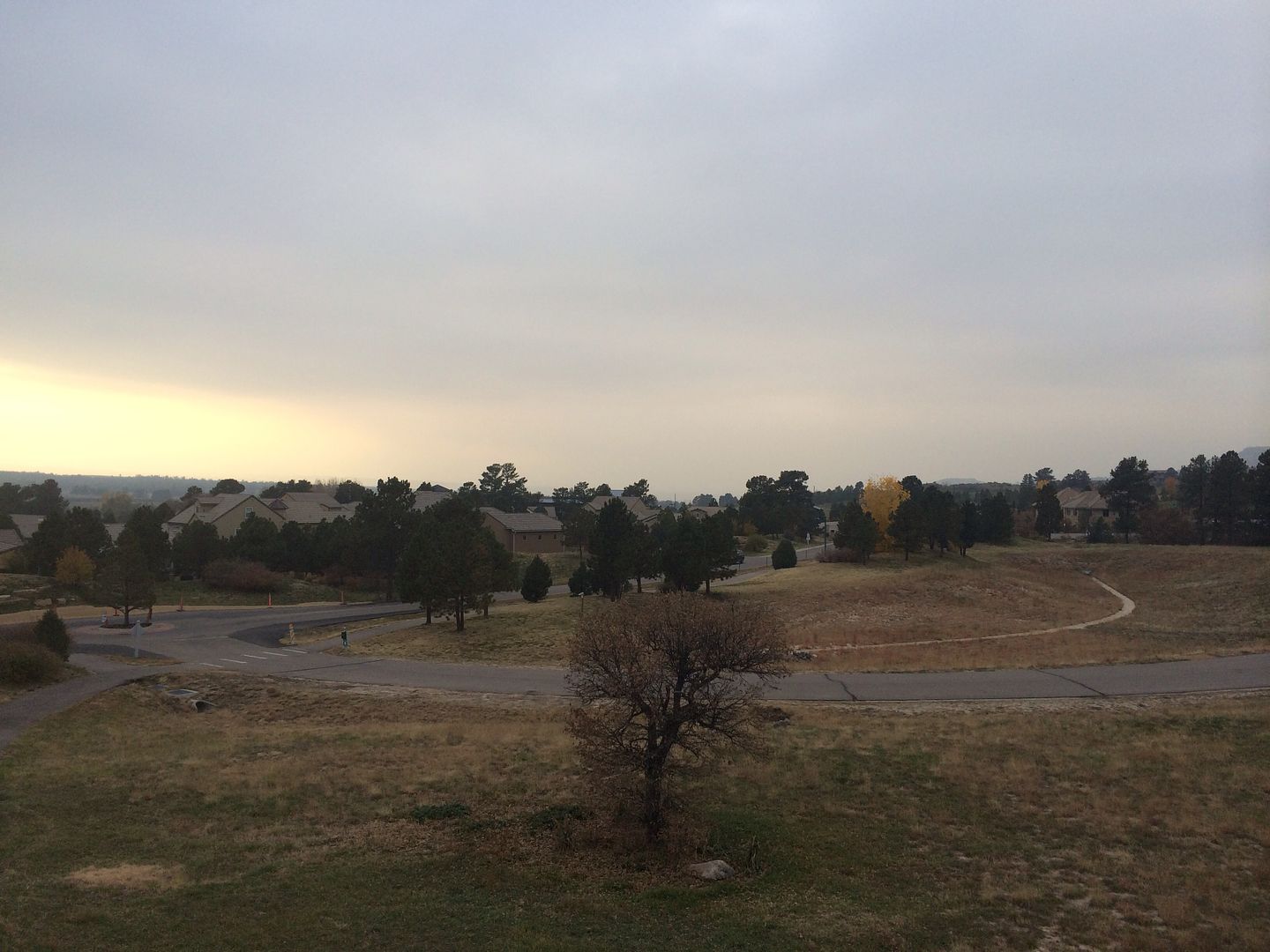
|
|
|
|
[#5]
Quoted:
The Cirius can be equipped for flight into known icing conditions so that alone may not have been it. The flight was filed at an IFR altitude so the pilot may well have been rated. I don't know that there's a smoking gun with this one. SB, look at the registration data to the upper right of the Flight Aware page. The plane appears to be a Glasair SPORTSMAN GS-2. |
|
|
|
[#6]
Can't fix stupid, if you can't do it don't try to fake it.
|
|
|
|
[#7]
Quoted:
You plaintiffs attorney? Not a lawyer period. Just a GA VFR pilot who has overnighted at unplanned places multiple times due to weather. I have my limits. |
|
|
|
[#8]
Quoted:
SB, look at the registration data to the upper right of the Flight Aware page. The plane appears to be a Glasair SPORTSMAN GS-2. Quoted:
Quoted:
The Cirius can be equipped for flight into known icing conditions so that alone may not have been it. The flight was filed at an IFR altitude so the pilot may well have been rated. I don't know that there's a smoking gun with this one. SB, look at the registration data to the upper right of the Flight Aware page. The plane appears to be a Glasair SPORTSMAN GS-2. The filed plan was for an SR20/G, which would jive with a 140kt cruise at 13,000. |
|
|
|
[#9]
Quoted:
The filed plan was for an SR20/G, which would jive with a 140kt cruise at 13,000. Quoted:
Quoted:
Quoted:
The Cirius can be equipped for flight into known icing conditions so that alone may not have been it. The flight was filed at an IFR altitude so the pilot may well have been rated. I don't know that there's a smoking gun with this one. SB, look at the registration data to the upper right of the Flight Aware page. The plane appears to be a Glasair SPORTSMAN GS-2. The filed plan was for an SR20/G, which would jive with a 140kt cruise at 13,000. Based upon the flight plan, he crashed at a ground elevation at least 1,000 feet higher than the pilot would have expected to be at. Ground right where he crashed is about 6500 feet. |
|
|
|
[#10]
Quoted:
The filed plan was for an SR20/G, which would jive with a 140kt cruise at 13,000. I have had erroneous aircraft types using flight following. The Glasair is capable of that airspeed and altitude, especially with the larger engine. Glasair Specs |
|
|
|
[#11]
Quoted:
I have had erroneous aircraft types using flight following. The Glasair is capable of that airspeed and altitude, especially with the larger engine. Glasair Specs Quoted:
Quoted:
The filed plan was for an SR20/G, which would jive with a 140kt cruise at 13,000. I have had erroneous aircraft types using flight following. The Glasair is capable of that airspeed and altitude, especially with the larger engine. Glasair Specs Teach me to trust the FAA and not the news. 
|
|
|
|
[#12]
Quoted:
Teach me to trust the FAA and not the news. Both can be erroneous. The preponderance of information at this time suggests the Glasair. You may be right about a Cirrus having anti-ice capabilities. I just do not not recall and need to take the pup out rather than google it. I did go outside after sunset last night and it was somewhat foggy. Castle Rock is north of the Palmer divide so they can have substantially different weather. A few years ago a young B52 pilot crashed at COS killing himself and his wife. This was just a few days before Thanksgiving or Christmas. The weather at COS was bad and possibly OK up in the Denver area. Another local pilot and his wife died shortly after take-off when a cold front came though in the Oklahoma area. The plane was reported to have impacted near vertically. Too many people die when they continue flying when they should not. Being late for something or having to spend unexpected money for a rental car and hotel are trivial if continuing results in a fatal crash. |
|
|
|
[#13]
Quoted:
Both can be erroneous. The preponderance of information at this time suggests the Glasair. You may be right about a Cirrus having anti-ice capabilities. I just do not not recall and need to take the pup out rather than google it. I did go outside after sunset last night and it was somewhat foggy. Castle Rock is north of the Palmer divide so they can have substantially different weather. A few years ago a young B52 pilot crashed at COS killing himself and his wife. This was just a few days before Thanksgiving or Christmas. The weather at COS was bad and possibly OK up in the Denver area. Another local pilot and his wife died shortly after take-off when a cold front came though in the Oklahoma area. The plane was reported to have impacted near vertically. Too many people die when they continue flying when they should not. Being late for something or having to spend unexpected money for a rental car and hotel are trivial if continuing results in a fatal crash. Quoted:
Quoted:
Teach me to trust the FAA and not the news. Both can be erroneous. The preponderance of information at this time suggests the Glasair. You may be right about a Cirrus having anti-ice capabilities. I just do not not recall and need to take the pup out rather than google it. I did go outside after sunset last night and it was somewhat foggy. Castle Rock is north of the Palmer divide so they can have substantially different weather. A few years ago a young B52 pilot crashed at COS killing himself and his wife. This was just a few days before Thanksgiving or Christmas. The weather at COS was bad and possibly OK up in the Denver area. Another local pilot and his wife died shortly after take-off when a cold front came though in the Oklahoma area. The plane was reported to have impacted near vertically. Too many people die when they continue flying when they should not. Being late for something or having to spend unexpected money for a rental car and hotel are trivial if continuing results in a fatal crash. The article had pictures. It wasn't a Cirrus. And you're right aeronautical decision making and risk management aren't really stressed enough in the curriculum, at least he one I went through. |
|
|
|
[#14]
heck a B-17 crashed into the Rampart Range just a little south of Castle Rock in 1952.
The Palmer Divide plays funny weather tricks |
|
|
 Win a FREE Membership!
Sign up for the ARFCOM weekly newsletter and be entered to win a free ARFCOM membership. One new winner* is announced every week!
You will receive an email every Friday morning featuring the latest chatter from the hottest topics, breaking news surrounding legislation, as well as exclusive deals only available to ARFCOM email subscribers.

AR15.COM is the world's largest firearm community and is a gathering place for firearm enthusiasts of all types.
From hunters and military members, to competition shooters and general firearm enthusiasts, we welcome anyone who values and respects the way of the firearm.

Subscribe to our monthly Newsletter to receive firearm news, product discounts from your favorite Industry Partners, and more.
Copyright © 1996-2024 AR15.COM LLC. All Rights Reserved.
Any use of this content without express written consent is prohibited.
AR15.Com reserves the right to overwrite or replace any affiliate, commercial, or monetizable links, posted by users, with our own.