|
[#1]
Generally just mellow Fall weather, but can switch quickly between hot/cold. I would be prepared for t-shirts during the day and light/medium jackets at night.
|
|
|
|
[#2]
I was there last year over Veterans Day weekend.
It was warm enough that I wore shorts. |
|
|
|
[#3]
Still an asshole.
|
|
|
|
[#4]
Quoted:
Still an asshole. |
|
|
|
[#5]
If you are talking about Wilson's Creek Battlefield I found it an awesome experience. Branson is cooler and less crowded but the shows still go on. Check Silver Dollar City for special events in the fall.
|
|
|
|
[#6]
I am thinking of visiting Wilson Creek, Pea Ridge and a few lesser known battlefields. My research never ends.
|
|
|
|
[#7]
How is Branson Oct-Nov? I pushed my date back.
|
|
|
|
[#8]
Cooler, but not cold, and more of a chance of rain.
November is my favorite month, because I can wear a hoodie or jacket most of the time. (Plus, deer season starts mid-month). |
|
|
|
[#9]
October will be about perfect. The weather could hit the high 80's, and the nights will be cool to cold. Early November could be very nice, or could get cold about the 10th. Firearms deer season opens around the the 10th.
Pea Ridge has be reworked from the first time I went there in the 80's to my last trip around 2012 or 2013; it's a great place to visit. I don't know what improvements have been made at Wilson's Creek in recent years. Branson itself has turned into a tourist trap mess that holds no interest for me nowadays. It's open year round, although I expect the crowds are a little more manageable now. Cool weather helps mitigate the aggravation. While you are going to Pea Ridge, you might as well visit AG Russel's knife shop in Rogers, Arkansas. |
|
|
|
[#10]
Thanks again. I'm not into the normal tourist stuff. It's mostly battlefields for me and Branson is just a place to flop for the night.
|
|
|
|
[#11]
Wilson's Creek is great. My wife and I had the yearly pass there. It's a great place to hike the trails and really see what was what. You'll see an absolute ton of deer as well!
|
|
|
|
[#12]
Check into a room in the lodge at Roaring River State Park. More convenient to Pea Ridge, not much farther to Wilson's Creek.
https://mostateparks.com/park/roaring-river-state-park You'll have to call for prices and reservations - http://www.roaringriverstatepark.com/reservations.htm 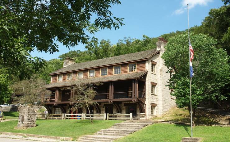
Full disclosure, but the park won't be this busy in October - 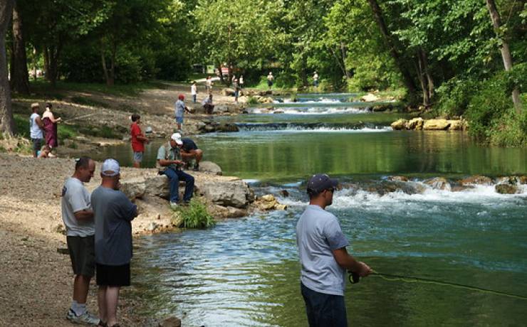
|
|
|
|
[#13]
We went to Wilson's Creek while in Branson a couple years ago in May. There were a couple schools buses of kids there on a school trip. We arrived just in time to be locked down with the group while police searched the park for a fleeing felon. Finally let us out, but everyone had to leave the park.
Went to Pea Ridge also. Getting there on the back roads through the mountains was interesting. The road twisted like a can of worms. |
|
|
|
[#14]
Quoted:
I am thinking of visiting Wilson Creek, Pea Ridge and a few lesser known battlefields. My research never ends. |
|
|
|
[#15]
The Wright County Historical Society has a fairly new book about the Battle of Hartville during Marmaduke's First Campaign.
I'll have to ask my wife for a link to the site she was looking at this weekend. You'd think Wright County is at the very extreme end of the planet when it comes to use of the internet. The societies web page is useless, and the facebook page didn't look much better. The facebook page for Hartville is nearly laughable, or cute, or something. A trip through town on google earth tells a better story. She was looking at the WCHS Facebook page. I guess logging in helps to see the stuff I couldn't find earlier. https://www.facebook.com/pages/Wright-County-Historical-Society/159799320720433 and I just found this interesting site: http://www.ozarkscivilwar.org/regions/wright I'm interested in Hartville and Wright County because my wife and I grew up there. My wife's paternal grandparents ran the store at St. George on the map in the link just above, and her maternal grandparents ran a store less than two miles west at High Point (not shown on that map). My uncle and aunt owned a farm at the confluence of Dove Creek and Whetstone Creek under the H in Wright until they passed; that was a productive farm than made them wealthy through 50 years of hard, hard work. Dove Mountain in Wood Township is one of the highest locations in Missouri, but it's not a dramatic rise from the surrounding terrain. 
The map is remarkable for the towns it does not show. A string of towns along the south edge follow the railroad; Mountain Grove, then Norwood, Macomb, Mansfield, and Cedar Gap working from the east boundary to the west. |
|
|
|
[#16]
Quoted: You doing any work on the Western Sharpshooters or 66th Illinois Vol Inf? |
|
|
|
[#17]
Quoted:
I've mentioned them in my two books on sharpshooters. They didn't fight in the Trans-Mississippi but rather in the Midwest. There were a few "sharpshooter" battalions in the Trans-Mississippi, but these were Confederate and I've seen no evidence that the Confederate units there received the same degree of training in marksmanship like the men of Patrick Cleburne's division or (most of) the battalions in the Army of Northern Virginia. |
|
|
|
[#18]
Quoted: If you wish, I can put you in touch with a guy who is doing quite a bit of primary research on both units. |
|
|
|
[#19]
Quoted:
Fred Ray? |
|
|
|
[#20]
@screechjet1 - sure.
|
|
|
|
[#21]
Quoted:She was looking at the WCHS Facebook page. I guess logging in helps to see the stuff I couldn't find earlier.
https://www.facebook.com/pages/Wright-County-Historical-Society/159799320720433 Quoted:She was looking at the WCHS Facebook page. I guess logging in helps to see the stuff I couldn't find earlier.
https://www.facebook.com/pages/Wright-County-Historical-Society/159799320720433 I'm interested in Hartville and Wright County because my wife and I grew up there. My wife's paternal grandparents ran the store at St. George on the map in the link just above, and her maternal grandparents ran a store less than two miles west at High Point (not shown on that map). My uncle and aunt owned a farm at the confluence of Dove Creek and Whetstone Creek under the H in Wright until they passed; that was a productive farm than made them wealthy through 50 years of hard, hard work. Dove Mountain in Wood Township is one of the highest locations in Missouri, but it's not a dramatic rise from the surrounding terrain. |
|
|
|
[#22]
I have seen a Trail of Tears map that showed a camp in the creek bottom there on the north side of H. 38 on my uncle's farm. I can't remember if it is in a book I have about Missouri history, one my sister has, or one that I checked out of the county library when I was a kid. All of the old timers called the region East of Green Mountain into Texas County starting about Beaver Creek "The Nation", and had stories that several Cherokee settled there. There has been a ton of arrow heads picked up in those fields, and there is probably another ton or two.
|
|
|
|
[#23]
...
|
|
|
|
[#24]
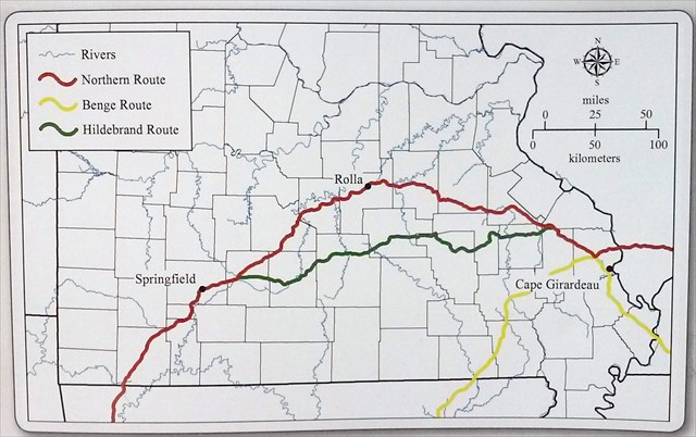
I think starting with research on the Hildebrand Route and the Benge Route of the Trail of Tears are the best place to start.
Here's a document to read. Page 39 is where the description of the Hildebrand Route into Wright County starts. Unfortunately it jumps from Astoria to the Gasconade, and the description from there to Hartville without much else described in between. Also see the map on page 80 that shows the route crossing Dove Creek and Whetstone Creek at H. E and H. 38. https://dnr.mo.gov/shpo/nps-nr/64501226.pd A book I found, "The Trail of Tears Across Missouri By Joan Gilbert" This would be a great topic for a new thread. |
|
|
|
[#25]
I attempted to mostly unhijack this thread.
Here's a relevant map, the Marches and Engagements of Shelby's Cavalry during the Confederate War. The best way to view this map is by following the link. http://digital.shsmo.org/cdm/singleitem/collection/Maps/id/34/rec/3 |
|
|
|
[#26]
Go ahead. I'm happy to learn more about the area. I know the Trail of Tears went through Ft. Smith.
|
|
|
 Win a FREE Membership!
Sign up for the ARFCOM weekly newsletter and be entered to win a free ARFCOM membership. One new winner* is announced every week!
You will receive an email every Friday morning featuring the latest chatter from the hottest topics, breaking news surrounding legislation, as well as exclusive deals only available to ARFCOM email subscribers.

AR15.COM is the world's largest firearm community and is a gathering place for firearm enthusiasts of all types.
From hunters and military members, to competition shooters and general firearm enthusiasts, we welcome anyone who values and respects the way of the firearm.

Subscribe to our monthly Newsletter to receive firearm news, product discounts from your favorite Industry Partners, and more.
Copyright © 1996-2024 AR15.COM LLC. All Rights Reserved.
Any use of this content without express written consent is prohibited.
AR15.Com reserves the right to overwrite or replace any affiliate, commercial, or monetizable links, posted by users, with our own.


