|
Posted: 9/6/2010 10:51:33 AM EDT
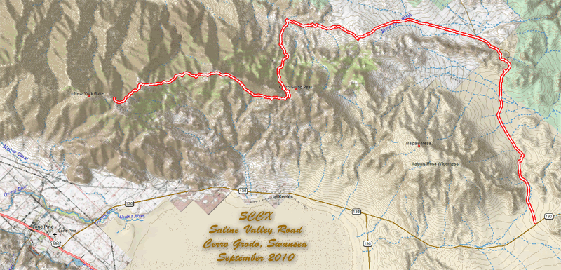
Spend a nice three day weekend off road. The area is the next mountain ridge east of the Mount Whitney range across the Owens Valley. The next valley over is the Saline Valley and from a top of the Cerro Gordo, Swansea, and New York Peak you have views east and west from 8000 to 10000 feet up. The Saline Valley road is easily passable by any sort of vehicle, Cerro Gordo and Swansea less so. The Cerro Gordo trail has some long steep climbs that are best done in 4WD. There were a couple of sections that needed a low range effort to crawl up loose rocks deeper than I cared to dig down to - walking was nearly impossible in these scree areas. 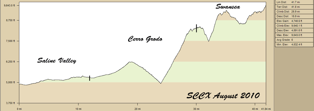
A view from the Saline Valley towards the mountain range we'll be climbing. 
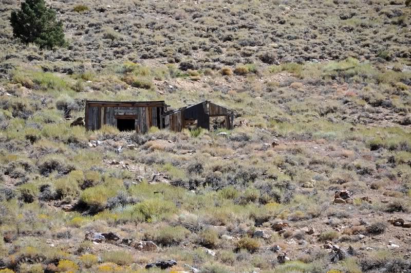
The area has lots of mines - silver, lead, dolomite, borax and even salt. Some of the mines date back to the 1800s and were abandoned long ago but some are still actively worked. Being beyond lowered Honda Civic range much of the old buildings still stand. I found none tagged or vandalized. Some were damaged by fire but I got the feeling that it was from some drunken miner's careless lamp rather than by a different idiot. The finds at Cerro Gordo were discovered by Mexicans in 1865 and produced 17 million dollars worth of silver, lead, and zinc. Minerals were transported by mule train and tram to the "Bessie Brady" boat dock and then across the Owens lake - the lake was later drained to feed the growing water needs of Los Angeles. 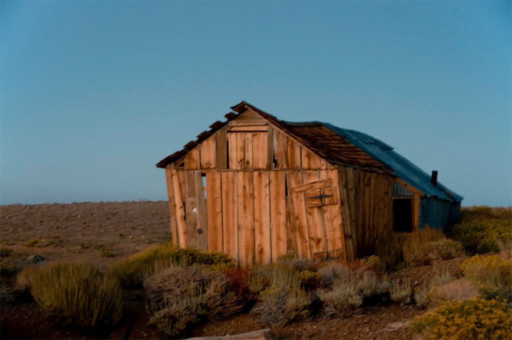
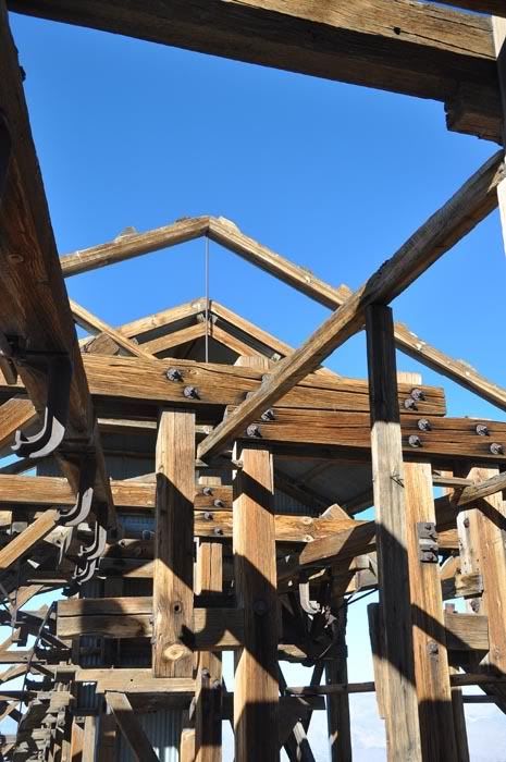
The 13.5 mile long salt tram was built in 1911 to transport salt mined from the Saline valley up and over the Cerro Gordo range and down to where the Owens lake use to be. Barges there would move it across the lake for further transportation by rail on to Los Angeles. Come to find out that the salt wasn't as dry as they thought it would be and therefore more heavy ... so the buckets had to be loaded less full than the business plan called for. The tram way was very labor intensive to boot. The first loads of salt were delivered in July of 1913 and the last in 1930. The tram rises 7000 feet from the Saline Valley in the east and down 5000 feet to Owens. The support cable was 1 1/8th thick and there was a series of support and control stations along the route. The Inyo Mountain ridge is 8720 feet up and the dry air has helped preserve the wood. There is a private restoration effort going on but the 100 year old buildings and structures were in remarkably good shape. The structure has been put on the National Register of Historic Places and is unique worldwide. 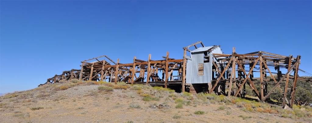

That date is May 1904, not 2004! 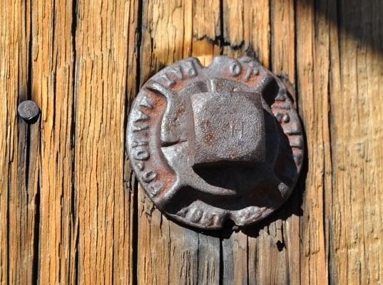
We camped outside the Burgess Mine area up around 9500 feet up. The air was thinner and setting up camp and running about camp was more difficult than it needed to be. The views from up there were amazing. 
Come sunset the stars came out. Note the portion of Milky Way. 
And the Big Dipper rising. 
Some of the petroglyphs along the trail. 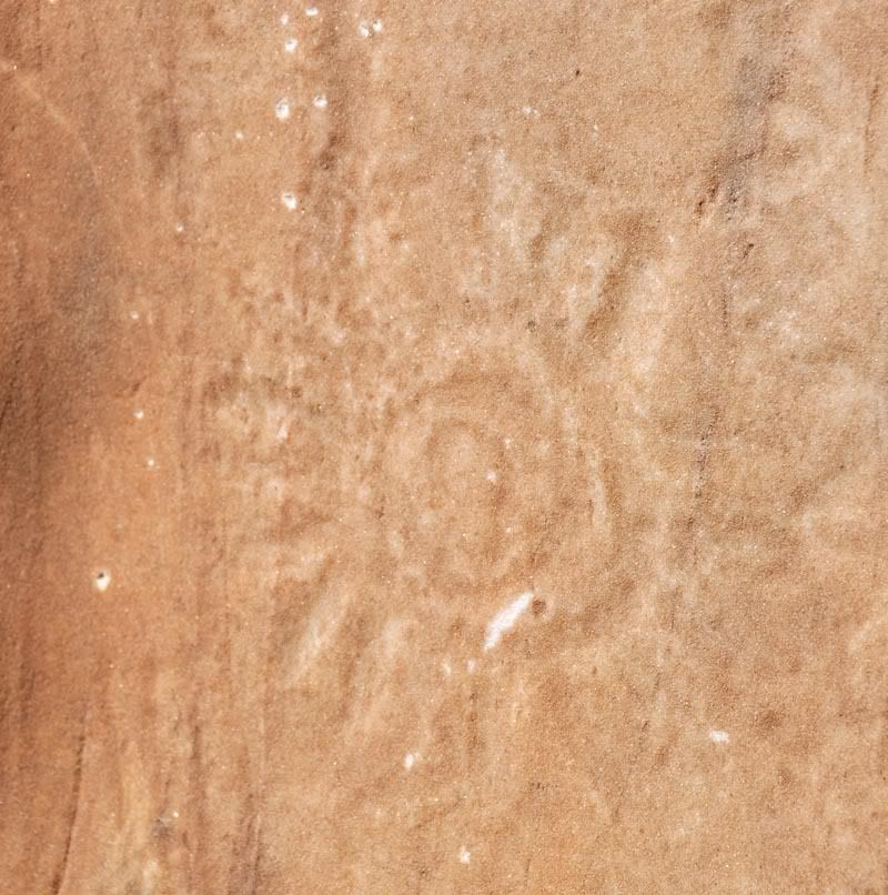

Not every truck that enters the mountain range makes it out. 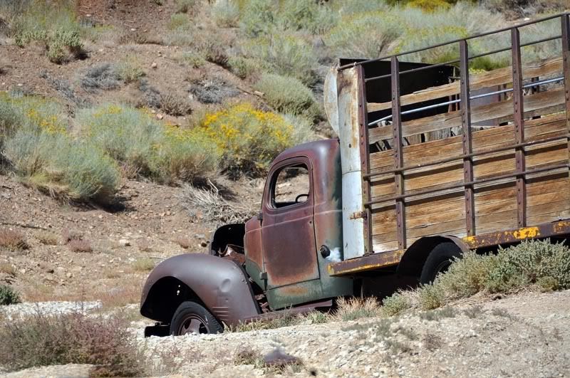
|
|
|
 Win a FREE Membership!
Sign up for the ARFCOM weekly newsletter and be entered to win a free ARFCOM membership. One new winner* is announced every week!
You will receive an email every Friday morning featuring the latest chatter from the hottest topics, breaking news surrounding legislation, as well as exclusive deals only available to ARFCOM email subscribers.

AR15.COM is the world's largest firearm community and is a gathering place for firearm enthusiasts of all types.
From hunters and military members, to competition shooters and general firearm enthusiasts, we welcome anyone who values and respects the way of the firearm.

Subscribe to our monthly Newsletter to receive firearm news, product discounts from your favorite Industry Partners, and more.
Copyright © 1996-2024 AR15.COM LLC. All Rights Reserved.
Any use of this content without express written consent is prohibited.
AR15.Com reserves the right to overwrite or replace any affiliate, commercial, or monetizable links, posted by users, with our own.