You don't' really need to spend a bunch of money on maps. You can get free topo maps and just learn to use the features of the gps to mark your tracks and make routes or something.
I have the entire southeast on my Astros, they are not navagatable but they have streets and topo stuff on, they are very useful.
A handheld differs from a nav unit in that it's a lot more durable, battery life is better, there are different uses and features.
For instance, I can mark waypoints. I can either "goto" these waypoints or just have them as a reference. I can make "tracks" and save them. There is a trip screen with fields that you can customize. Actually you can customize about every screen.
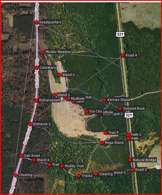
There are so many features it can be a little overwhelming and confusing at first but it's actually very intuitive. Here are some "maps" I've made over the years.
This is my tracks and waypoints superimposed over sat images on gpsvisualizer.com This isn't what I choose to see on my gps. The straight lines are kind of an artifact. If you stop tracking, then start again, it connects the tracks. My astro's save more tracks so I don't do it that way anymore. I just left it because it was too much trouble to clean it up.

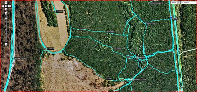
Here is another example.

The cool thing about that website is that you can save a few tracks and stuff, go to that site, and see a big overview of where you were at. This enabled us to figure out where the deer were bedding and where they were eating.
Later I will try and post some pics of what I see on my gps screen. I subscribed to the garmin service where you can put sat images right on your gps but they were pretty useless, just a bunch of treetops. I much prefer the free topo maps.
It's fun to go traipsing around in the woods at night helping to find deer or dogs and not having to worry about getting very lost. I always have spare batteries.
 Win a FREE Membership!