|
[#1]
Well, these reverse 911/ emergency calls aren't exactly timely. Just got a robocall telling people around FM116/FM580 to take cover. That's Pidcoke. That storm is already in/ past Gatesville.
 |
|
|
|
[#2]
Stay safe down there. Some of the pics I've seen are epic (in a bad way). 
On the bright side, your drought is probably over. 
|
|
|
|
[#3]
Our ranch in Topsey area was right in path. I live in Austin so family is safe. Prayers for friends and neighbors in the area.
|
|
|
|
[#4]
OBSERVED TORNADO... WWUS54 KOUN 251958 SVSOUN SEVERE WEATHER STATEMENT NATIONAL WEATHER SERVICE NORMAN OK 258 PM CDT MON MAY 25 2015 OKC005-013-252030- /O.CON.KOUN.TO.W.0127.000000T0000Z-150525T2030Z/ BRYAN OK-ATOKA OK- 258 PM CDT MON MAY 25 2015 ...A TORNADO WARNING REMAINS IN EFFECT UNTIL 330 PM CDT FOR NORTHWESTERN BRYAN AND SOUTHWESTERN ATOKA COUNTIES... AT 257 PM CDT...A CONFIRMED TORNADO PRODUCING DAMAGE WAS LOCATED 3 MILES NORTH OF BLUE...MOVING NORTHEAST AT 35 MPH. ANOTHER STORM WITH ROTATION INDICATED ON RADAR WAS LOCATED 5 MILES SOUTHWEST OF DURANT. HAZARD...DAMAGING TORNADO AND GOLF BALL SIZE HAIL. SOURCE...WEATHER SPOTTERS CONFIRMED TORNADO. IMPACT...FLYING DEBRIS WILL BE DANGEROUS TO THOSE CAUGHT WITHOUT SHELTER. MOBILE HOMES WILL BE DAMAGED OR DESTROYED. DAMAGE TO ROOFS...WINDOWS AND VEHICLES WILL OCCUR. TREE DAMAGE IS LIKELY. LOCATIONS IMPACTED INCLUDE... DURANT...ATOKA...COLBERT...CADDO...BOKCHITO...SILO...TUSHKA... CANEY...KENEFIC...MEAD...ARMSTRONG...LANE...BLUE...CARTWRIGHT... CALERA...BENTLEY AND NORTHWESTERN MCGEE CREEK LAKE. LAT...LON 3402 9611 3383 9657 3416 9645 3416 9641 3426 9641 3447 9585 TIME...MOT...LOC 1957Z 213DEG 31KT 3408 9619 TORNADO...OBSERVED HAIL...1.75IN $$ ..SPEG. |
|
|
|
[#5]
Quoted:
Well, these reverse 911/ emergency calls aren't exactly timely. Just got a robocall telling people around FM116/FM580 to take cover. That's Pidcoke. That storm is already in/ past Gatesville. Yeah, I've found the same thing. Even with the tornado sirens are sometimes late. Twitter and watching the radar is always best. |
|
|
|
[#6]
According to my mother it is hailing between Hutto and Taylor.
Raining hard in Hutto now. My front yard 
TORNADO ON THE GROUND WEST GEORGETOWN |
|
|
|
[#7]
edit: NVM
|
|
|
|
[#8]
Radar indicated tornado 5.39 nm south of Belton. Now warned by NWS. WWUS54 KFWD 252006 SVSFWD SEVERE WEATHER STATEMENT NATIONAL WEATHER SERVICE FORT WORTH TX 306 PM CDT MON MAY 25 2015 TXC027-252030- /O.CON.KFWD.TO.W.0096.000000T0000Z-150525T2030Z/ BELL TX- 306 PM CDT MON MAY 25 2015 ...A TORNADO WARNING REMAINS IN EFFECT UNTIL 330 PM CDT FOR CENTRAL BELL COUNTY... AT 306 PM CDT...A SEVERE THUNDERSTORM CAPABLE OF PRODUCING A TORNADO WAS LOCATED NEAR SALADO...OR 7 MILES SOUTH OF BELTON...MOVING NORTHEAST AT 20 MPH. HAZARD...TORNADO AND QUARTER SIZE HAIL. SOURCE...RADAR INDICATED ROTATION. IMPACT...FLYING DEBRIS WILL BE DANGEROUS TO THOSE CAUGHT WITHOUT SHELTER. MOBILE HOMES WILL BE DAMAGED OR DESTROYED. DAMAGE TO ROOFS...WINDOWS AND VEHICLES WILL OCCUR. TREE DAMAGE IS LIKELY. THIS DANGEROUS STORM WILL BE NEAR... LITTLE RIVER-ACADEMY AROUND 325 PM CDT. THIS INCLUDES INTERSTATE 35 BETWEEN MILE MARKERS 285 AND 304. PRECAUTIONARY/PREPAREDNESS ACTIONS... TAKE COVER NOW! MOVE TO AN INTERIOR ROOM ON THE LOWEST FLOOR OF A STURDY BUILDING. AVOID WINDOWS. IF YOU ARE OUTDOORS...IN A MOBILE HOME...OR IN A VEHICLE...MOVE TO THE CLOSEST SUBSTANTIAL SHELTER AND PROTECT YOURSELF FROM FLYING DEBRIS. && LAT...LON 3090 9752 3095 9753 3099 9755 3117 9740 3114 9727 3099 9721 3090 9747 TIME...MOT...LOC 2006Z 236DEG 19KT 3096 9746 TORNADO...RADAR INDICATED HAIL...1.00IN $$ 92 |
|
|
|
[#9]
Quoted: Yeah, I've found the same thing. Even with the tornado sirens are sometimes late. Twitter and watching the radar is always best. Quoted: Quoted: Well, these reverse 911/ emergency calls aren't exactly timely. Just got a robocall telling people around FM116/FM580 to take cover. That's Pidcoke. That storm is already in/ past Gatesville. Yeah, I've found the same thing. Even with the tornado sirens are sometimes late. Twitter and watching the radar is always best. Yup. And without twitter, I usually get more timely info on a more regular basis, right here. |
|
|
|
[#10]
I'm gonna call another one at Lorena/Golinda.
|
|
|
|
[#11]
Quoted:
I was just thinking about you. I know you're right in the area. Stay safe. Quoted:
Quoted:
5 current rotations in central TX. I was just thinking about you. I know you're right in the area. Stay safe. Thanks man. Got the wife and the dog in the closet. Sirens went off. Hasn't gotten here yet but I'm on south side of temple so the salado rotation was troubling. Looks to be weakening, hope it is. |
|
|
|
[#12]
Quoted:
<a href="http://s339.photobucket.com/user/thorm001/media/F02A6016-53BF-4E05-B066-846C7974B560_zpsn0756ba9.jpg.html" target="_blank">http://i339.photobucket.com/albums/n443/thorm001/F02A6016-53BF-4E05-B066-846C7974B560_zpsn0756ba9.jpg</a> Hola mi amigo , tomar una cerveza |
|
|
|
[#13]
|
|
|
|
[#14]
Rotation indicated near Bee Cave headed towards N Austin, Pflugerville.
Absolute downpour here. |
|
|
|
[#15]
Tag.
|
|
|
|
[#16]
All clear sounded for temple for now.
The good news is Now I have river front property! 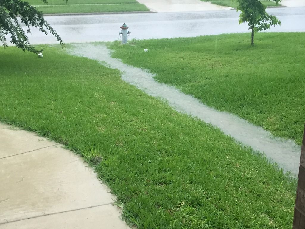
|
|
|
|
[#17]
Here in lewisville we've been getting slammed with heavy rains and decent gusts.
I have one of the conference rooms opened just in case. |
|
|
|
[#18]
Getting 58+ straight line winds in SE Williamson county.
|
|
|
|
[#19]
Quoted: Rotation indicated near Bee Cave headed towards N Austin, Pflugerville. Absolute downpour here. Just for what it's worth, I'm not showing any low level rotation on my radar. There is some mid and upper level rotation. Bear in mind that I'm not the NWS. That's the last tornado warning in Texas. SEVERE WEATHER STATEMENT NATIONAL WEATHER SERVICE AUSTIN/SAN ANTONIO TX 341 PM CDT MON MAY 25 2015 TXC453-252051- /O.EXP.KEWX.TO.W.0028.000000T0000Z-150525T2045Z/ TRAVIS TX- 341 PM CDT MON MAY 25 2015 ...THE TORNADO WARNING FOR CENTRAL TRAVIS COUNTY WILL EXPIRE AT 345 PM CDT... THE STORM WHICH PROMPTED THE WARNING HAS WEAKENED BELOW SEVERE LIMITS...AND NO LONGER APPEARS CAPABLE OF PRODUCING A TORNADO. THEREFORE THE WARNING WILL BE ALLOWED TO EXPIRE. A TORNADO WATCH REMAINS IN EFFECT UNTIL 1000 PM CDT FOR SOUTH CENTRAL TEXAS. LAT...LON 3026 9784 3040 9792 3046 9783 3046 9782 3043 9778 3043 9776 3045 9774 3046 9769 3048 9768 3048 9764 3049 9762 3036 9754 TIME...MOT...LOC 2038Z 243DEG 26KT 3036 9781 $$ RUNYEN |
|
|
|
[#20]
So....what's the flooding picture? Any of y'all getting anything severe?
|
|
|
|
[#21]
Quoted:
Just for what it's worth, I'm not showing any low level rotation on my radar. There is some mid and upper level rotation. Bear in mind that I'm not the NWS. <snip> Quoted:
Quoted:
Rotation indicated near Bee Cave headed towards N Austin, Pflugerville. Absolute downpour here. Just for what it's worth, I'm not showing any low level rotation on my radar. There is some mid and upper level rotation. Bear in mind that I'm not the NWS. <snip> I wanted to watch the NWS chat to see what they talk about, get a more heads up. Went to the website, and at the bottom it says this: "Note: Individuals, companies, or other entities involved in ‘chasing’ weather events and posting or streaming text or pictures of the event, but do not otherwise have a need to communicate with NWS do not meet the qualifications for this Service, regardless of the number of ‘followers’ or recipients." Little snobbery there I think. 
|
|
|
|
[#22]
Did the parts of Texas that had a drought get some rain?
|
|
|
|
[#23]
Was thinking of movin to FL but now I have a swamp of my own right here.
|
|
|
|
[#24]
Quoted:
Did the parts of Texas that had a drought get some rain? Yeah. Most of the drought areas got rain. |
|
|
|
[#25]
Quoted: I wanted to watch the NWS chat to see what they talk about, get a more heads up. Went to the website, and at the bottom it says this: "Note: Individuals, companies, or other entities involved in ‘chasing’ weather events and posting or streaming text or pictures of the event, but do not otherwise have a need to communicate with NWS do not meet the qualifications for this Service, regardless of the number of ‘followers’ or recipients." Little snobbery there I think. Quoted: Quoted: Quoted: Rotation indicated near Bee Cave headed towards N Austin, Pflugerville. Absolute downpour here. Just for what it's worth, I'm not showing any low level rotation on my radar. There is some mid and upper level rotation. Bear in mind that I'm not the NWS. <snip> I wanted to watch the NWS chat to see what they talk about, get a more heads up. Went to the website, and at the bottom it says this: "Note: Individuals, companies, or other entities involved in ‘chasing’ weather events and posting or streaming text or pictures of the event, but do not otherwise have a need to communicate with NWS do not meet the qualifications for this Service, regardless of the number of ‘followers’ or recipients." Little snobbery there I think. I called 2 tornados today....before the NWS issued warnings for them. I'm not the NWS...but I did stay at a Holiday Inn Express once. The NWS also certified me as an 'Advanced SKYWARN Spotter'. I just don't want to see people get hurt and killed needlessly. |
|
|
|
[#26]
Quoted:
Load mags like a mofo Veal Station reporting. No more veal..
|
|
|
|
[#27]
DFW flights are going nuts, Flightaware has them circling all over the place. Same for Austin.
|
|
|
|
[#28]
Quoted:
So....what's the flooding picture? Any of y'all getting anything severe? I'm west of Bee Cave in Spicewood on a hill. I can't see any flooding but it's been pouring for hours. I drove over the Perdenales River on Hwy 71 yesterday and it had pretty swift water probably 20 to 30 feet deep and 50 yards wide. It was dry a few weeks ago. I have over $40K in damage from the hail storm two weeks ago.
|
|
|
|
[#29]
I'm in Farmers Branch, just NW of downtown Dallas and the worst of it just passed over me with about 2 minutes of hard rainfall and a lot of thunder. Now it's barely sprinkling.
The strong storms always seem to peter out right before they get to this area. |
|
|
|
[#30]
Quoted: I'm west of Bee Cave in Spicewood on a hill. I can't see any flooding but it's been pouring for hours. I drove over the Perdenales River on Hwy 71 yesterday and it had pretty swift water probably 20 to 30 feet deep and 50 yards wide. It was dry a few weeks ago. I have over $40K in damage from the hail storm two weeks ago. Quoted: Quoted: So....what's the flooding picture? Any of y'all getting anything severe? I'm west of Bee Cave in Spicewood on a hill. I can't see any flooding but it's been pouring for hours. I drove over the Perdenales River on Hwy 71 yesterday and it had pretty swift water probably 20 to 30 feet deep and 50 yards wide. It was dry a few weeks ago. I have over $40K in damage from the hail storm two weeks ago. Damn....I hope you're insured. Report is Bee Cave road is closed due to high water. That was at 2:17. Also several 'water over the road' reports in Williamson and Travis Counties. |
|
|
|
[#31]
795 WFUS54 KFWD 252059 TORFWD TXC331-252130- /O.NEW.KFWD.TO.W.0098.150525T2059Z-150525T2130Z/ BULLETIN - EAS ACTIVATION REQUESTED TORNADO WARNING NATIONAL WEATHER SERVICE FORT WORTH TX 359 PM CDT MON MAY 25 2015 THE NATIONAL WEATHER SERVICE IN FORT WORTH HAS ISSUED A * TORNADO WARNING FOR... NORTHERN MILAM COUNTY IN CENTRAL TEXAS... * UNTIL 430 PM CDT * AT 358 PM CDT...A SEVERE THUNDERSTORM CAPABLE OF PRODUCING A TORNADO WAS LOCATED NEAR CAMERON...MOVING NORTHEAST AT 40 MPH. HAZARD...TORNADO AND QUARTER SIZE HAIL. SOURCE...RADAR INDICATED ROTATION. IMPACT...FLYING DEBRIS WILL BE DANGEROUS TO THOSE CAUGHT WITHOUT SHELTER. MOBILE HOMES WILL BE DAMAGED OR DESTROYED. DAMAGE TO ROOFS...WINDOWS AND VEHICLES WILL OCCUR. TREE DAMAGE IS LIKELY. * THIS DANGEROUS STORM WILL BE NEAR... CAMERON AROUND 405 PM CDT. OTHER LOCATIONS IMPACTED BY THIS TORNADIC THUNDERSTORM INCLUDE BUCKHOLTS. PRECAUTIONARY/PREPAREDNESS ACTIONS... TAKE COVER NOW! MOVE TO AN INTERIOR ROOM ON THE LOWEST FLOOR OF A STURDY BUILDING. AVOID WINDOWS. IF YOU ARE OUTDOORS...IN A MOBILE HOME...OR IN A VEHICLE...MOVE TO THE CLOSEST SUBSTANTIAL SHELTER AND PROTECT YOURSELF FROM FLYING DEBRIS. && LAT...LON 3076 9707 3091 9718 3111 9683 3108 9681 3106 9682 3105 9677 3103 9678 3100 9677 3100 9675 3097 9677 3093 9676 3092 9673 3090 9673 3090 9672 3091 9669 3090 9669 TIME...MOT...LOC 2058Z 236DEG 35KT 3085 9706 TORNADO...RADAR INDICATED HAIL...1.00IN $$ 92 |
|
|
|
[#32]
With all the construction on I 35 between salado and Waco I bet it's a damned mess right now.
|
|
|
|
[#33]
Quoted: With all the construction on I 35 between salado and Waco I bet it's a damned mess right now. That's a damned mess anytime. |
|
|
|
[#34]
Quoted:
That's a damned mess anytime. Quoted:
Quoted:
With all the construction on I 35 between salado and Waco I bet it's a damned mess right now. That's a damned mess anytime. Ha! That's no lie. Local news just reported 1 foot to 1 1/2 foot water over I 35 in both Temple and Lorena, with some stranded cars. |
|
|
|
[#35]
|
|
|
|
[#36]
Quoted:
I called 2 tornados today....before the NWS issued warnings for them. I'm not the NWS...but I did stay at a Holiday Inn Express once. The NWS also certified me as an 'Advanced SKYWARN Spotter'. I just don't want to see people get hurt and killed needlessly. Quoted:
Quoted:
Quoted:
Quoted:
Rotation indicated near Bee Cave headed towards N Austin, Pflugerville. Absolute downpour here. Just for what it's worth, I'm not showing any low level rotation on my radar. There is some mid and upper level rotation. Bear in mind that I'm not the NWS. <snip> I wanted to watch the NWS chat to see what they talk about, get a more heads up. Went to the website, and at the bottom it says this: "Note: Individuals, companies, or other entities involved in ‘chasing’ weather events and posting or streaming text or pictures of the event, but do not otherwise have a need to communicate with NWS do not meet the qualifications for this Service, regardless of the number of ‘followers’ or recipients." Little snobbery there I think. I called 2 tornados today....before the NWS issued warnings for them. I'm not the NWS...but I did stay at a Holiday Inn Express once. The NWS also certified me as an 'Advanced SKYWARN Spotter'. I just don't want to see people get hurt and killed needlessly. Doing the SKYWARN thing has been something I've wanted to do for a while, but never got around to it. I just looked at the schedule, and all the classes were in feb/march it seems. No more classes. |
|
|
|
[#37]
Quoted: Ha! That's no lie. Local news just reported 1 foot to 1 1/2 foot water over I 35 in both Temple and Lorena, with some stranded cars. Quoted: Quoted: Quoted: With all the construction on I 35 between salado and Waco I bet it's a damned mess right now. That's a damned mess anytime. Ha! That's no lie. Local news just reported 1 foot to 1 1/2 foot water over I 35 in both Temple and Lorena, with some stranded cars. Did they ever fix that underpass in Lorena? I've got to imagine that puppy has 10' of water in it. |
|
|
|
[#38]
Quoted:
I wanted to watch the NWS chat to see what they talk about, get a more heads up. Went to the website, and at the bottom it says this: "Note: Individuals, companies, or other entities involved in ‘chasing’ weather events and posting or streaming text or pictures of the event, but do not otherwise have a need to communicate with NWS do not meet the qualifications for this Service, regardless of the number of ‘followers’ or recipients." Little snobbery there I think. Quoted:
Quoted:
Quoted:
Rotation indicated near Bee Cave headed towards N Austin, Pflugerville. Absolute downpour here. Just for what it's worth, I'm not showing any low level rotation on my radar. There is some mid and upper level rotation. Bear in mind that I'm not the NWS. <snip> I wanted to watch the NWS chat to see what they talk about, get a more heads up. Went to the website, and at the bottom it says this: "Note: Individuals, companies, or other entities involved in ‘chasing’ weather events and posting or streaming text or pictures of the event, but do not otherwise have a need to communicate with NWS do not meet the qualifications for this Service, regardless of the number of ‘followers’ or recipients." Little snobbery there I think. Not really, if you knew how many people think they are certified weather people calling in to them with "their thoughts" you'd be shocked. |
|
|
|
[#39]
Quoted:
I called 2 tornados today....before the NWS issued warnings for them. I'm not the NWS...but I did stay at a Holiday Inn Express once. The NWS also certified me as an 'Advanced SKYWARN Spotter'. I just don't want to see people get hurt and killed needlessly. Quoted:
Quoted:
Quoted:
Quoted:
Rotation indicated near Bee Cave headed towards N Austin, Pflugerville. Absolute downpour here. Just for what it's worth, I'm not showing any low level rotation on my radar. There is some mid and upper level rotation. Bear in mind that I'm not the NWS. <snip> I wanted to watch the NWS chat to see what they talk about, get a more heads up. Went to the website, and at the bottom it says this: "Note: Individuals, companies, or other entities involved in ‘chasing’ weather events and posting or streaming text or pictures of the event, but do not otherwise have a need to communicate with NWS do not meet the qualifications for this Service, regardless of the number of ‘followers’ or recipients." Little snobbery there I think. I called 2 tornados today....before the NWS issued warnings for them. I'm not the NWS...but I did stay at a Holiday Inn Express once. The NWS also certified me as an 'Advanced SKYWARN Spotter'. I just don't want to see people get hurt and killed needlessly. Where did they touch down? |
|
|
|
[#40]
The backyard is a pool now and it has been tornado warning after tornado warning today here in Cedar Park.
|
|
|
|
[#41]
Quoted: Doing the SKYWARN thing has been something I've wanted to do for a while, but never got around to it. I just looked at the schedule, and all the classes were in feb/march it seems. No more classes. Quoted: Quoted: Quoted: Quoted: Quoted: Rotation indicated near Bee Cave headed towards N Austin, Pflugerville. Absolute downpour here. Just for what it's worth, I'm not showing any low level rotation on my radar. There is some mid and upper level rotation. Bear in mind that I'm not the NWS. <snip> I wanted to watch the NWS chat to see what they talk about, get a more heads up. Went to the website, and at the bottom it says this: "Note: Individuals, companies, or other entities involved in ‘chasing’ weather events and posting or streaming text or pictures of the event, but do not otherwise have a need to communicate with NWS do not meet the qualifications for this Service, regardless of the number of ‘followers’ or recipients." Little snobbery there I think. I called 2 tornados today....before the NWS issued warnings for them. I'm not the NWS...but I did stay at a Holiday Inn Express once. The NWS also certified me as an 'Advanced SKYWARN Spotter'. I just don't want to see people get hurt and killed needlessly. Doing the SKYWARN thing has been something I've wanted to do for a while, but never got around to it. I just looked at the schedule, and all the classes were in feb/march it seems. No more classes. This course has been officially designated by the NWS as a nationally-uniform training course for all SKYWARN Spotters. This course can be taken as a substitute for or a supplement to the face-to-face SKYWARN Spotter training sessions held in every WFO. Check with your local WFO for any additional requirements or recommendations. Now you have no excuse. |
|
|
|
[#42]
Quoted: Where did they touch down? Quoted: Quoted: Quoted: Quoted: Quoted: Rotation indicated near Bee Cave headed towards N Austin, Pflugerville. Absolute downpour here. Just for what it's worth, I'm not showing any low level rotation on my radar. There is some mid and upper level rotation. Bear in mind that I'm not the NWS. <snip> I wanted to watch the NWS chat to see what they talk about, get a more heads up. Went to the website, and at the bottom it says this: "Note: Individuals, companies, or other entities involved in ‘chasing’ weather events and posting or streaming text or pictures of the event, but do not otherwise have a need to communicate with NWS do not meet the qualifications for this Service, regardless of the number of ‘followers’ or recipients." Little snobbery there I think. I called 2 tornados today....before the NWS issued warnings for them. I'm not the NWS...but I did stay at a Holiday Inn Express once. The NWS also certified me as an 'Advanced SKYWARN Spotter'. I just don't want to see people get hurt and killed needlessly. Where did they touch down? |
|
|
|
[#43]
Quoted:
So....what's the flooding picture? Any of y'all getting anything severe? They just opened the flood gates at Tom Miller. Bull Creek and Shoal Creek will probably tops their banks, and they are close right now. Haven't heard anything about Onion. Low water Crossings are all closed. ETA: Austin. |
|
|
|
[#44]
Sirens went off in Hewitt about an hour ago. Now just rumbly rain. Over 3" since it started
Just heard Hwy 77 south of Rosebud ....rotation crossing Hwy 77 edit...now 2 rotations 4:15pm |
|
|
|
[#45]
KXAN is saying the tornado in Milam Co. is producing a large debris ball.
|
|
|
|
[#46]
Quoted: Well, these reverse 911/ emergency calls aren't exactly timely. Just got a robocall telling people around FM116/FM580 to take cover. That's Pidcoke. That storm is already in/ past Gatesville. Same thing in Cedar Park. We had the kids in an interior closet and the warning was canceled, we walked out to a ringing phone telling us to seek shelter. Thanks guys. |
|
|
|
[#47]
Observed tornado near Kirvin in Freestone County.
|
|
|
|
[#48]
Here on the west side of DFW it looks like we are done with the rain for awhile. East Texas is just getting started.
|
|
|
|
[#49]
My sister lives in Hurst; Already texted her about the storms. Hope everything's OK.
|
|
|
|
[#50]
Hewitt checking in. Without power for over an hour. Heavy rain and strong winds but no tornadoes spotted. Plenty of fuel for the generator so no worries.
|
|
|
 Win a FREE Membership!
Sign up for the ARFCOM weekly newsletter and be entered to win a free ARFCOM membership. One new winner* is announced every week!
You will receive an email every Friday morning featuring the latest chatter from the hottest topics, breaking news surrounding legislation, as well as exclusive deals only available to ARFCOM email subscribers.

AR15.COM is the world's largest firearm community and is a gathering place for firearm enthusiasts of all types.
From hunters and military members, to competition shooters and general firearm enthusiasts, we welcome anyone who values and respects the way of the firearm.

Subscribe to our monthly Newsletter to receive firearm news, product discounts from your favorite Industry Partners, and more.
Copyright © 1996-2024 AR15.COM LLC. All Rights Reserved.
Any use of this content without express written consent is prohibited.
AR15.Com reserves the right to overwrite or replace any affiliate, commercial, or monetizable links, posted by users, with our own.


.jpg)
